File:Groundwater management and protection areas, Virginia LOC 92681536.tif

Size of this JPG preview of this TIF file: 782 × 600 pixels. Other resolutions: 313 × 240 pixels | 626 × 480 pixels | 1,001 × 768 pixels | 1,280 × 982 pixels | 2,560 × 1,964 pixels | 3,175 × 2,436 pixels.
Original file (3,175 × 2,436 pixels, file size: 22.13 MB, MIME type: image/tiff)
Captions
Captions
Add a one-line explanation of what this file represents
Summary edit
| Description |
English: "Source: Map prepared using automated map construction, National Cartographic Center, Fort Worth, Texas, 1991." "1004445-01." Available also through the Library of Congress Web site as a raster image. |
||
| Title | Groundwater management and protection areas, Virginia | ||
| Shelf ID | G3881.C34 1991 .U51 | ||
| Date | |||
| Source | https://www.loc.gov/item/92681536/ | ||
| Author | United States. Soil Conservation Service; National Cartographic Center (U.S.) | ||
| Permission (Reusing this file) |
|
||
| Other versions |
|
||
| Location | Virginia. · United States · Virginia | ||
| Part of | American Memory · Catalog · Geography And Map Division · Additional Conservation And Environment Cartographic Items | ||
| Subject | United States · Maps · Management · Groundwater · Virginia |


Licensing edit
This work is in the public domain in the United States because it is a work prepared by an officer or employee of the United States Government as part of that person’s official duties under the terms of Title 17, Chapter 1, Section 105 of the US Code.
Note: This only applies to original works of the Federal Government and not to the work of any individual U.S. state, territory, commonwealth, county, municipality, or any other subdivision. This template also does not apply to postage stamp designs published by the United States Postal Service since 1978. (See § 313.6(C)(1) of Compendium of U.S. Copyright Office Practices). It also does not apply to certain US coins; see The US Mint Terms of Use.
|
 | |
| This file has been identified as being free of known restrictions under copyright law, including all related and neighboring rights. | ||
File history
Click on a date/time to view the file as it appeared at that time.
| Date/Time | Thumbnail | Dimensions | User | Comment | |
|---|---|---|---|---|---|
| current | 09:25, 10 June 2018 | 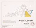 | 3,175 × 2,436 (22.13 MB) | Fæ (talk | contribs) | LOC Maps https://www.loc.gov/item/92681536/ #10585 |
You cannot overwrite this file.
File usage on Commons
The following page uses this file: