File:Hünenpforte und Weißenstein.JPG

Size of this preview: 799 × 600 pixels. Other resolutions: 320 × 240 pixels | 640 × 480 pixels | 1,024 × 768 pixels | 1,280 × 960 pixels | 2,560 × 1,921 pixels | 3,909 × 2,933 pixels.
Original file (3,909 × 2,933 pixels, file size: 3.2 MB, MIME type: image/jpeg)
Captions
Captions
Add a one-line explanation of what this file represents
Summary edit
| Description |
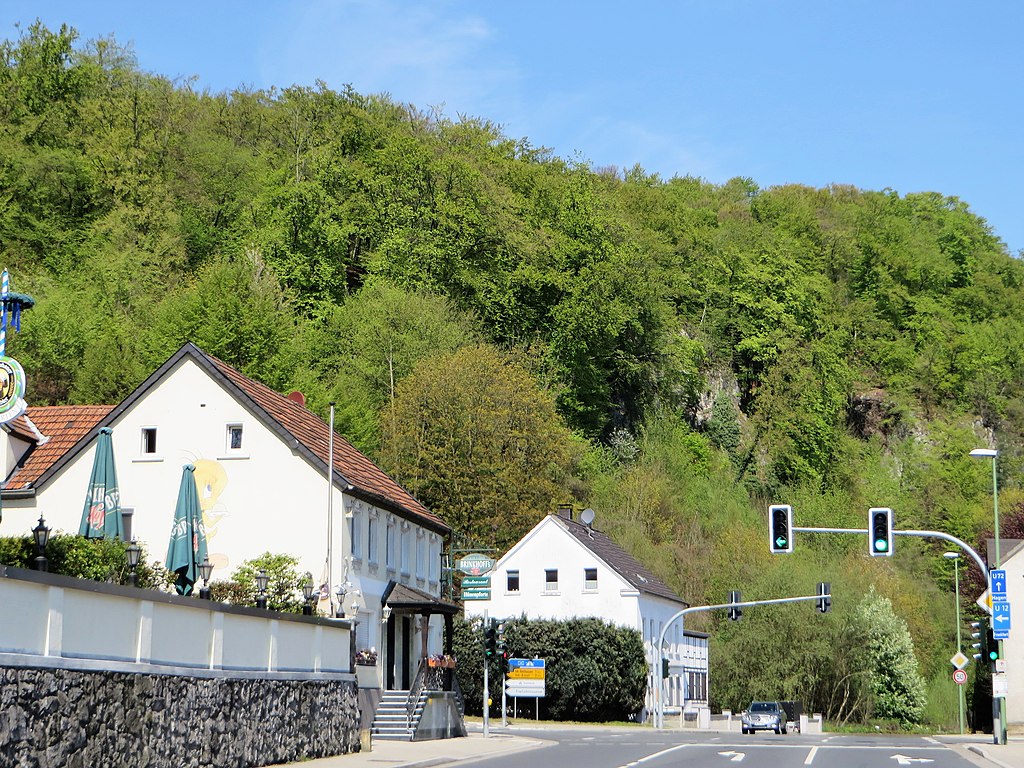
Deutsch: Naturschutzgebiet HA-002 „Mastberg und Weißenstein“ in Hagen-Holthausen. Blick von der Hohenlimburger Straße (B 7) in Höhe Restaurant Hünenpforte auf den offenen Kalkfelsenhang des Weißensteins (189 m). Auf dem geschützten Bereich befinden sich seltene Waldmeister- und Orchideen-Buchenwaldbestände sowie Schlucht- und Hangmischwald. Es handelt sich um den größten zusammenhängenden Laubwaldkomplex im Hagener Raum mit Resten von Halbtrockenrasen. In dem Gebiet mit Kalkfelsen und Felsspaltenvegetation befinden sich auch nicht touristisch erschlossene Höhlen, wie z. B. die archäologisch bedeutende Blätterhöhle. Am Fuße des ca. 70 Meter hoch aufragenden Massenkalkkegels „Weißenstein“ befindet sich direkt an der B 7 eine bemerkenswerte Karstquelle, der „Barmer Teich“. Im Westen grenzt an das „NSG-Mastberg und Weißenstein“ das Naturschutzgebiet „Temporärer Mastberg“. |
| Date | |
| Source | Own work |
| Author | Bärwinkel,Klaus |
Licensing edit
I, the copyright holder of this work, hereby publish it under the following licenses:

|
Permission is granted to copy, distribute and/or modify this document under the terms of the GNU Free Documentation License, Version 1.2 or any later version published by the Free Software Foundation; with no Invariant Sections, no Front-Cover Texts, and no Back-Cover Texts. A copy of the license is included in the section entitled GNU Free Documentation License. |
This file is licensed under the Creative Commons Attribution 3.0 Unported license.
- You are free:
- to share – to copy, distribute and transmit the work
- to remix – to adapt the work
- Under the following conditions:
- attribution – You must give appropriate credit, provide a link to the license, and indicate if changes were made. You may do so in any reasonable manner, but not in any way that suggests the licensor endorses you or your use.
You may select the license of your choice.
File history
Click on a date/time to view the file as it appeared at that time.
| Date/Time | Thumbnail | Dimensions | User | Comment | |
|---|---|---|---|---|---|
| current | 16:43, 21 February 2020 | | 3,909 × 2,933 (3.2 MB) | Bärwinkel,Klaus (talk | contribs) | Etwas veränderte Version der Datei. Selbst bearbeitet am 21.02.2020 ~~~~ |
| 16:05, 27 September 2016 |  | 1,181 × 885 (402 KB) | Bärwinkel,Klaus (talk | contribs) | Etwas veränderte Version der Datei „Hünenpforte und Weißenstein.JPG“ mit besserer Ausrichtung. Selbst bearbeitet am 27.09.2016 ~~~~ | |
| 15:12, 2 May 2016 |  | 4,000 × 3,000 (3.12 MB) | Bärwinkel,Klaus (talk | contribs) | {{Information |Description ={{de|1=Naturschutzgebiet HA-002 Weißenstein in Hagen-Holthausen. Blick von der Hohenlimburger Straße in Höhe der Gaststätte Hünenpforte auf den offenen Kalkfelsenhang des Weißenstein (189 m). Auf dem geschützen... |
You cannot overwrite this file.
File usage on Commons
There are no pages that use this file.
File usage on other wikis
The following other wikis use this file:
- Usage on de.wikipedia.org
- Usage on www.wikidata.org