File:Hagen NSG-Ehemaliger Yachthafen Harkortsee.JPG

Size of this preview: 800 × 515 pixels. Other resolutions: 320 × 206 pixels | 640 × 412 pixels | 1,024 × 659 pixels | 1,280 × 824 pixels | 2,560 × 1,648 pixels | 3,979 × 2,561 pixels.
Original file (3,979 × 2,561 pixels, file size: 1.91 MB, MIME type: image/jpeg)
Captions
Captions
Add a one-line explanation of what this file represents
Summary
edit
| Description |
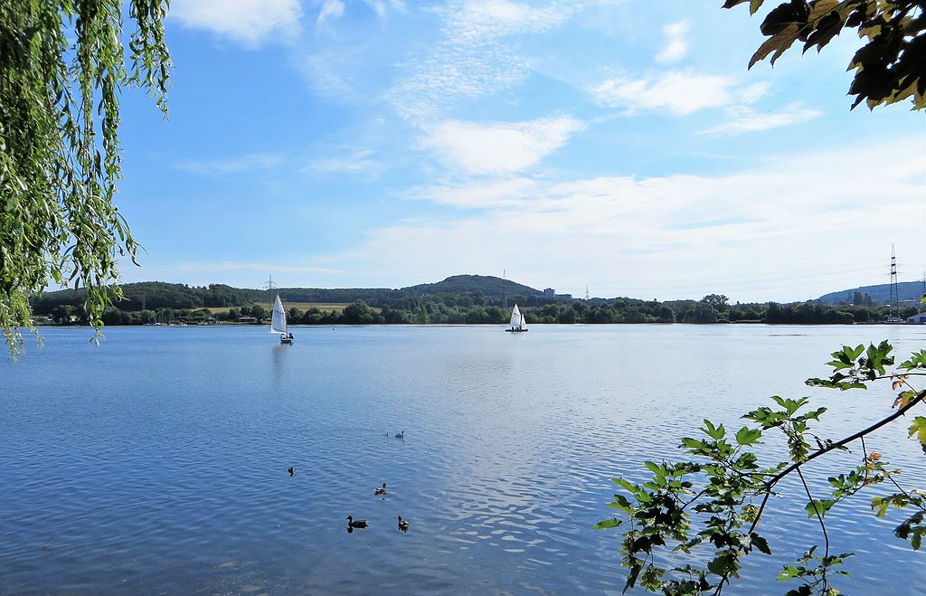
Deutsch: Naturschutzgebiet HA-010 „Ehemaliger Yachthafen Harkortsee“ in Hagen. Blick vom Strandweg in Wetter über den Harkortsee auf das gegenüberliegende Schutzgebiet. Der Bereich liegt westlich von Werdringen am Ostufer des Harkortsees (Foto: vom rechten Strommasten bis in Höhe des linken Segelbootes). Es umfaßt zwei ehemalige, miteinander verbundene Hafenbecken, die mit dem Harkortsee in Verbindung stehen sowie die angrenzenden landwirtschaftlich genutzten Flächen. Im Hintergrund sieht man in der Mitte den Kaisberg (185 m). |
| Date | |
| Source | Own work |
| Author | Bärwinkel,Klaus |
Licensing
edit
I, the copyright holder of this work, hereby publish it under the following licenses:

|
Permission is granted to copy, distribute and/or modify this document under the terms of the GNU Free Documentation License, Version 1.2 or any later version published by the Free Software Foundation; with no Invariant Sections, no Front-Cover Texts, and no Back-Cover Texts. A copy of the license is included in the section entitled GNU Free Documentation License. |
This file is licensed under the Creative Commons Attribution 3.0 Unported license.
- You are free:
- to share – to copy, distribute and transmit the work
- to remix – to adapt the work
- Under the following conditions:
- attribution – You must give appropriate credit, provide a link to the license, and indicate if changes were made. You may do so in any reasonable manner, but not in any way that suggests the licensor endorses you or your use.
You may select the license of your choice.
| Annotations | This image is annotated: View the annotations at Commons |
File history
Click on a date/time to view the file as it appeared at that time.
| Date/Time | Thumbnail | Dimensions | User | Comment | |
|---|---|---|---|---|---|
| current | 11:59, 10 July 2016 | | 3,979 × 2,561 (1.91 MB) | Bärwinkel,Klaus (talk | contribs) | {{Information |Description ={{de|1=Naturschutzgebiet HA-010 NSG-Ehemaliger Yachthafen Harkortsee in Hagen. Blick vom Strandufer in Wetter über den Harkortsee auf das gegenüberliegende Schutzgebiet. Der Bereich liegt westlich von Werdringen am... |
You cannot overwrite this file.
File usage on Commons
The following 2 pages use this file:
File usage on other wikis
The following other wikis use this file:
- Usage on de.wikipedia.org
- Usage on www.wikidata.org