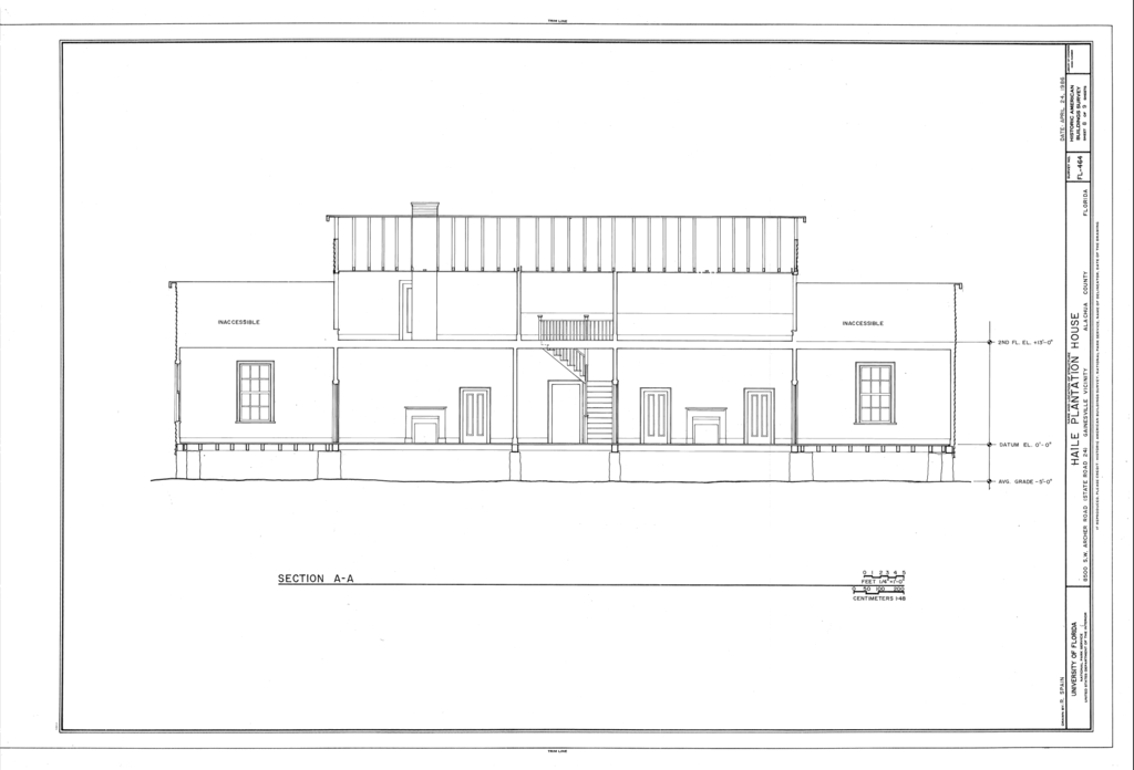
File:Haile Plantation House, 8500 Southwest Archer Road (State Route 24), Gainesville, Alachua County, FL HABS FL-464 (sheet 8 of 9).png

Size of this preview: 800 × 544 pixels. Other resolutions: 320 × 218 pixels | 640 × 435 pixels | 1,024 × 697 pixels | 1,280 × 871 pixels | 2,560 × 1,742 pixels | 14,400 × 9,798 pixels.
Original file (14,400 × 9,798 pixels, file size: 2.18 MB, MIME type: image/png)
Captions
Captions
Add a one-line explanation of what this file represents
| This image is a JPEG version of the original TIF image at File: Haile Plantation House, 8500 Southwest Archer Road (State Route 24), Gainesville, Alachua County, FL HABS FL-464 (sheet 8 of 9).tif.
However, any edits to the image should be based on the original TIF version in order to prevent generation loss, and both versions should be updated. Do not make edits based on this version. |
Summary
edit| Warning | The original file is very high-resolution. It might not load properly or could cause your browser to freeze when opened at full size. |
|---|
| HABS FL-464 (sheet 8 of 9) - Haile Plantation House, 8500 Southwest Archer Road (State Route 24), Gainesville, Alachua County, FL | ||||
|---|---|---|---|---|
| Photographer |
Related names:
|
|||
| Title |
HABS FL-464 (sheet 8 of 9) - Haile Plantation House, 8500 Southwest Archer Road (State Route 24), Gainesville, Alachua County, FL |
|||
| Depicted place | Florida; Alachua County; Gainesville | |||
| Date | Documentation compiled after 1933 | |||
| Dimensions | 24 x 36 in. (D size) | |||
| Current location |
Library of Congress Prints and Photographs Division Washington, D.C. 20540 USA http://hdl.loc.gov/loc.pnp/pp.print |
|||
| Accession number |
HABS FL-464 (sheet 8 of 9) |
|||
| Credit line |
|
|||
| Notes |
|
|||
| Source | https://www.loc.gov/pictures/item/fl0521.sheet.00008a | |||
| Permission (Reusing this file) |
|
|||
| Other versions |
,_Gainesville,_Alachua_County,_FL_HABS_FL-464_(sheet_1_of_9).png) ,_Gainesville,_Alachua_County,_FL_HABS_FL-464_(sheet_2_of_9).png) ,_Gainesville,_Alachua_County,_FL_HABS_FL-464_(sheet_3_of_9).png) ,_Gainesville,_Alachua_County,_FL_HABS_FL-464_(sheet_4_of_9).png) ,_Gainesville,_Alachua_County,_FL_HABS_FL-464_(sheet_5_of_9).png) ,_Gainesville,_Alachua_County,_FL_HABS_FL-464_(sheet_6_of_9).png) ,_Gainesville,_Alachua_County,_FL_HABS_FL-464_(sheet_7_of_9).png) ,_Gainesville,_Alachua_County,_FL_HABS_FL-464_(sheet_9_of_9).png) |
|||

,_Gainesville,_Alachua_County,_FL_HABS_FL-464_(sheet_8_of_9).png&action=edit§ion=1)
,_Gainesville,_Alachua_County,_FL_HABS_FL-464_(sheet_8_of_9).png&flash=no)
| Object location | | View this and other nearby images on: OpenStreetMap |
|---|
,_Gainesville,_Alachua_County,_FL_HABS_FL-464_(sheet_8_of_9).png¶ms=029.651390_N_-082.325000_E_globe:Earth_class:object_type:object__&language=en)
File history
Click on a date/time to view the file as it appeared at that time.
| Date/Time | Thumbnail | Dimensions | User | Comment | |
|---|---|---|---|---|---|
| current | 09:47, 21 July 2014 | | 14,400 × 9,798 (2.18 MB) | Fæ (talk | contribs) | {{Compressed version|file=File:Haile_Plantation_House,_8500_Southwest_Archer_Road_(State_Route_24),_Gainesville,_Alachua_County,_FL_HABS_FL-464_(sheet_8_of_9).tif|thumb=nothumb}} =={{int:filedesc}}== {{Photograph | accession number = HABS FL-464 (she... |
You cannot overwrite this file.
File usage on Commons
The following 18 pages use this file:
- File:Haile Plantation House, 8500 Southwest Archer Road (State Route 24), Gainesville, Alachua County, FL HABS FL-464 (sheet 1 of 9).png
- File:Haile Plantation House, 8500 Southwest Archer Road (State Route 24), Gainesville, Alachua County, FL HABS FL-464 (sheet 1 of 9).tif
- File:Haile Plantation House, 8500 Southwest Archer Road (State Route 24), Gainesville, Alachua County, FL HABS FL-464 (sheet 2 of 9).png
- File:Haile Plantation House, 8500 Southwest Archer Road (State Route 24), Gainesville, Alachua County, FL HABS FL-464 (sheet 2 of 9).tif
- File:Haile Plantation House, 8500 Southwest Archer Road (State Route 24), Gainesville, Alachua County, FL HABS FL-464 (sheet 3 of 9).png
- File:Haile Plantation House, 8500 Southwest Archer Road (State Route 24), Gainesville, Alachua County, FL HABS FL-464 (sheet 3 of 9).tif
- File:Haile Plantation House, 8500 Southwest Archer Road (State Route 24), Gainesville, Alachua County, FL HABS FL-464 (sheet 4 of 9).png
- File:Haile Plantation House, 8500 Southwest Archer Road (State Route 24), Gainesville, Alachua County, FL HABS FL-464 (sheet 4 of 9).tif
- File:Haile Plantation House, 8500 Southwest Archer Road (State Route 24), Gainesville, Alachua County, FL HABS FL-464 (sheet 5 of 9).png
- File:Haile Plantation House, 8500 Southwest Archer Road (State Route 24), Gainesville, Alachua County, FL HABS FL-464 (sheet 5 of 9).tif
- File:Haile Plantation House, 8500 Southwest Archer Road (State Route 24), Gainesville, Alachua County, FL HABS FL-464 (sheet 6 of 9).png
- File:Haile Plantation House, 8500 Southwest Archer Road (State Route 24), Gainesville, Alachua County, FL HABS FL-464 (sheet 6 of 9).tif
- File:Haile Plantation House, 8500 Southwest Archer Road (State Route 24), Gainesville, Alachua County, FL HABS FL-464 (sheet 7 of 9).png
- File:Haile Plantation House, 8500 Southwest Archer Road (State Route 24), Gainesville, Alachua County, FL HABS FL-464 (sheet 7 of 9).tif
- File:Haile Plantation House, 8500 Southwest Archer Road (State Route 24), Gainesville, Alachua County, FL HABS FL-464 (sheet 8 of 9).png
- File:Haile Plantation House, 8500 Southwest Archer Road (State Route 24), Gainesville, Alachua County, FL HABS FL-464 (sheet 8 of 9).tif
- File:Haile Plantation House, 8500 Southwest Archer Road (State Route 24), Gainesville, Alachua County, FL HABS FL-464 (sheet 9 of 9).png
- File:Haile Plantation House, 8500 Southwest Archer Road (State Route 24), Gainesville, Alachua County, FL HABS FL-464 (sheet 9 of 9).tif
,_Gainesville,_Alachua_County,_FL_HABS_FL-464_(sheet_8_of_9).png)
,_Gainesville,_Alachua_County,_FL_HABS_FL-464_(sheet_8_of_9).png&oldid=664249174)