File:Harmon Den Trail map - Pisgah National Forest, North Carolina LOC 2006635212.tif

Size of this JPG preview of this TIF file: 396 × 599 pixels. Other resolutions: 159 × 240 pixels | 317 × 480 pixels | 508 × 768 pixels | 677 × 1,024 pixels | 1,354 × 2,048 pixels | 8,908 × 13,470 pixels.
Original file (8,908 × 13,470 pixels, file size: 343.3 MB, MIME type: image/tiff)
Captions
Captions
Add a one-line explanation of what this file represents
Summary
edit| Warning | The original file is very high-resolution. It might not load properly or could cause your browser to freeze when opened at full size. |
|---|
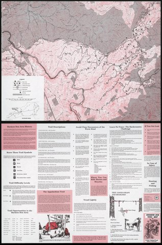
| Description |
English: Relief shown by contours and spot heights. Title from panel. "*U.S. GPO: 1995-0-636-827." Includes location map. Text and ill. on verso Available also through the Library of Congress Web site as a raster image. |
||
| Title | Harmon Den Trail map : Pisgah National Forest, North Carolina | ||
| Shelf ID | G3902.H34E63 1995 .U5 | ||
| Date | |||
| Source | https://www.loc.gov/item/2006635212/ | ||
| Author | United States. Forest Service | ||
| Permission (Reusing this file) |
|
||
| Other versions |
|
||
| Location | United States · Harmon Den Trail. · Harmon Den Trail · North Carolina | ||
| Part of | American Memory · General Maps · Catalog · Transportation And Communication · Geography And Map Division | ||
| Subject | North Carolina · United States · Maps · Harmon Den Trail · Outdoor Recreation · Harmon Den Trail (N.C.) |


Licensing
edit| This work is from the Library of Congress. According to the library, there are no known copyright restrictions on the use of this work. |  |
File history
Click on a date/time to view the file as it appeared at that time.
| Date/Time | Thumbnail | Dimensions | User | Comment | |
|---|---|---|---|---|---|
| current | 14:50, 15 June 2019 |  | 8,908 × 13,470 (343.3 MB) | Fæ (talk | contribs) | LOC Maps https://www.loc.gov/item/2006635212/ #6049 |
You cannot overwrite this file.
File usage on Commons
The following page uses this file: