File:Homochitto National Forest, Mississippi. LOC 75695927.jpg
Size of this preview: 561 × 600 pixels. Other resolutions: 225 × 240 pixels | 449 × 480 pixels | 718 × 768 pixels | 958 × 1,024 pixels | 1,916 × 2,048 pixels | 6,882 × 7,356 pixels.
Original file (6,882 × 7,356 pixels, file size: 7.87 MB, MIME type: image/jpeg)
Captions
Captions
Add a one-line explanation of what this file represents
Summary edit
| Description |
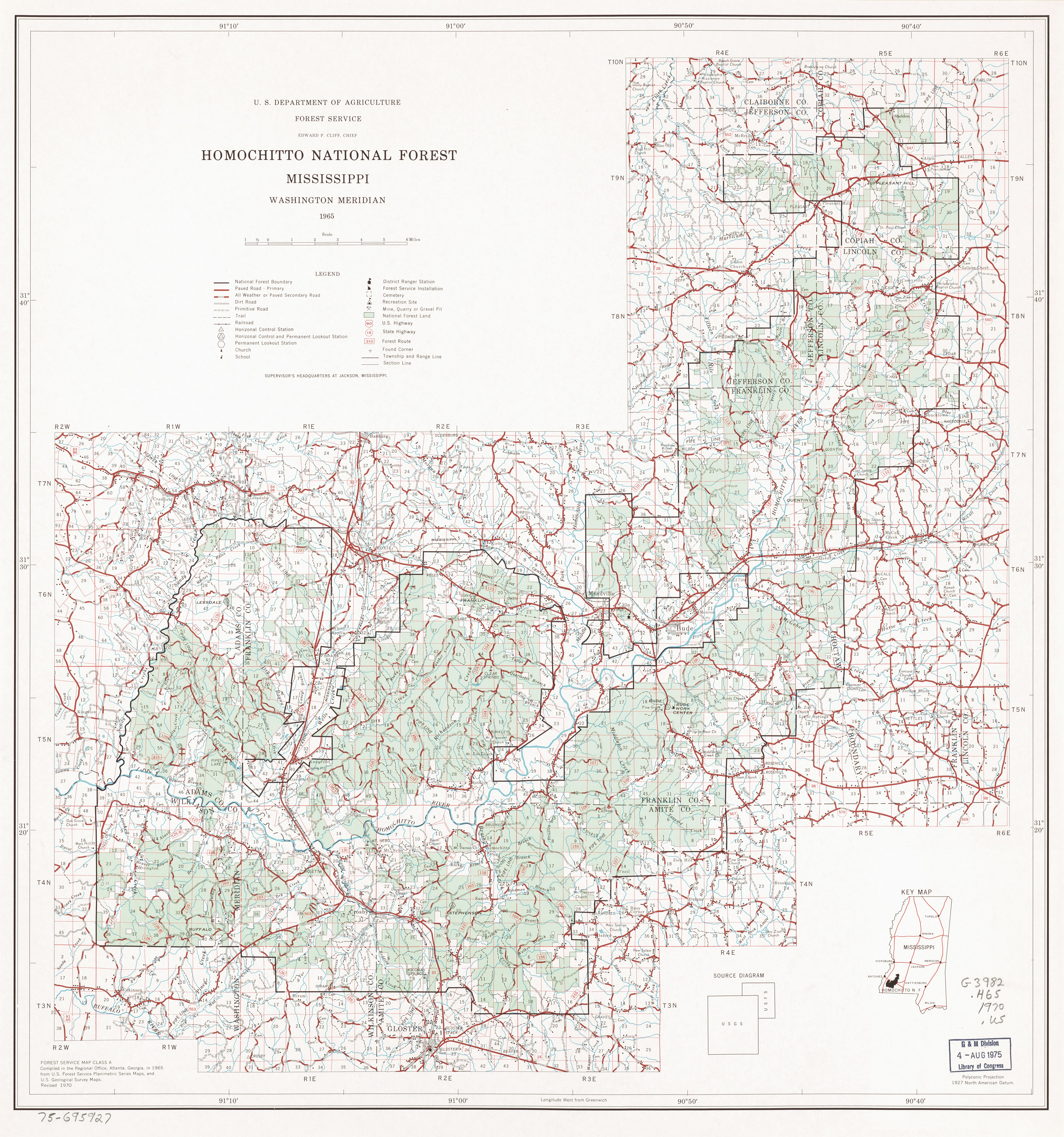
English: Scale ca. 1:126,720. "Polyconic projection." "Washington meridian." "Forest Service map class A." Includes location map and "Source diagram." Available also through the Library of Congress Web site as a raster image. AACR2 |
||
| Title | Homochitto National Forest, Mississippi. | ||
| Shelf ID | G3982.H65 1970 .U5 | ||
| Date | |||
| Source | https://www.loc.gov/item/75695927/ | ||
| Author | United States. Forest Service. Southern Region | ||
| Permission (Reusing this file) |
|
||
| Other versions |
|
||
| Location | Homochitto National Forest. · United States · Mississippi · Homochitto National Forest | ||
| Part of | American Memory · General Maps · Catalog · Geography And Map Division | ||
| Subject | United States · Maps · Mississippi · Homochitto National Forest · Homochitto National Forest (Miss.) |


Licensing edit
| This work is from the Library of Congress. According to the library, there are no known copyright restrictions on the use of this work. |  |
File history
Click on a date/time to view the file as it appeared at that time.
| Date/Time | Thumbnail | Dimensions | User | Comment | |
|---|---|---|---|---|---|
| current | 03:37, 23 December 2018 | | 6,882 × 7,356 (7.87 MB) | Fæ (talk | contribs) | LOC Maps https://www.loc.gov/item/75695927/ #19570 |
You cannot overwrite this file.
File usage on Commons
The following page uses this file: