File:Karte-der-Charlottenhöhle.svg

Size of this PNG preview of this SVG file: 300 × 600 pixels. Other resolutions: 120 × 240 pixels | 240 × 480 pixels | 384 × 768 pixels | 512 × 1,024 pixels | 1,024 × 2,048 pixels.
Original file (SVG file, nominally 300 × 600 pixels, file size: 66 KB)
Captions
Captions
Add a one-line explanation of what this file represents
Summary edit
| Description |
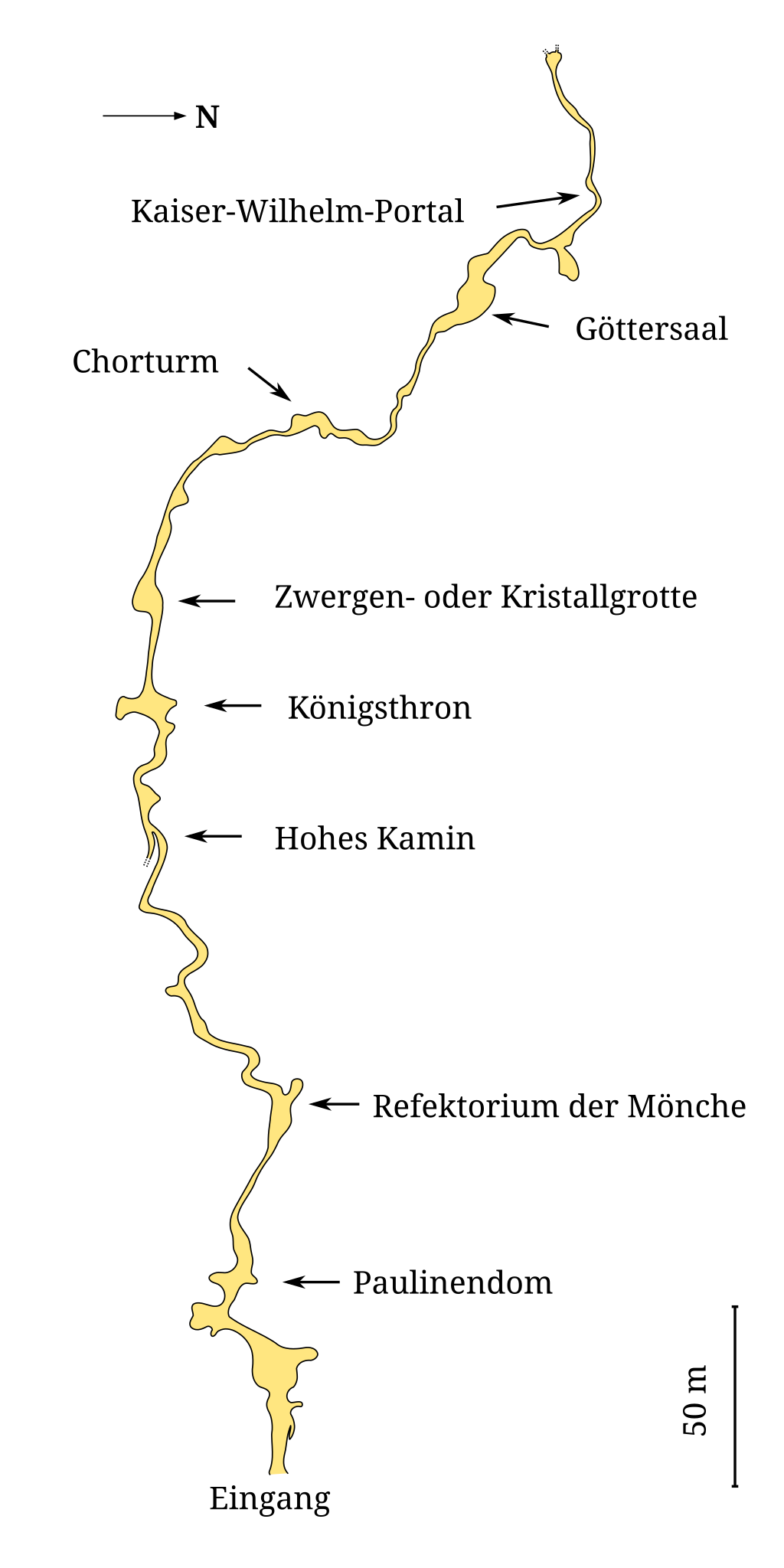
Deutsch: de:Charlottenhöhle |
| Source | Own work |
| Author | Biezl |
This W3C-unspecified vector image was created with Inkscape .
Licensing edit
| I, the copyright holder of this work, release this work into the public domain. This applies worldwide. In some countries this may not be legally possible; if so: I grant anyone the right to use this work for any purpose, without any conditions, unless such conditions are required by law. |
File history
Click on a date/time to view the file as it appeared at that time.
| Date/Time | Thumbnail | Dimensions | User | Comment | |
|---|---|---|---|---|---|
| current | 13:22, 26 December 2009 | | 300 × 600 (66 KB) | Wuselig (talk | contribs) | Reverted to version as of 12:30, 15 November 2009 Hohes Kamin ist Schwäbisch und deshalb der korrekte Originalnamen |
| 08:48, 25 December 2009 |  | 300 × 600 (67 KB) | Biezl (talk | contribs) | Hohes Kamin -> Hoher Kamin | |
| 12:30, 15 November 2009 |  | 300 × 600 (66 KB) | Biezl (talk | contribs) | {{Information |Description={{de|1=de:Charlottenhöhle}} |Source={{own}} |Author=Biezl |Date= |Permission= |other_versions= }} {{Inkscape}} |
You cannot overwrite this file.
File usage on Commons
There are no pages that use this file.
File usage on other wikis
The following other wikis use this file:
- Usage on de.wikipedia.org
- Usage on en.wikipedia.org
- Usage on fr.wikipedia.org