File:Lake Seminole, Florida-Georgia-Alabama, satellite image map - NASA LANDSAT-1, 1-500,000, N3015W08512 LOC 79694282.jpg
Size of this preview: 731 × 599 pixels. Other resolutions: 293 × 240 pixels | 586 × 480 pixels | 937 × 768 pixels | 1,249 × 1,024 pixels | 2,498 × 2,048 pixels | 7,603 × 6,233 pixels.
Original file (7,603 × 6,233 pixels, file size: 6.62 MB, MIME type: image/jpeg)
Captions
Captions
Add a one-line explanation of what this file represents
Summary
edit| Description |
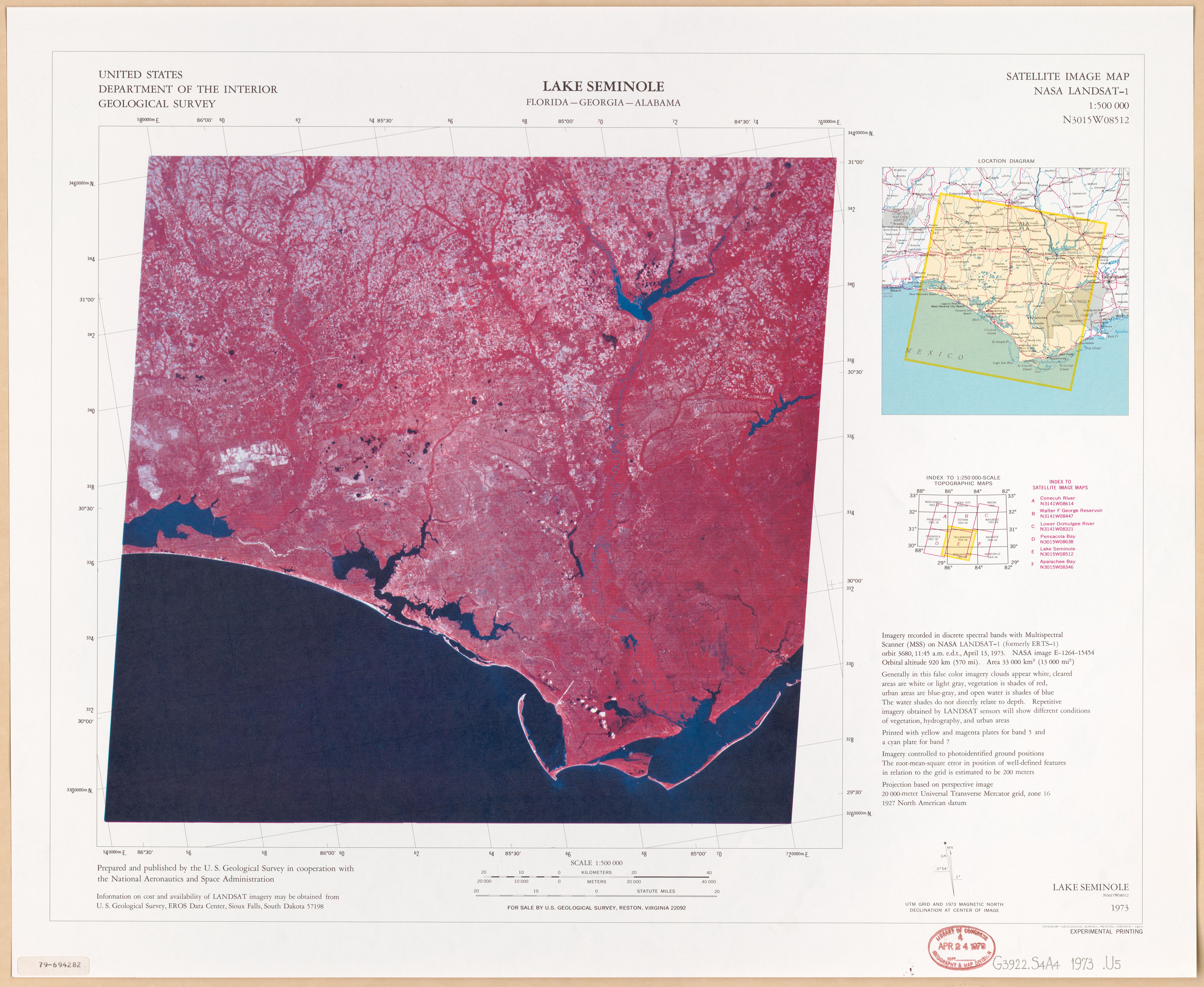
English: Scale 1:500,000. Title in lower right corner: Lake Seminole, N3015W08512, 1973. "Imagery recorded ... April 13, 1973." "Projection based on perspective image, 20,000-meter universal transverse Mercator grid ..." Covers Lake Seminole region. "Experimental printing." Includes text, location map, and index to topographic and satellite image map coverage. Available also through the Library of Congress Web site as a raster image. AACR2 |
||
| Title | Lake Seminole, Florida-Georgia-Alabama, satellite image map : NASA LANDSAT-1, 1:500,000, N3015W08512 | ||
| Shelf ID | G3922.S4A4 1973 .U5 | ||
| Date | |||
| Source | https://www.loc.gov/item/79694282/ | ||
| Author | Geological Survey (U.S.); United States. National Aeronautics And Space Administration | ||
| Permission (Reusing this file) |
|
||
| Other versions |
|
||
| Location | Seminole, Lake, Region. · Georgia · Seminole, Lake, Region · Region · Florida · Lake · United States · Seminole · Alabama | ||
| Part of | American Memory · General Maps · Catalog · Geography And Map Division | ||
| Subject | Seminole, Lake, Region (Ga. And Fla.) · Georgia · Seminole, Lake, Region · Florida · United States · Remote-Sensing Maps · Alabama |


Licensing
edit
| This work is from the Library of Congress. According to the library, there are no known copyright restrictions on the use of this work. |  |
File history
Click on a date/time to view the file as it appeared at that time.
| Date/Time | Thumbnail | Dimensions | User | Comment | |
|---|---|---|---|---|---|
| current | 13:56, 24 August 2018 | | 7,603 × 6,233 (6.62 MB) | Fæ (talk | contribs) | LOC Maps https://www.loc.gov/item/79694282/ #4989 |
You cannot overwrite this file.
File usage on Commons
The following page uses this file: