File:Land use, Calcasieu-Sabine River basin area, Cameron and Calcasieu parishes, Louisiana LOC 92682943.jpg
Size of this preview: 800 × 415 pixels. Other resolutions: 320 × 166 pixels | 640 × 332 pixels | 1,024 × 531 pixels | 1,280 × 664 pixels | 2,560 × 1,327 pixels | 6,256 × 3,243 pixels.
Original file (6,256 × 3,243 pixels, file size: 2.57 MB, MIME type: image/jpeg)
Captions
Captions
Add a one-line explanation of what this file represents
Summary
edit| Description |
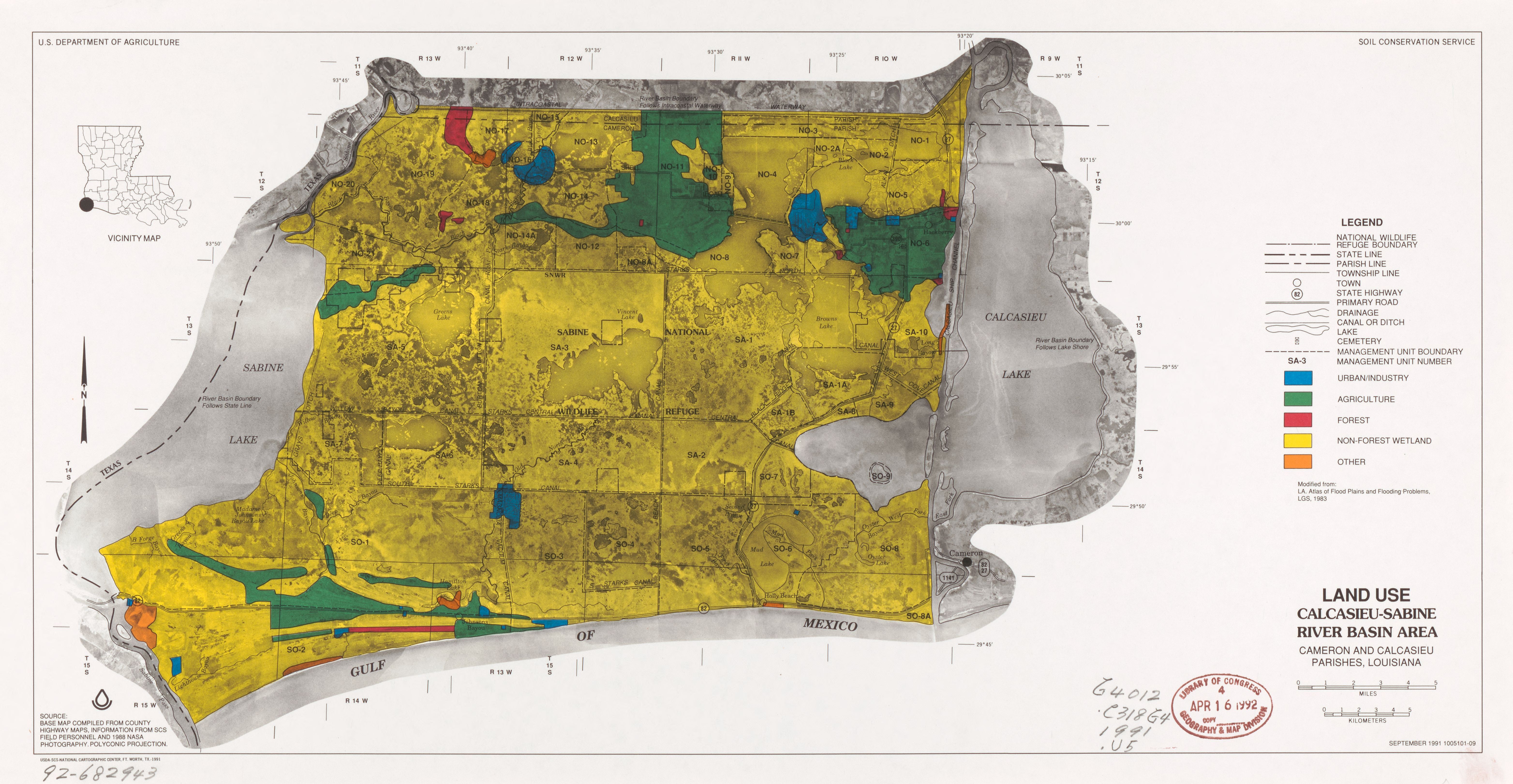
English: "September 1991 1005101-09." Land use data printed in color on photomap base. "Modified from: L.A. atlas of flood plains and flooding problems, LGS, 1983." "Source: Base map compiled from county highway maps. Information from SCS field personnel and 1988 NASA photography." Includes location map. Available also through the Library of Congress Web site as a raster image. |
||
| Title | Land use, Calcasieu-Sabine River basin area, Cameron and Calcasieu parishes, Louisiana | ||
| Shelf ID | G4012.C318G4 1991 .U5 | ||
| Date | |||
| Source | https://www.loc.gov/item/92682943/ | ||
| Author | United States. Soil Conservation Service; National Cartographic Center (U.S.) | ||
| Permission (Reusing this file) |
|
||
| Other versions |
|
||
| Location | Sabine Lake Region. · United States · Lousiana · Sabine Lake Region · Calcasieu Lake Region · Louisiana · Texas · Calcasieu Lake Region. | ||
| Part of | American Memory · Catalog · Geography And Map Division · Additional Conservation And Environment Cartographic Items | ||
| Subject | Sabine Lake Region (La. And Tex.) · Calcasieu Lake Region (La.) · Land Use · United States · Maps · Remote-Sensing Maps · Sabine Lake Region · Calcasieu Lake Region · Louisiana · Texas |


Licensing
edit
| This work is from the Library of Congress. According to the library, there are no known copyright restrictions on the use of this work. |  |
File history
Click on a date/time to view the file as it appeared at that time.
| Date/Time | Thumbnail | Dimensions | User | Comment | |
|---|---|---|---|---|---|
| current | 12:04, 22 May 2019 | | 6,256 × 3,243 (2.57 MB) | Fæ (talk | contribs) | LOC Maps https://www.loc.gov/item/92682943/ #4825 |
You cannot overwrite this file.
File usage on Commons
The following page uses this file: