File:Lika region map.png

Size of this preview: 547 × 599 pixels. Other resolutions: 219 × 240 pixels | 438 × 480 pixels | 730 × 800 pixels.
Original file (730 × 800 pixels, file size: 35 KB, MIME type: image/png)
Captions
Captions
Add a one-line explanation of what this file represents
Summary edit
| Description |
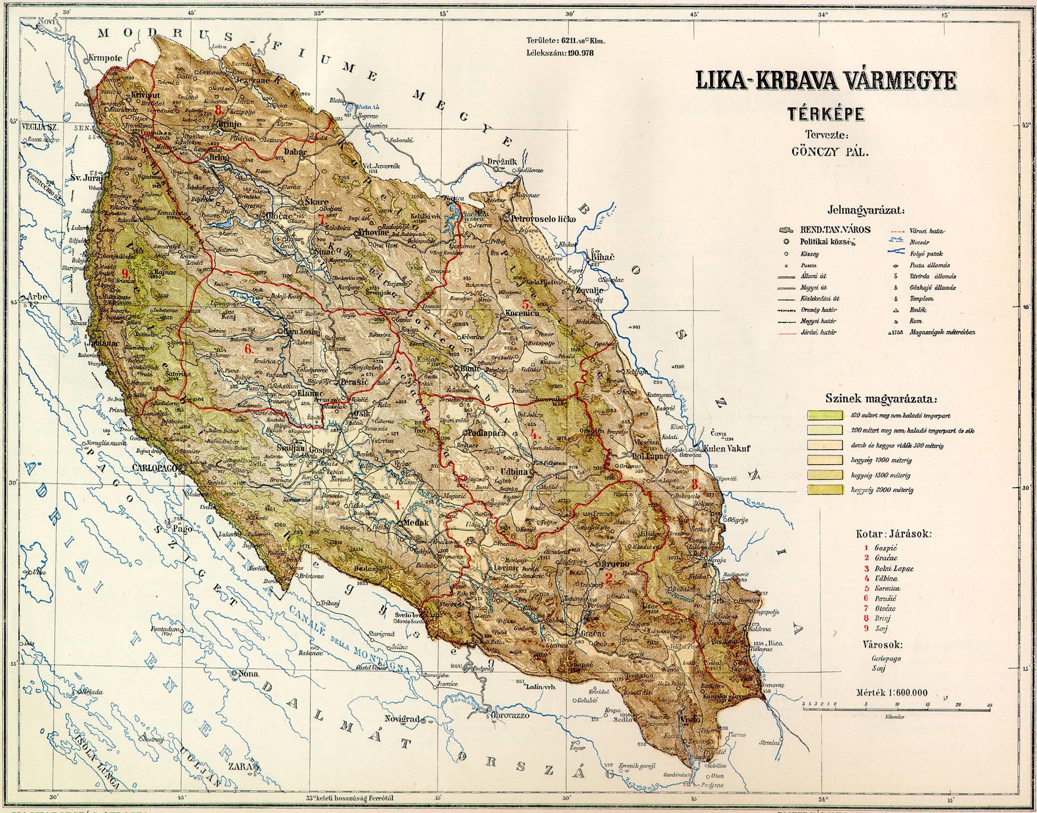
English: Geographical region of Lika in Croatia. Hrvatski: Zemljopisna regija Lika u Hrvatskoj. |
| Date | |
| Source | Own work |
| Author | PANONIAN |
Licensing edit
| I, the copyright holder of this work, release this work into the public domain. This applies worldwide. In some countries this may not be legally possible; if so: I grant anyone the right to use this work for any purpose, without any conditions, unless such conditions are required by law. |
References edit
Borders of Lika region that I used in this map are borders of historical Lika-Krbava County of Croatia-Slavonia:
- http://img117.imageshack.us/img117/7104/51molikml6.gif
- http://lazarus.elte.hu/hun/maps/1910/gonczy/likakrbava.jpg
- http://lazarus.elte.hu/hun/maps/1910/lika-kr.jpg
- Povijesni atlas, Učila - Zagreb, Zagreb, 1971.
- Školski istorijski atlas, Zavod za izdavanje udžbenika SR Srbije, Beograd, 1970.
File history
Click on a date/time to view the file as it appeared at that time.
| Date/Time | Thumbnail | Dimensions | User | Comment | |
|---|---|---|---|---|---|
| current | 10:39, 15 February 2011 | | 730 × 800 (35 KB) | PANONIAN (talk | contribs) | {{Information |Description ={{en|1=Geographical region of Lika in Croatia.}} |Source ={{own}} |Author =PANONIAN |Date = |Permission = |other_versions = }} |
You cannot overwrite this file.
File usage on Commons
The following page uses this file:
File usage on other wikis
The following other wikis use this file:
- Usage on be-tarask.wikipedia.org
- Usage on be.wikipedia.org
- Usage on bs.wikipedia.org
- Usage on da.wikipedia.org
- Usage on en.wikipedia.org
- Usage on hr.wikipedia.org
- Usage on hu.wikipedia.org
- Usage on id.wikipedia.org
- Usage on lt.wikipedia.org
- Usage on nl.wikipedia.org
- Usage on no.wikipedia.org
- Usage on pl.wikipedia.org
- Usage on sh.wikipedia.org
- Usage on sk.wikipedia.org
- Usage on sl.wikipedia.org
- Usage on sv.wikipedia.org
- Usage on uk.wikipedia.org