File:Madagascar ESA411360.tiff

Original file (4,670 × 5,681 pixels, file size: 151.83 MB, MIME type: image/tiff)
Captions
Captions
Summary
edit| Description |
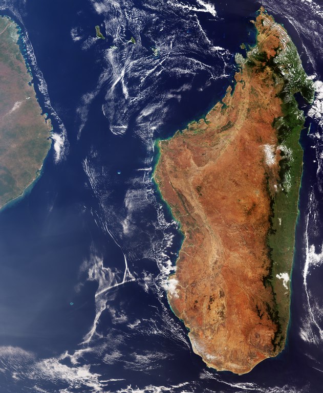
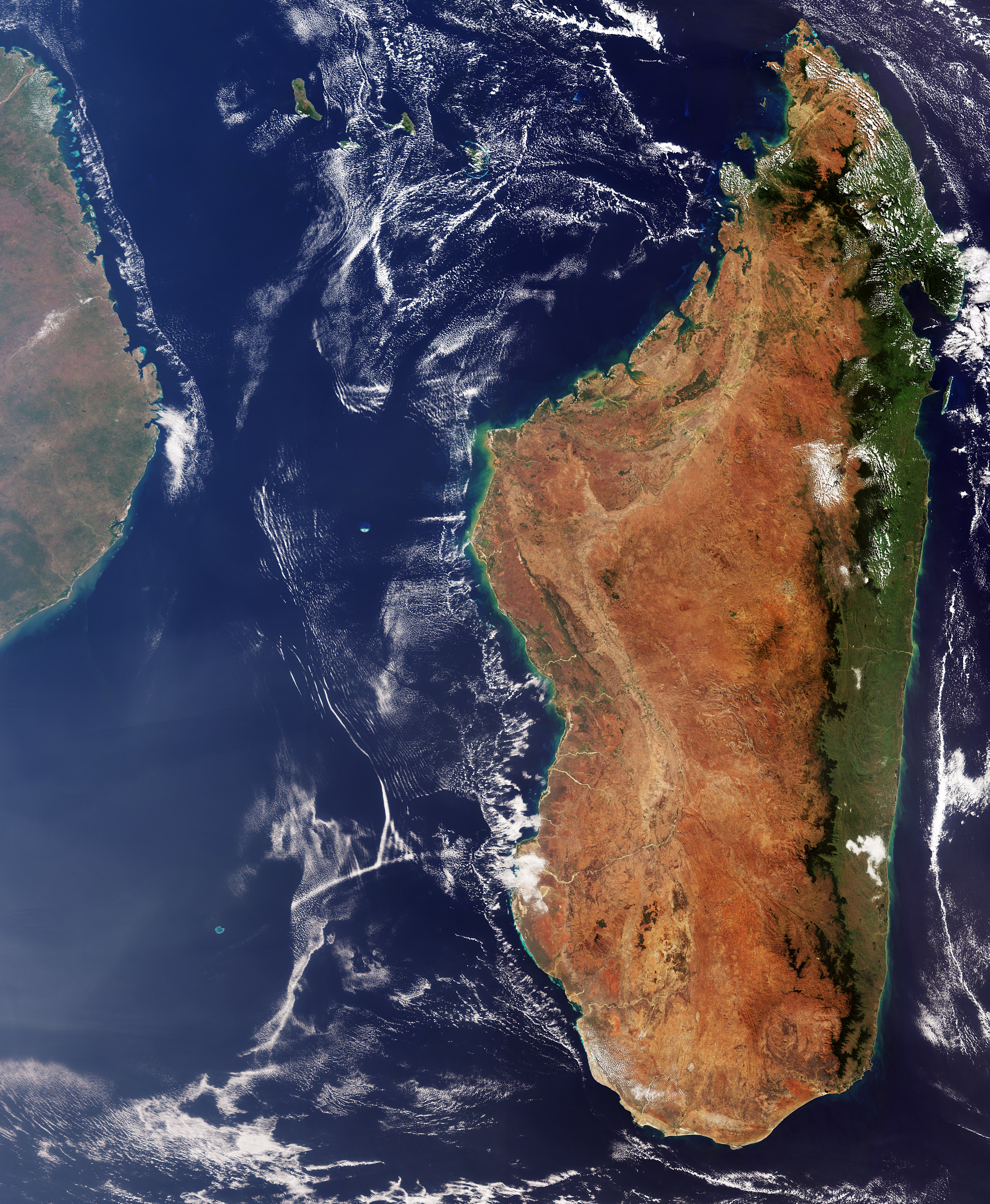
English: The Copernicus Sentinel-3 mission takes us over Madagascar. This huge island nation, located off the east coast of Africa and seen in the left of the image, has a population of around 25 million. More than half of the country’s inhabitants are aged under 25. The island is also home to rare flora and fauna, having developed its own ecosystems and wildlife since splitting from the African continent some 160 million years ago.
Preserving its impressive biodiversity is an ongoing challenge for the country. With an area of almost 600 000 sq km, Madagascar is the fourth largest island in the world. Some of the world’s most extensive coral reef systems, huge mangrove areas, and a vast array of birds, lemurs, and many other species can be found here. Deforestation poses a serious threat to the island’s habitats, with illegal wildlife trade representing a further challenge. In this true-colour image from Copernicus Sentinel-3’s ocean and land colour instrument, we can see sediment in the water along the coast. The island appears in green on the east coast, where the prevailing trade winds bring clouds and up to 3.5 m of rain per year to the low-lying coast. The central and western highlands and coast appear in brown and are much dryer, especially between May to October. The volcanic mountainous area of Ankaratra can be found in the central highlands. In the north of the island, the highest peak of Maromokotro stands almost 2900 m above sea level. The Mozambique Channel, which separates Madagascar from the continent, is an important shipping route for east Africa and home to significant tuna reserves. Efforts are underway to ensure that sustainability is considered in local development. Identifying and protecting critical habitats, such as migratory corridors, is part of this work. Sentinel-3 is a two-satellite mission to supply the coverage and data delivery needed for Europe’s Copernicus environmental monitoring programme. It provides critical information for a range of applications from marine observation to large-area vegetation monitoring. This image, which was captured on 7 August 2018, is also featured on theEarth from Space video programme. |
| Date | |
| Source | http://www.esa.int/spaceinimages/Images/2018/11/Madagascar |
| Author | European Space Agency |
| Permission (Reusing this file) |
contains modified Copernicus Sentinel data (2018), processed by ESA,CC BY-SA 3.0 IGO |
| Other versions | |
| Title | Madagascar |
| System | Copernicus |
| Set | Earth observation image of the week |
| Mission | Sentinel-3 |
| Activity | Observing the Earth |

Licensing
edit- You are free:
- to share – to copy, distribute and transmit the work
- to remix – to adapt the work
- Under the following conditions:
- attribution – You must give appropriate credit, provide a link to the license, and indicate if changes were made. You may do so in any reasonable manner, but not in any way that suggests the licensor endorses you or your use.
- share alike – If you remix, transform, or build upon the material, you must distribute your contributions under the same or compatible license as the original.

|
This image contains data from a satellite in the Copernicus Programme, such as Sentinel-1, Sentinel-2 or Sentinel-3. Attribution is required when using this image.
Attribution: Contains modified Copernicus Sentinel data {{{year}}}
The use of Copernicus Sentinel Data is regulated under EU law (Commission Delegated Regulation (EU) No 1159/2013 and Regulation (EU) No 377/2014). Relevant excerpts:
Free access shall be given to GMES dedicated data [...] made available through GMES dissemination platforms [...].
Access to GMES dedicated data [...] shall be given for the purpose of the following use in so far as it is lawful:
GMES dedicated data [...] may be used worldwide without limitations in time.
GMES dedicated data and GMES service information are provided to users without any express or implied warranty, including as regards quality and suitability for any purpose. |
File history
Click on a date/time to view the file as it appeared at that time.
| Date/Time | Thumbnail | Dimensions | User | Comment | |
|---|---|---|---|---|---|
| current | 13:23, 3 April 2019 |  | 4,670 × 5,681 (151.83 MB) | Fæ (talk | contribs) | European Space Agency, Id 411360, http://www.esa.int/spaceinimages/Images/2018/11/Madagascar, User:Fæ/Project_list/ESA |
You cannot overwrite this file.
File usage on Commons
The following 2 pages use this file: