File:Map illustrating the operations of the Seventh Division under Brig. General G. W. Morgan at Cumberland Gap, Tennessee, during a portion of the year 1862 LOC 99448847.jpg
Size of this preview: 519 × 599 pixels. Other resolutions: 208 × 240 pixels | 416 × 480 pixels | 665 × 768 pixels | 887 × 1,024 pixels | 1,773 × 2,048 pixels | 3,876 × 4,476 pixels.
Original file (3,876 × 4,476 pixels, file size: 3.39 MB, MIME type: image/jpeg)
Captions
Captions
Add a one-line explanation of what this file represents
Summary
edit| Description |
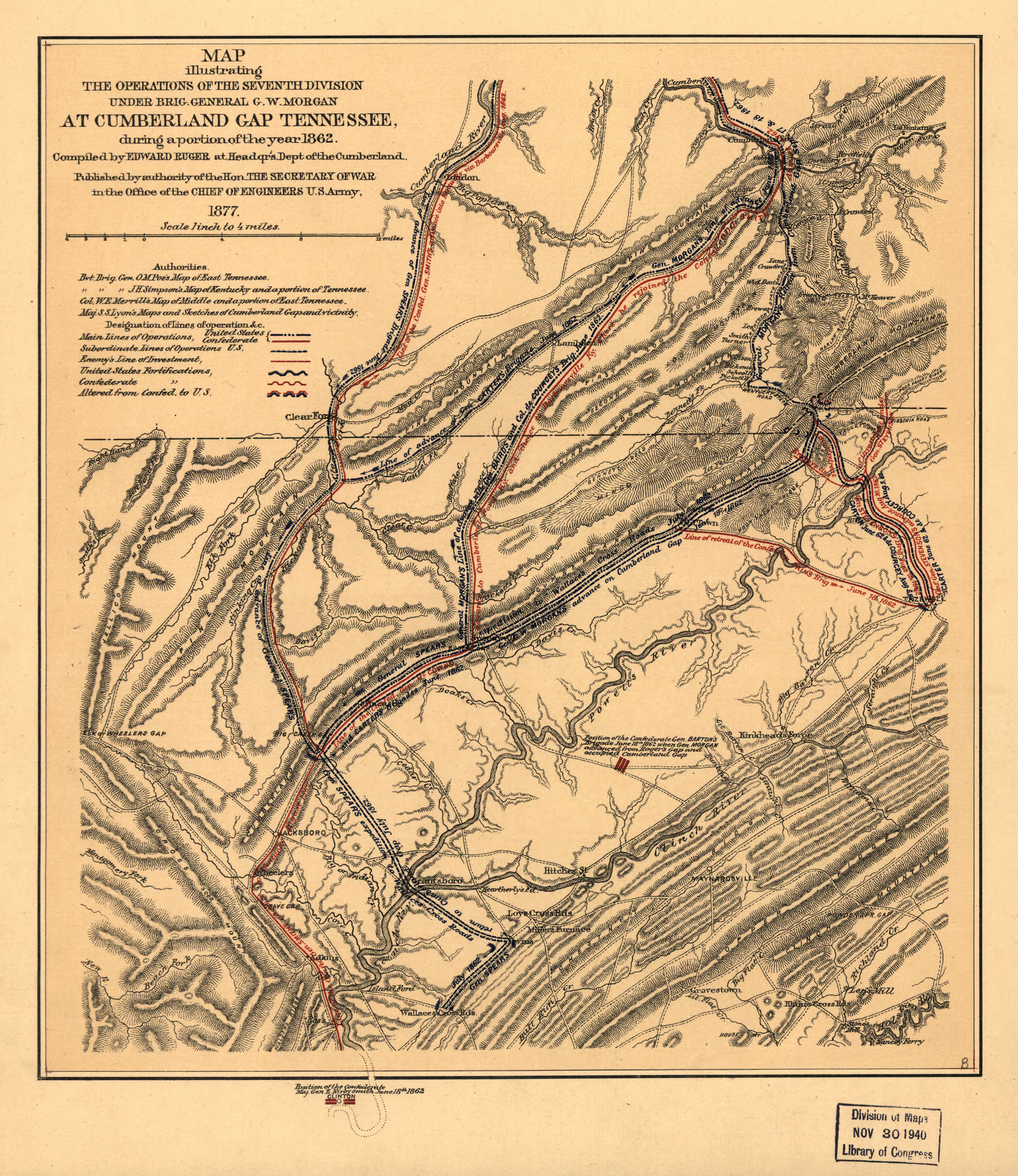
English: Scale 1:253,440. LC Civil War Maps (2nd ed.), 407 Shows troop movements and fortifications, roads, towns, drainage, and hachures. Description derived from published bibliography. Available also through the Library of Congress web site as raster image. |
||
| Title | Map illustrating the operations of the Seventh Division under Brig. General G. W. Morgan at Cumberland Gap, Tennessee, during a portion of the year 1862 | ||
| Shelf ID | G3964.C942S5 1877 .R8 | ||
| Date | |||
| Source | https://www.loc.gov/item/99448847/ | ||
| Author | Ruger, Edward | ||
| Permission (Reusing this file) |
|
||
| Other versions |
|
||
| Location | United States · Tennessee · Cumberland Gap | ||
| Part of | Military Battles And Campaigns · American Memory · Civil War Maps · Catalog · Geography And Map Division | ||
| Subject | Cumberland Gap Campaign · Cumberland Gap (Tenn.) · Civil War · United States · Maps · Tennessee · Cumberland Gap · History |


Licensing
edit
|
This is a faithful photographic reproduction of a two-dimensional, public domain work of art. The work of art itself is in the public domain for the following reason:
The official position taken by the Wikimedia Foundation is that "faithful reproductions of two-dimensional public domain works of art are public domain".
This photographic reproduction is therefore also considered to be in the public domain in the United States. In other jurisdictions, re-use of this content may be restricted; see Reuse of PD-Art photographs for details. | ||||
File history
Click on a date/time to view the file as it appeared at that time.
| Date/Time | Thumbnail | Dimensions | User | Comment | |
|---|---|---|---|---|---|
| current | 18:42, 14 May 2018 | | 3,876 × 4,476 (3.39 MB) | Fæ (talk | contribs) | LOC Maps https://www.loc.gov/item/99448847/ #8543 |
You cannot overwrite this file.
File usage on Commons
The following page uses this file: