File:Map of Lancashire Sheet 030, Ordnance Survey, 1846-1873.jpg

Size of this preview: 800 × 533 pixels. Other resolutions: 320 × 213 pixels | 640 × 427 pixels | 1,024 × 683 pixels | 1,280 × 853 pixels | 2,560 × 1,707 pixels | 10,741 × 7,160 pixels.
Original file (10,741 × 7,160 pixels, file size: 9.17 MB, MIME type: image/jpeg)
Captions
Captions
Add a one-line explanation of what this file represents
Summary
edit
| Map of Lancashire | |
|---|---|
| Author |
Ordnance Survey |
| Title |
Map of Lancashire |
| Description |
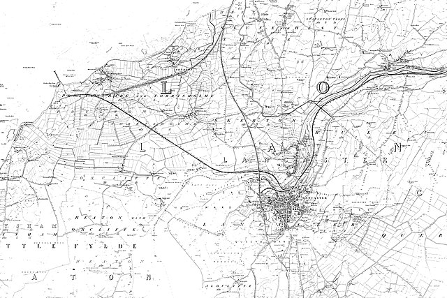
English: Sheet 030 Aldcliffe, Bare, Halton, Heaton, Lancaster, Morecambe, Oxcliffe Hill, Sandylands, Scale Hall, Skerton, Slyne, Torrisholme, West End, White Lund, LA1 5, LA4 6, LA2 6, LA3 3, LA1 1, LA4 5, LA3 1, LA1 2, LA4 4 |
| Date | between 1846 and 1873 |
| Source/Photographer | http://www.british-history.ac.uk/os-1-to-10560/lancashire/030 |
Licensing
edit
|
This is a faithful photographic reproduction of a two-dimensional, public domain work of art. The work of art itself is in the public domain for the following reason:
The official position taken by the Wikimedia Foundation is that "faithful reproductions of two-dimensional public domain works of art are public domain".
This photographic reproduction is therefore also considered to be in the public domain in the United States. In other jurisdictions, re-use of this content may be restricted; see Reuse of PD-Art photographs for details. | ||||
File history
Click on a date/time to view the file as it appeared at that time.
| Date/Time | Thumbnail | Dimensions | User | Comment | |
|---|---|---|---|---|---|
| current | 17:18, 12 November 2017 | | 10,741 × 7,160 (9.17 MB) | Fæ (talk | contribs) | BHO JPEG http://www.british-history.ac.uk/os-1-to-10560/lancashire/030 |
You cannot overwrite this file.
File usage on Commons
The following page uses this file: