File:Map of Miami Co., Ohio. LOC 2012592379.tif

Size of this JPG preview of this TIF file: 621 × 600 pixels. Other resolutions: 248 × 240 pixels | 497 × 480 pixels | 795 × 768 pixels | 1,060 × 1,024 pixels | 2,120 × 2,048 pixels | 16,248 × 15,697 pixels.
Original file (16,248 × 15,697 pixels, file size: 729.69 MB, MIME type: image/tiff)
Captions
Captions
Add a one-line explanation of what this file represents
Summary
edit| Warning | The original file is very high-resolution. It might not load properly or could cause your browser to freeze when opened at full size. |
|---|
| Description |
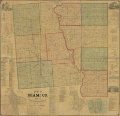
English: "Entered accordingly to act of Coppy right secured this 17th June northern district Ohio." LC Land ownership maps, 654 Available also through the Library of Congress Web site as a raster image. Includes directories and views of public properties. Insets: Newton, Newton, Tp -- Milton, Union Tp. -- Covington, Newberry Tp. -- City of Piqua -- Map of Troy -- Tippecanoe -- Fletcher, Brown Tp. -- Lena, Brown Tp. -- Casstown -- Clayton, Newbery Tp. -- Laura -- West Charleston, Bethel Tp. -- Fredericktown, Union and Monroe Tps. -- Brant, Bethel Tp. |
||
| Title | Map of Miami Co., Ohio. | ||
| Shelf ID | G4083.M5G46 1858 .A7 G4083.M5G46 1858 .A7 Copy 2 | ||
| Date | |||
| Source | https://www.loc.gov/item/2012592379/ | ||
| Author | Arrott, W.; Middleton, Strobridge & Co. | ||
| Permission (Reusing this file) |
|
||
| Other versions |
|
||
| Location | United States · Miami County · Ohio | ||
| Part of | American Memory · Catalog · County Landownership Maps · Geography And Map Division · Cultural Landscapes | ||
| Subject | Cadastral Maps · Miami County · Cities And Towns · United States · Maps · Ohio · Real Property · Landowners |


Licensing
edit|
This is a faithful photographic reproduction of a two-dimensional, public domain work of art. The work of art itself is in the public domain for the following reason:
The official position taken by the Wikimedia Foundation is that "faithful reproductions of two-dimensional public domain works of art are public domain".
This photographic reproduction is therefore also considered to be in the public domain in the United States. In other jurisdictions, re-use of this content may be restricted; see Reuse of PD-Art photographs for details. | ||||
File history
Click on a date/time to view the file as it appeared at that time.
| Date/Time | Thumbnail | Dimensions | User | Comment | |
|---|---|---|---|---|---|
| current | 08:05, 3 June 2018 |  | 16,248 × 15,697 (729.69 MB) | Fæ (talk | contribs) | LOC Maps https://www.loc.gov/item/2012592379/ #3263 |
You cannot overwrite this file.
File usage on Commons
The following page uses this file: