File:Map of Nova Scotia, or Acadia; with the islands of Cape Breton and St. John's, from actual surveys, LOC 74696153.jpg

Size of this preview: 800 × 588 pixels. Other resolutions: 320 × 235 pixels | 640 × 471 pixels | 1,024 × 753 pixels | 1,280 × 941 pixels | 2,560 × 1,882 pixels | 16,720 × 12,295 pixels.
Original file (16,720 × 12,295 pixels, file size: 28.14 MB, MIME type: image/jpeg)
Captions
Captions
Add a one-line explanation of what this file represents
Summary
edit| Warning | The original file is very high-resolution. It might not load properly or could cause your browser to freeze when opened at full size. |
|---|
| Description |
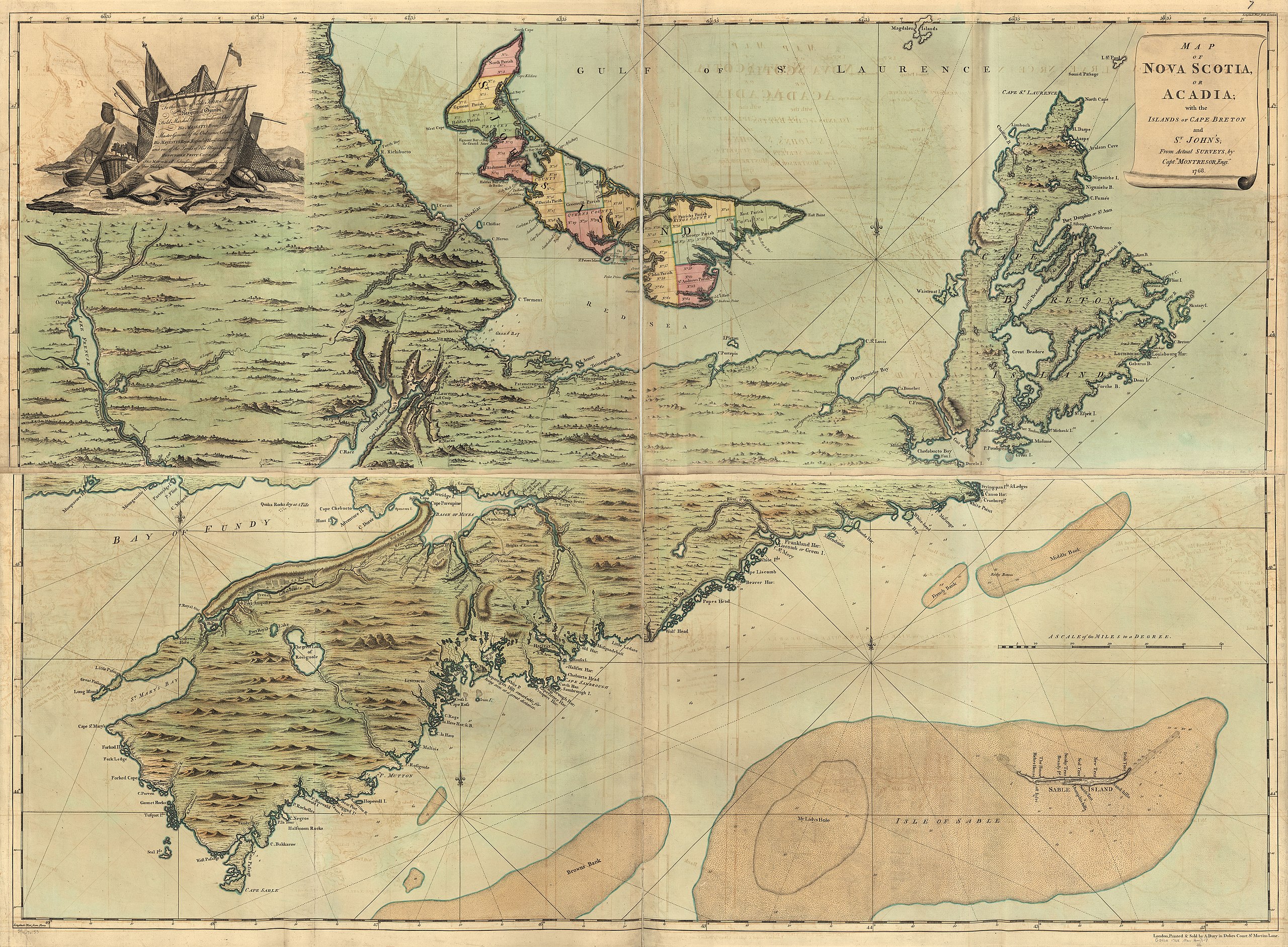
English: Scale ca. 1:390,000. Hand colored. Relief shown pictorially and by hachures. Depths shown by soundings. Shows administrative boundaries on St. John's Island. Includes inscription to "John Manners." Available also through the Library of Congress Web site as a raster image. Vault AACR2: 100; 651/1; 651/2; 651/3; 651/4; 651/5; 700/1 |
||
| Title | Map of Nova Scotia, or Acadia; with the islands of Cape Breton and St. John's, from actual surveys, | ||
| Shelf ID | G3420 1768 .M61 | ||
| Date | |||
| Source | https://www.loc.gov/item/74696153/ | ||
| Author | Montrésor, John; Dury, Andrew | ||
| Permission (Reusing this file) |
|
||
| Location | Cape Breton Island · Canada · Acadia · Nova Scotia · Prince Edward Island | ||
| Part of | France In America · Military Battles And Campaigns · Catalog · American Memory · Geography And Map Division · American Revolution And Its Era: Maps And Charts Of North America And The West Indies, 1750-1789 | ||
| Subject | Canada · Prince Edward Island · Maps · Early Works To 1800 · Acadia · Nova Scotia · Administrative And Political Divisions · Cape Breton Island (N.S.) · Cape Breton Island |

Licensing
edit
|
This is a faithful photographic reproduction of a two-dimensional, public domain work of art. The work of art itself is in the public domain for the following reason:
The official position taken by the Wikimedia Foundation is that "faithful reproductions of two-dimensional public domain works of art are public domain".
This photographic reproduction is therefore also considered to be in the public domain in the United States. In other jurisdictions, re-use of this content may be restricted; see Reuse of PD-Art photographs for details. | ||||
File history
Click on a date/time to view the file as it appeared at that time.
| Date/Time | Thumbnail | Dimensions | User | Comment | |
|---|---|---|---|---|---|
| current | 23:36, 24 May 2018 | | 16,720 × 12,295 (28.14 MB) | Fæ (talk | contribs) | LOC Maps https://www.loc.gov/item/74696153/ #14495 |
You cannot overwrite this file.
File usage on Commons
There are no pages that use this file.