File:Map of the lands of the Memphis & Little Rock Railroad Company (as reorganized) 1878. LOC 98688708.jpg

Size of this preview: 800 × 331 pixels. Other resolutions: 320 × 132 pixels | 640 × 264 pixels | 1,024 × 423 pixels | 1,280 × 529 pixels | 2,560 × 1,058 pixels | 14,467 × 5,977 pixels.
Original file (14,467 × 5,977 pixels, file size: 17.54 MB, MIME type: image/jpeg)
Captions
Captions
Add a one-line explanation of what this file represents
Summary
edit| Warning | The original file is very high-resolution. It might not load properly or could cause your browser to freeze when opened at full size. |
|---|
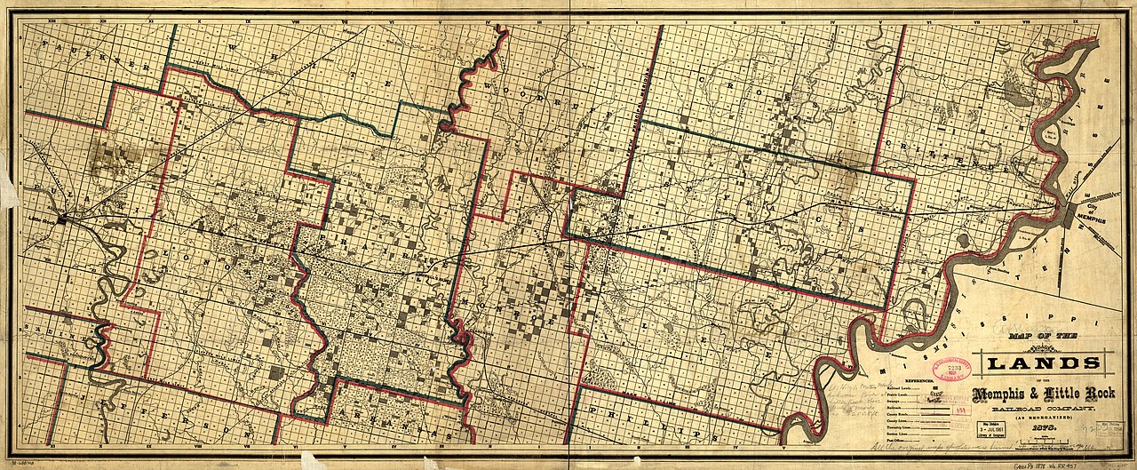
| Description |
English: Map covers part of Arkansas between Memphis and Little Rock showing drainage, prairie lands, counties, cities and towns, township and county lines, county roads, and the railroads. |
||
| Title | Map of the lands of the Memphis & Little Rock Railroad Company (as reorganized) 1878. | ||
| Shelf ID | G4001.P3 1878 .W6 | ||
| Date | |||
| Source | https://www.loc.gov/item/98688708/ | ||
| Author | Woodward, Tiernan, And Hale; Memphis And Little Rock Railroad Company | ||
| Permission (Reusing this file) |
|
||
| Other versions |
|
||
| Location | United States · Arkansas | ||
| Part of | American Memory · Catalog · Railroad Maps, 1828-1900 · Geography And Map Division · Transportation And Communication | ||
| Subject | Memphis And Little Rock Railroad · Railroads · Railroad Land Grants · United States · Maps · Arkansas |


_1878._LOC_98688708.jpg&action=edit§ion=1)
_1878._LOC_98688708.jpg&flash=no)
Licensing
edit_1878._LOC_98688708.jpg&action=edit§ion=2)
|
This is a faithful photographic reproduction of a two-dimensional, public domain work of art. The work of art itself is in the public domain for the following reason:
The official position taken by the Wikimedia Foundation is that "faithful reproductions of two-dimensional public domain works of art are public domain".
This photographic reproduction is therefore also considered to be in the public domain in the United States. In other jurisdictions, re-use of this content may be restricted; see Reuse of PD-Art photographs for details. | ||||
File history
Click on a date/time to view the file as it appeared at that time.
| Date/Time | Thumbnail | Dimensions | User | Comment | |
|---|---|---|---|---|---|
| current | 12:55, 16 May 2018 | | 14,467 × 5,977 (17.54 MB) | Fæ (talk | contribs) | LOC Maps https://www.loc.gov/item/98688708/ #1032 |
You cannot overwrite this file.
File usage on Commons
The following page uses this file:
_1878._LOC_98688708.jpg&oldid=670105452)