File:Map of the town of Plymouth, Windsor County, Vermont. LOC 2008624018.jpg

Size of this preview: 555 × 599 pixels. Other resolutions: 222 × 240 pixels | 444 × 480 pixels | 711 × 768 pixels | 948 × 1,024 pixels | 1,896 × 2,048 pixels | 9,396 × 10,148 pixels.
Original file (9,396 × 10,148 pixels, file size: 14.37 MB, MIME type: image/jpeg)
Captions
Captions
Add a one-line explanation of what this file represents
Summary
edit| Warning | The original file is very high-resolution. It might not load properly or could cause your browser to freeze when opened at full size. |
|---|
| Description |
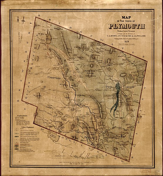
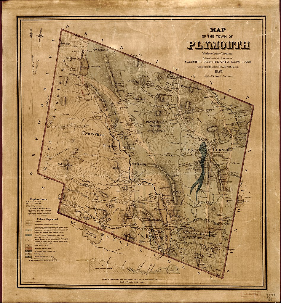
English: General map showing buildings and householders' names. Relief shown by hachures. "Geologically colored by Albert D. Hager." Includes geological cross-section. Copy imperfect: Brittle, darkened, creased, with small tears along edges, backed by cloth. Available also through the Library of Congress Web site as a raster image. Acquisitions control no.: 2007-001 |
||
| Title | Map of the town of Plymouth, Windsor County, Vermont. | ||
| Shelf ID | G3754.P57 1859 .C3 | ||
| Date | |||
| Source | https://www.loc.gov/item/2008624018/ | ||
| Author | C.A. Scott, J.W. Stickney & J.A. Pollard; Hager, Albert D. (Albert David) | ||
| Permission (Reusing this file) |
|
||
| Other versions |
|
||
| Location | Plymouth (Town) · United States · Vermont · Plymouth · Town | ||
| Part of | American Memory · Cities And Towns · Catalog · Geography And Map Division | ||
| Subject | Vermont · Plymouth (Town) · Geology · Plymouth (Vt. : Town) · United States · Maps · Real Property |

Licensing
edit
|
This is a faithful photographic reproduction of a two-dimensional, public domain work of art. The work of art itself is in the public domain for the following reason:
The official position taken by the Wikimedia Foundation is that "faithful reproductions of two-dimensional public domain works of art are public domain".
This photographic reproduction is therefore also considered to be in the public domain in the United States. In other jurisdictions, re-use of this content may be restricted; see Reuse of PD-Art photographs for details. | ||||
File history
Click on a date/time to view the file as it appeared at that time.
| Date/Time | Thumbnail | Dimensions | User | Comment | |
|---|---|---|---|---|---|
| current | 20:42, 4 June 2018 | | 9,396 × 10,148 (14.37 MB) | Fæ (talk | contribs) | LOC Maps https://www.loc.gov/item/2008624018/ #4914 |
You cannot overwrite this file.
File usage on Commons
The following page uses this file: