File:Mapa de las tierras compradas al gobierno y particulares par el Corl. Desmenaro - (región de Honda, Colombia) LOC 2004632061.jpg

Size of this preview: 800 × 522 pixels. Other resolutions: 320 × 209 pixels | 640 × 417 pixels | 1,024 × 668 pixels | 1,280 × 835 pixels | 2,560 × 1,670 pixels | 7,530 × 4,912 pixels.
Original file (7,530 × 4,912 pixels, file size: 5.9 MB, MIME type: image/jpeg)
Captions
Captions
Add a one-line explanation of what this file represents
Summary
edit| Description |
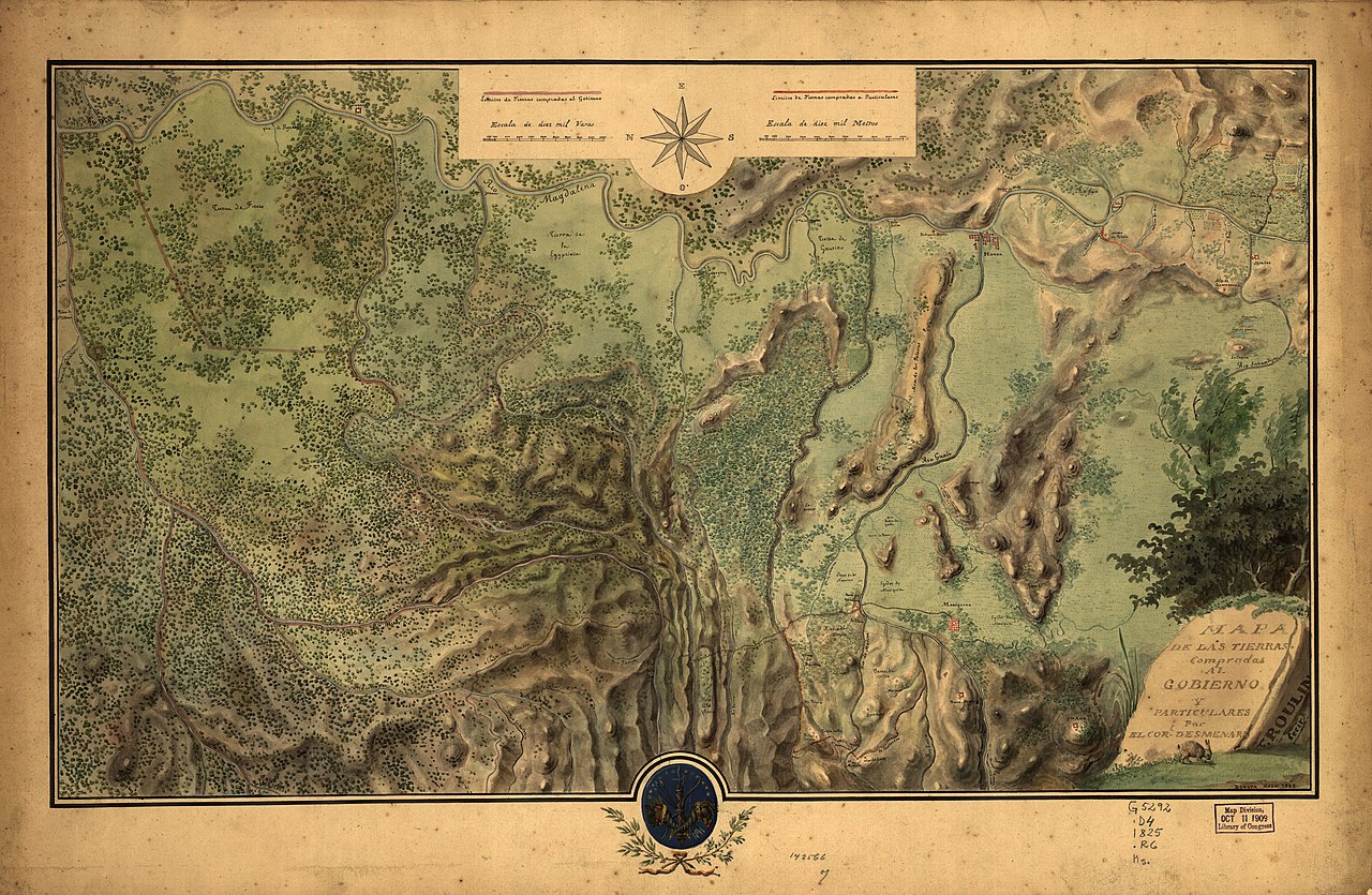
English: Shows boundaries of land purchased to government and individuals in region of Honda west of Magdalena River. In lower right corner: Bogota mayo 1825. Relief shown by shading. Oriented with north to the left. Pen-and-ink and watercolors. Accompanied by ms. contract. 1 sheet : both sides ; 23 x 37 cm., folded to 23 x 19 cm. Available also through the Library of Congress Web site as a raster image. Includes col. ill. LC Luso-Hispanic World, 254 |
||
| Title | Mapa de las tierras compradas al gobierno y particulares par el Corl. Desmenaro : [región de Honda, Colombia] | ||
| Shelf ID | G5294.H6G46 1825 .R6 | ||
| Date | |||
| Source | https://www.loc.gov/item/2004632061/ | ||
| Author | Roulin, F. | ||
| Permission (Reusing this file) |
|
||
| Other versions |
|
||
| Location | Honda Region · Tolima · Colombia | ||
| Part of | American Memory · Catalog · Geography And Map Division · Cultural Landscapes | ||
| Subject | Maps, Manuscript · Honda Region · Honda Region (Tolima) · Tolima · Colombia · Real Property |


_LOC_2004632061.jpg&action=edit§ion=1)
Licensing
edit_LOC_2004632061.jpg&action=edit§ion=2)
|
This is a faithful photographic reproduction of a two-dimensional, public domain work of art. The work of art itself is in the public domain for the following reason:
The official position taken by the Wikimedia Foundation is that "faithful reproductions of two-dimensional public domain works of art are public domain".
This photographic reproduction is therefore also considered to be in the public domain in the United States. In other jurisdictions, re-use of this content may be restricted; see Reuse of PD-Art photographs for details. | ||||
File history
Click on a date/time to view the file as it appeared at that time.
| Date/Time | Thumbnail | Dimensions | User | Comment | |
|---|---|---|---|---|---|
| current | 08:01, 8 June 2018 | | 7,530 × 4,912 (5.9 MB) | Fæ (talk | contribs) | LOC Maps https://www.loc.gov/item/2004632061/ #23588 |
You cannot overwrite this file.
File usage on Commons
The following page uses this file:
_LOC_2004632061.jpg&oldid=803928258)