File:New York 1-50,000. West Point & vicinity LOC 79693037.jpg

Size of this preview: 800 × 455 pixels. Other resolutions: 320 × 182 pixels | 640 × 364 pixels | 1,024 × 583 pixels | 1,280 × 728 pixels | 2,560 × 1,457 pixels | 16,357 × 9,309 pixels.
Original file (16,357 × 9,309 pixels, file size: 21.72 MB, MIME type: image/jpeg)
Captions
Captions
Add a one-line explanation of what this file represents
Summary
edit| Warning | The original file is very high-resolution. It might not load properly or could cause your browser to freeze when opened at full size. |
|---|
| Description |
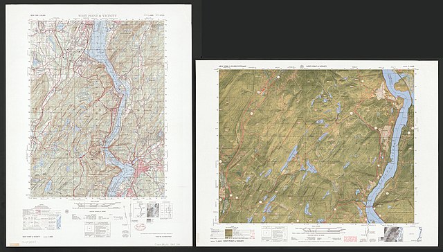
English: Scale 1:50,000. Standard map series designation: Series V721S. "Projection: Transverse Mercator." Relief shown by contours and spot heights. Depths shown by contours and soundings. "Road data 1966-67. Map information as of 1962-1965." Includes boundary diagr., "Elevation guide," and index to adjoining sheets. On verso, 1:25,000: West Point & vicinity, pictomap. Available also through the Library of Congress Web site as a raster image. AACR2 |
||
| Title | New York 1:50,000. West Point & vicinity | ||
| Shelf ID | G3804.W53A1 1967 .U51 | ||
| Date | |||
| Source | https://www.loc.gov/item/79693037/ | ||
| Author | United States. Army Map Service | ||
| Permission (Reusing this file) |
|
||
| Location | West Point Region · New York | ||
| Part of | American Memory · General Maps · Catalog · Geography And Map Division | ||
| Subject | West Point Region (N.Y.) · Remote-Sensing Maps · Maps, Topographic |

Licensing
edit
| This work is from the Library of Congress. According to the library, there are no known copyright restrictions on the use of this work. |  |
File history
Click on a date/time to view the file as it appeared at that time.
| Date/Time | Thumbnail | Dimensions | User | Comment | |
|---|---|---|---|---|---|
| current | 08:05, 20 May 2018 | | 16,357 × 9,309 (21.72 MB) | Fæ (talk | contribs) | LOC Maps https://www.loc.gov/item/79693037/ #12148 |
You cannot overwrite this file.
File usage on Commons
There are no pages that use this file.