File:Ouachita National Forest pocket guide, Arkansas, Oklahoma. LOC 2011590420.jpg
Size of this preview: 708 × 600 pixels. Other resolutions: 283 × 240 pixels | 567 × 480 pixels | 907 × 768 pixels | 1,209 × 1,024 pixels | 2,418 × 2,048 pixels | 7,880 × 6,674 pixels.
Original file (7,880 × 6,674 pixels, file size: 7.24 MB, MIME type: image/jpeg)
Captions
Captions
Add a one-line explanation of what this file represents
Summary
edit| Description |
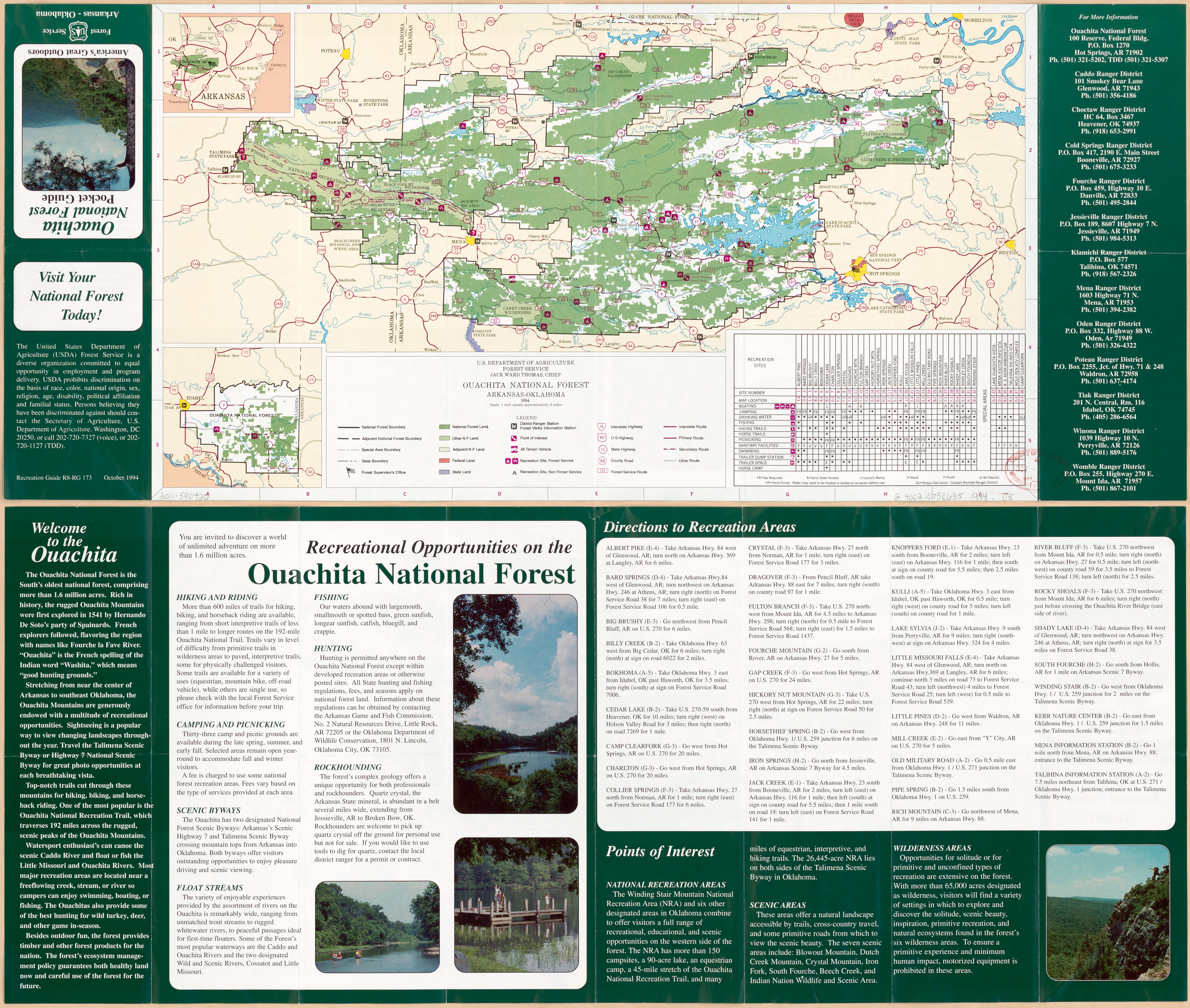
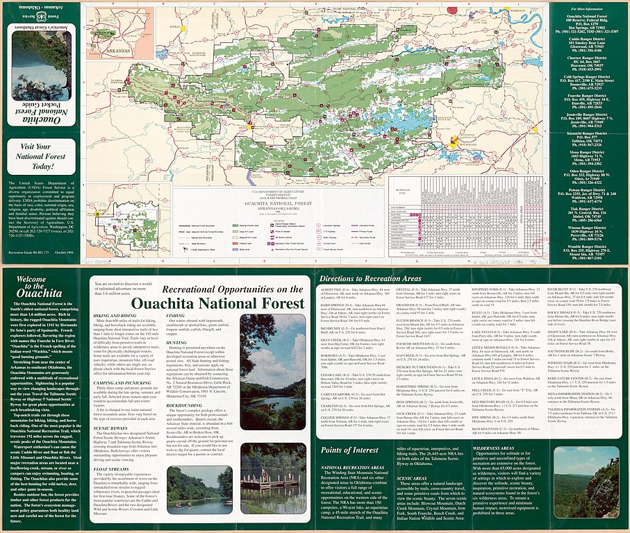
English: Title from panel. "Recreation Guide R8-RG 173." Includes text, area map, location map and indexed list to recreation sites. Text and col. ill. on map. "October 1994." Available also through the Library of Congress Web site as a raster image. |
||
| Title | Ouachita National Forest pocket guide, Arkansas, Oklahoma. | ||
| Shelf ID | G4002.O75E635 1994 .U5 | ||
| Date | |||
| Source | https://www.loc.gov/item/2011590420/ | ||
| Author | United States. Forest Service | ||
| Permission (Reusing this file) |
|
||
| Other versions |
|
||
| Location | Ouachita National Forest. · United States · Oklahoma · Arkansas · Ouachita National Forest | ||
| Part of | American Memory · General Maps · Catalog · Geography And Map Division | ||
| Subject | Ouachita National Forest · Oklahoma · Ouachita National Forest (Ark. And Okla.) · Outdoor Recreation · United States · Maps · Tourist Maps · Arkansas · Road Maps |


Licensing
edit
| This work is from the Library of Congress. According to the library, there are no known copyright restrictions on the use of this work. |  |
File history
Click on a date/time to view the file as it appeared at that time.
| Date/Time | Thumbnail | Dimensions | User | Comment | |
|---|---|---|---|---|---|
| current | 08:12, 29 May 2019 | | 7,880 × 6,674 (7.24 MB) | Fæ (talk | contribs) | LOC Maps https://www.loc.gov/item/2011590420/ #15700 |
You cannot overwrite this file.
File usage on Commons
The following page uses this file: