File:Pisgah National Forest (Pisgah Ranger District), North Carolina - 1993 LOC 97683417.tif

Size of this JPG preview of this TIF file: 718 × 599 pixels. Other resolutions: 288 × 240 pixels | 575 × 480 pixels | 920 × 768 pixels | 1,227 × 1,024 pixels | 2,454 × 2,048 pixels | 9,745 × 8,133 pixels.
Original file (9,745 × 8,133 pixels, file size: 226.75 MB, MIME type: image/tiff)
Captions
Captions
Add a one-line explanation of what this file represents
Summary
edit| Warning | The original file is very high-resolution. It might not load properly or could cause your browser to freeze when opened at full size. |
|---|
| Description |
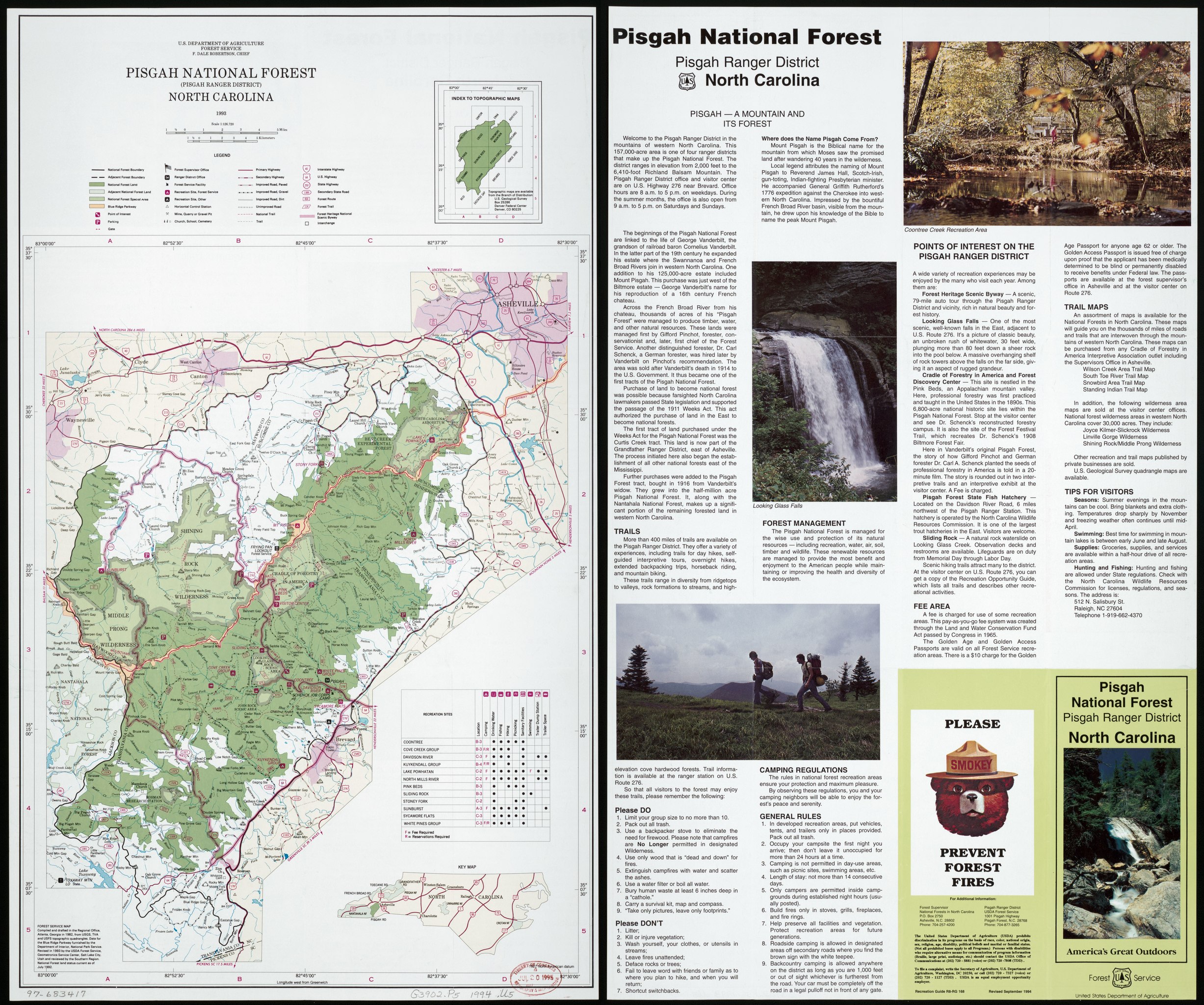
English: Relief shown by hachures and spot heights. "Revised in 1993 by the USDA Forest Service, Geometronics Service Center, Salt Lake City, Utah, and reviewed by the Southern Region." Includes indexed table of recreational sites, index map of U.S.G.S. topographic coverage, and location map. Text and col. ill. on verso. "Recreation guide R8-RG 168." Available also through the Library of Congress Web site as a raster image. |
||
| Title | Pisgah National Forest (Pisgah Ranger District), North Carolina : 1993 | ||
| Shelf ID | G3902.P5 1994 .U5 | ||
| Date | |||
| Source | https://www.loc.gov/item/97683417/ | ||
| Author | United States. Forest Service. Southern Region | ||
| Permission (Reusing this file) |
|
||
| Other versions |
|
||
| Location | United States · Pisgah National Forest · North Carolina · Pisgah National Forest. | ||
| Part of | American Memory · General Maps · Catalog · Geography And Map Division | ||
| Subject | United States · Maps · Pisgah National Forest (N.C.) · Pisgah National Forest · North Carolina |

,_North_Carolina_-_1993_LOC_97683417.jpg)
Licensing
edit| This work is from the Library of Congress. According to the library, there are no known copyright restrictions on the use of this work. |  |
File history
Click on a date/time to view the file as it appeared at that time.
| Date/Time | Thumbnail | Dimensions | User | Comment | |
|---|---|---|---|---|---|
| current | 12:52, 5 September 2018 |  | 9,745 × 8,133 (226.75 MB) | Fæ (talk | contribs) | LOC Maps https://www.loc.gov/item/97683417/ #12143 |
You cannot overwrite this file.
File usage on Commons
The following page uses this file: