File:Plan of the city of Washington - seat of government of the United States LOC 88694087.tif

Size of this JPG preview of this TIF file: 800 × 596 pixels. Other resolutions: 320 × 238 pixels | 640 × 477 pixels | 1,024 × 762 pixels | 1,280 × 953 pixels | 2,560 × 1,906 pixels | 5,148 × 3,833 pixels.
Original file (5,148 × 3,833 pixels, file size: 56.45 MB, MIME type: image/tiff)
Captions
Captions
Add a one-line explanation of what this file represents
Summary edit
| Description |
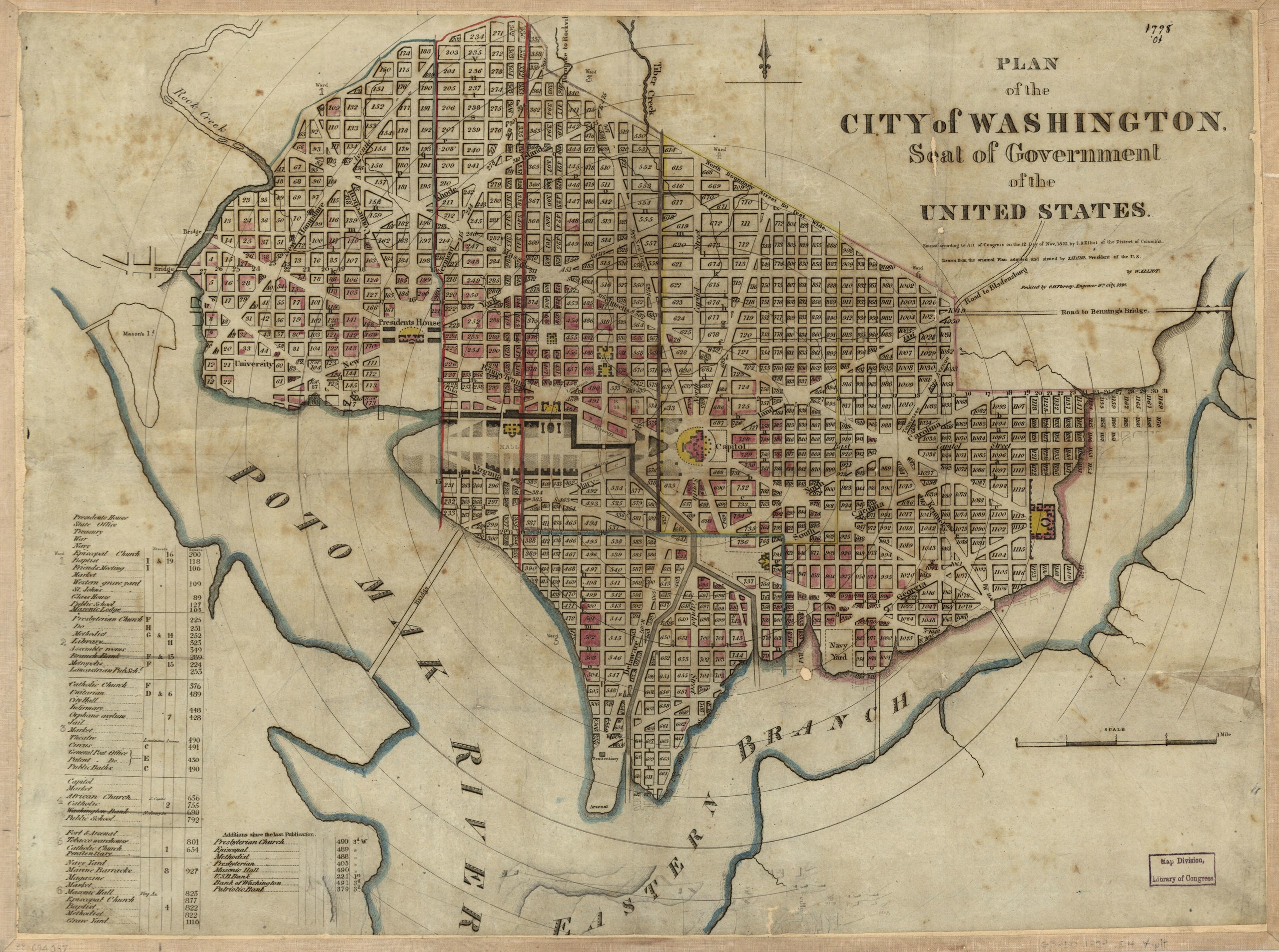
English: Shows block numbers, wards, existing and proposed government buildings, and radial distances from Capitol. "Entered according to Act of Congress on the 12 day of Nov. 1822 by S.A. Elliot of the District of Columbia." Includes indexed table of points of interest. LC Ward maps, 222 Available also through the Library of Congress Web site as a raster image. LC copy annotated in ink, mounted on cloth backing, and edged with cloth. Phillips. Washington 1324 Vault DCP |
||
| Title | Plan of the city of Washington : seat of government of the United States | ||
| Shelf ID | G3850 1829 .E4 | ||
| Date | |||
| Source | https://www.loc.gov/item/88694087/ | ||
| Author | Elliot, William; Elliot, S. Alfred; Throop, G. H. | ||
| Permission (Reusing this file) |
|
||
| Other versions |
|
||
| Location | United States · Washington D.C. · District Of Columbia · Washington | ||
| Part of | American Memory · Cities And Towns · Catalog · Geography And Map Division | ||
| Subject | United States · Washington (D.C.) · District Of Columbia · Washington · Maps |


Licensing edit
|
This is a faithful photographic reproduction of a two-dimensional, public domain work of art. The work of art itself is in the public domain for the following reason:
The official position taken by the Wikimedia Foundation is that "faithful reproductions of two-dimensional public domain works of art are public domain".
This photographic reproduction is therefore also considered to be in the public domain in the United States. In other jurisdictions, re-use of this content may be restricted; see Reuse of PD-Art photographs for details. | ||||
File history
Click on a date/time to view the file as it appeared at that time.
| Date/Time | Thumbnail | Dimensions | User | Comment | |
|---|---|---|---|---|---|
| current | 20:52, 21 May 2018 |  | 5,148 × 3,833 (56.45 MB) | Fæ (talk | contribs) | LOC Maps https://www.loc.gov/item/88694087/ #971 |
You cannot overwrite this file.
File usage on Commons
The following page uses this file: