File:Plan of the town & fort of Grenada LOC 2010593380.jpg
Size of this preview: 463 × 600 pixels. Other resolutions: 185 × 240 pixels | 370 × 480 pixels | 593 × 768 pixels | 790 × 1,024 pixels | 1,581 × 2,048 pixels | 3,520 × 4,560 pixels.
Original file (3,520 × 4,560 pixels, file size: 2.43 MB, MIME type: image/jpeg)
Captions
Captions
Add a one-line explanation of what this file represents
Summary
edit| Description |
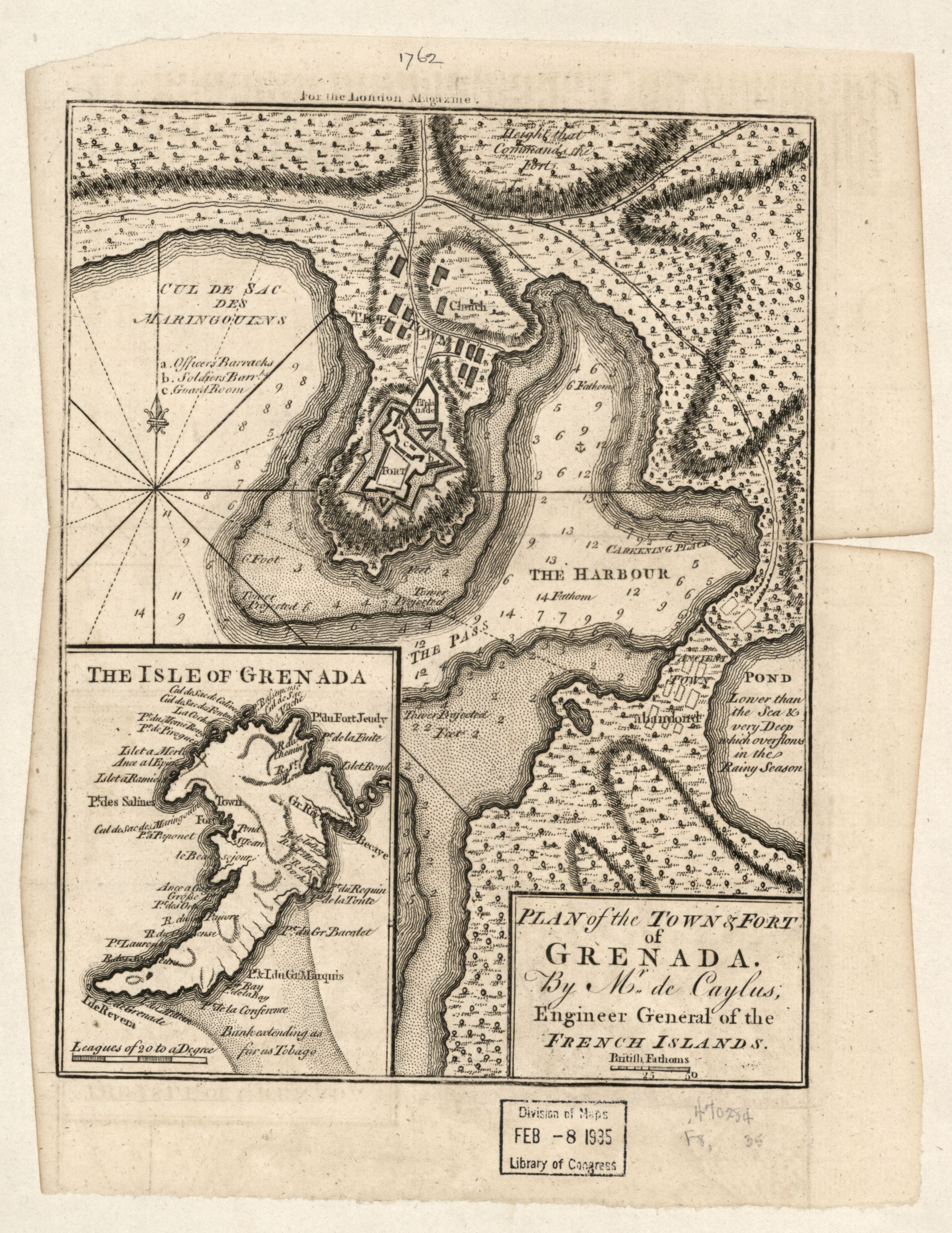
English: Shows town, fort, and harbor of Saint George's. Relief shown by hachures. Depths shown by soundings. In upper margin: For the London Magazine. From London magazine, or, Gentleman's monthly intelligencer. December 1762, v. 31. LC Maps of North America, 1750-1789, 2103 Available also through the Library of Congress Web site as a raster image. Inset: The isle of Grenada. |
||
| Title | Plan of the town & fort of Grenada | ||
| Shelf ID | G5134.S3 1762 .C2 | ||
| Date | |||
| Source | https://www.loc.gov/item/2010593380/ | ||
| Author | Caylus, De | ||
| Permission (Reusing this file) |
|
||
| Other versions |
|
||
| Location | Grenada · St. George'S · St. George'S. · Saint George'S | ||
| Part of | Military Battles And Campaigns · American Memory · Catalog · Geography And Map Division · American Revolution And Its Era: Maps And Charts Of North America And The West Indies, 1750-1789 | ||
| Subject | St. George'S · Fortification · Maps · Early Works To 1800 · Saint George'S · Grenada · Saint George'S (Grenada) · Harbors |


Licensing
edit
|
This is a faithful photographic reproduction of a two-dimensional, public domain work of art. The work of art itself is in the public domain for the following reason:
The official position taken by the Wikimedia Foundation is that "faithful reproductions of two-dimensional public domain works of art are public domain".
This photographic reproduction is therefore also considered to be in the public domain in the United States. In other jurisdictions, re-use of this content may be restricted; see Reuse of PD-Art photographs for details. | ||||
File history
Click on a date/time to view the file as it appeared at that time.
| Date/Time | Thumbnail | Dimensions | User | Comment | |
|---|---|---|---|---|---|
| current | 13:06, 22 May 2018 | | 3,520 × 4,560 (2.43 MB) | Fæ (talk | contribs) | LOC Maps https://www.loc.gov/item/2010593380/ #13314 |
You cannot overwrite this file.
File usage on Commons
The following page uses this file: