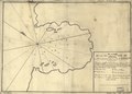
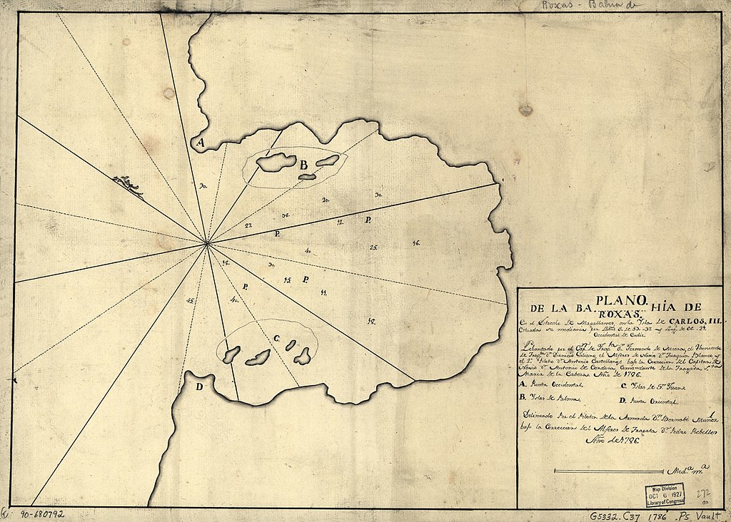
File:Plano de la Bahía de Roxas en el Estrecho de Magallanes en la Ysla de Carlos III cituada su mediania por latud S. de 53" 37" y longd. de 66" 21", occidental de Cádiz LOC 90680792.jpg

Size of this preview: 800 × 572 pixels. Other resolutions: 320 × 229 pixels | 640 × 458 pixels | 1,024 × 732 pixels | 1,280 × 915 pixels | 2,560 × 1,831 pixels | 5,582 × 3,992 pixels.
Original file (5,582 × 3,992 pixels, file size: 2.7 MB, MIME type: image/jpeg)
Captions
Captions
Add a one-line explanation of what this file represents
Summary
edit| Description |
English: Bahía de Roxas unidentifiable on modern maps and/or in gazetteers. Depths shown by soundings. Prime meridian: Cádiz. Oriented with north toward the upper left. Watermark: Strasburg fleur-de-lis. Pen-and-ink. Mounted on cloth backing. LC Luso-Hispanic World, 225 Available also through the Library of Congress Web site as a raster image. Indexed. Maggs number annotated in pencil in lower right corner: 272. Vault |
||
| Title | Plano de la Bahía de Roxas en el Estrecho de Magallanes en la Ysla de Carlos III cituada su mediania por latud S. de 53" 37" y longd. de 66" 21", occidental de Cádiz | ||
| Shelf ID | G5332.C37 1786 .P5 | ||
| Date | |||
| Source | https://www.loc.gov/item/90680792/ | ||
| Author | Miera, Fernando De.; Muñoz, Bernabe | ||
| Permission (Reusing this file) |
|
||
| Other versions |
|
||
| Location | Strait Of · Magellan · Chile · Magellan, Strait Of. · Argentina · Carlos Iii Island · Pacific Coast | ||
| Part of | American Memory · Catalog · Geography And Map Division · Cultural Landscapes | ||
| Subject | Maps, Manuscript · Carlos Iii Island (Chile) · Coasts · Magellan, Strait Of · Maps · Early Works To 1800 · Chile · Magellan, Strait Of (Chile And Argentina) · Pacific Coast (Chile) · Carlos Iii Island · Argentina · Pacific Coast |

Licensing
edit
|
This is a faithful photographic reproduction of a two-dimensional, public domain work of art. The work of art itself is in the public domain for the following reason:
The official position taken by the Wikimedia Foundation is that "faithful reproductions of two-dimensional public domain works of art are public domain".
This photographic reproduction is therefore also considered to be in the public domain in the United States. In other jurisdictions, re-use of this content may be restricted; see Reuse of PD-Art photographs for details. | ||||
File history
Click on a date/time to view the file as it appeared at that time.
| Date/Time | Thumbnail | Dimensions | User | Comment | |
|---|---|---|---|---|---|
| current | 07:47, 13 June 2018 | | 5,582 × 3,992 (2.7 MB) | Fæ (talk | contribs) | LOC Maps https://www.loc.gov/item/90680792/ #28710 |
You cannot overwrite this file.
File usage on Commons
The following page uses this file: