File:Potomac River basin. LOC gm70001060.jpg

Size of this preview: 800 × 326 pixels. Other resolutions: 320 × 130 pixels | 640 × 260 pixels | 1,024 × 417 pixels | 1,280 × 521 pixels | 2,560 × 1,042 pixels | 13,791 × 5,613 pixels.
Original file (13,791 × 5,613 pixels, file size: 5.85 MB, MIME type: image/jpeg)
Captions
Captions
Add a one-line explanation of what this file represents
Summary
edit| Description |
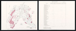
English: Scale 1:627,264. Inset: Location map. "Number and project purpose of reservoirs: Summary of type of storage by subwatershed, Potomac River basin" on verso. Available also through the Library of Congress Web site as a raster image. AACR2 |
||
| Title | Potomac River basin. | ||
| Shelf ID | G3792.P6C3 1969 .U5 | ||
| Date | |||
| Source | https://www.loc.gov/item/gm70001060/ | ||
| Author | United States. Soil Conservation Service | ||
| Permission (Reusing this file) |
|
||
| Other versions |
|
||
| Location | United States · Potomac River Watershed | ||
| Part of | American Memory · General Maps · Catalog · Geography And Map Division | ||
| Subject | United States · Maps · Water Resources Development · Potomac River Watershed |

Licensing
edit
| This work is from the Library of Congress. According to the library, there are no known copyright restrictions on the use of this work. |  |
File history
Click on a date/time to view the file as it appeared at that time.
| Date/Time | Thumbnail | Dimensions | User | Comment | |
|---|---|---|---|---|---|
| current | 23:08, 6 June 2018 | 13,791 × 5,613 (5.85 MB) | Fæ (talk | contribs) | LOC Maps https://www.loc.gov/item/gm70001060/ #22130 |
You cannot overwrite this file.
File usage on Commons
The following page uses this file: