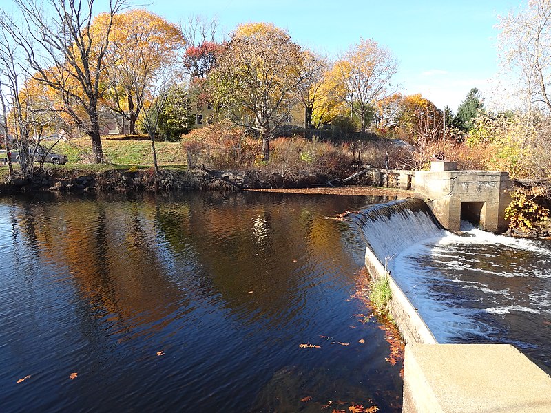
File:Potter Hill Dam Fishway (15461986883).jpg

Original file (4,896 × 3,672 pixels, file size: 7.27 MB, MIME type: image/jpeg)
Captions
Captions
Summary edit
| DescriptionPotter Hill Dam Fishway (15461986883).jpg |
English: These Hurricane Sandy resilience projects will remove the White Rock and Bradford Dams, assess the Potter Hill Dam Fishway on the Pawcatuck River and remove the Shady Lea Mill Dam on the Mattatuxet River in Connecticut and Rhode Island. This will restore connections of streams to regional river systems, enhance fish passage and reduce the risk of flooding and dam failure during future storm events. Two dams will be removed and one fishway will be repaired or replaced on the Pawcatuck River in Rhode Island and Connecticut. One dam will be removed from the Mattatuxet River in North Kingstown, Rhode Island where 0.5 mile of stream access will be restored and a new natural riparian area will be created in a former water impoundment. This will benefit river herring and American eel.
|
| Date | |
| Source | https://www.flickr.com/photos/usfwsnortheast/15461986883/ |
| Author | U. S. Fish and Wildlife Service - Northeast Region |
| Permission (Reusing this file) |
At the time of upload, the image license was automatically confirmed using the Flickr API. For more information see Flickr API detail. |
| Flickr sets InfoField |
|
| Flickr tags InfoField |
|
| Camera location | 41° 24′ 22.78″ N, 71° 50′ 35.38″ W | View this and other nearby images on: OpenStreetMap |
|---|
Licensing edit
- You are free:
- to share – to copy, distribute and transmit the work
- to remix – to adapt the work
- Under the following conditions:
- attribution – You must give appropriate credit, provide a link to the license, and indicate if changes were made. You may do so in any reasonable manner, but not in any way that suggests the licensor endorses you or your use.
| This image was originally posted to Flickr by U. S. Fish and Wildlife Service - Northeast Region at https://flickr.com/photos/43322816@N08/15461986883. It was reviewed on 30 September 2016 by FlickreviewR and was confirmed to be licensed under the terms of the cc-by-2.0. |
30 September 2016
| Public domainPublic domainfalsefalse |
This image or recording is the work of a U.S. Fish and Wildlife Service employee, taken or made as part of that person's official duties. As a work of the U.S. federal government, the image is in the public domain. For more information, see the Fish and Wildlife Service copyright policy.
العربيَّة ∙ català ∙ čeština ∙ eesti ∙ English ∙ español ∙ français ∙ italiano ∙ Nederlands ∙ polski ∙ português ∙ sicilianu ∙ suomi ∙ svenska ∙ Tiếng Việt ∙ Türkçe ∙ Zazaki ∙ македонски ∙ русский ∙ українська ∙ 日本語 ∙ 中文 ∙ 中文(简体) ∙ 中文(繁體) ∙ +/− |
 |
File history
Click on a date/time to view the file as it appeared at that time.
| Date/Time | Thumbnail | Dimensions | User | Comment | |
|---|---|---|---|---|---|
| current | 20:08, 30 September 2016 |  | 4,896 × 3,672 (7.27 MB) | Fæ (talk | contribs) | U.S. Fish and Wildlife Service Northeast Region, Set 72157663867246412, ID 15461986883, Original title Potter Hill Dam Fishway |
You cannot overwrite this file.
File usage on Commons
There are no pages that use this file.
Metadata
This file contains additional information such as Exif metadata which may have been added by the digital camera, scanner, or software program used to create or digitize it. If the file has been modified from its original state, some details such as the timestamp may not fully reflect those of the original file. The timestamp is only as accurate as the clock in the camera, and it may be completely wrong.
| Camera manufacturer | SONY |
|---|---|
| Camera model | DSC-WX100 |
| Exposure time | 1/320 sec (0.003125) |
| F-number | f/3.3 |
| ISO speed rating | 100 |
| Date and time of data generation | 13:21, 10 November 2014 |
| Lens focal length | 4.45 mm |
| Orientation | Normal |
| Horizontal resolution | 350 dpi |
| Vertical resolution | 350 dpi |
| Software used | DSC-WX100 v1.00 |
| File change date and time | 13:21, 10 November 2014 |
| Y and C positioning | Co-sited |
| Exposure Program | Normal program |
| Exif version | 2.3 |
| Date and time of digitizing | 13:21, 10 November 2014 |
| Meaning of each component |
|
| Image compression mode | 3 |
| APEX brightness | 8.6421875 |
| APEX exposure bias | 0 |
| Maximum land aperture | 3.4453125 APEX (f/3.3) |
| Metering mode | Pattern |
| Light source | Unknown |
| Flash | Flash fired, strobe return light not detected, auto mode |
| Supported Flashpix version | 1 |
| Color space | sRGB |
| File source | Digital still camera |
| Scene type | A directly photographed image |
| Custom image processing | Normal process |
| Exposure mode | Auto exposure |
| White balance | Auto white balance |
| Digital zoom ratio | 1 |
| Scene capture type | Standard |
| Contrast | Normal |
| Saturation | Normal |
| Sharpness | Normal |