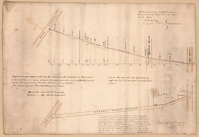
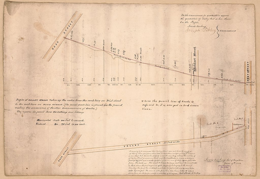
File:Profile of Valley Street taken up the center from the curb line on West Street to the curb line on Road Street - (Georgetown, Washington D.C.) LOC 88693342.jpg

Size of this preview: 800 × 553 pixels. Other resolutions: 320 × 221 pixels | 640 × 442 pixels | 1,024 × 707 pixels | 1,280 × 884 pixels | 2,560 × 1,769 pixels | 6,680 × 4,615 pixels.
Original file (6,680 × 4,615 pixels, file size: 3.42 MB, MIME type: image/jpeg)
Captions
Captions
Add a one-line explanation of what this file represents
Summary
edit| Description |
English: Covers Thirty-Second Street between P and R streets N.W. Oriented with north to the left. Black, brown, red inks, and light brown and green washes. Soiled, stained, faced with gauze, and mounted on cloth backing. Includes text, partial cadastral map of Valley Street, and statement of approval. Available also through the Library of Congress Web site as a raster image. Phillips. Washington 506 Vault DCP |
||
| Title | Profile of Valley Street taken up the center from the curb line on West Street to the curb line on Road Street : [Georgetown, Washington D.C.] | ||
| Shelf ID | G3852.T4625N23 1858 .C3 | ||
| Date | |||
| Source | https://www.loc.gov/item/88693342/ | ||
| Author | Carbery, Lewis | ||
| Permission (Reusing this file) |
|
||
| Other versions |
|
||
| Location | Washington D.C. · Thirty · Second Street · Washington · United States · District Of Columbia | ||
| Part of | American Memory · Cities And Towns · Catalog · Geography And Map Division | ||
| Subject | Washington (D.C.) · Thirty-Second Street · Washington · Maps, Manuscript · Thirty-Second Street (Washington, D.C.) · Streets · Charts, Diagrams, Etc · United States · Maps · District Of Columbia · Real Property · Manuscript Maps |


_LOC_88693342.jpg&action=edit§ion=1)
Licensing
edit_LOC_88693342.jpg&action=edit§ion=2)
|
This is a faithful photographic reproduction of a two-dimensional, public domain work of art. The work of art itself is in the public domain for the following reason:
The official position taken by the Wikimedia Foundation is that "faithful reproductions of two-dimensional public domain works of art are public domain".
This photographic reproduction is therefore also considered to be in the public domain in the United States. In other jurisdictions, re-use of this content may be restricted; see Reuse of PD-Art photographs for details. | ||||
File history
Click on a date/time to view the file as it appeared at that time.
| Date/Time | Thumbnail | Dimensions | User | Comment | |
|---|---|---|---|---|---|
| current | 02:22, 5 June 2018 | | 6,680 × 4,615 (3.42 MB) | Fæ (talk | contribs) | LOC Maps https://www.loc.gov/item/88693342/ #5118 |
You cannot overwrite this file.
File usage on Commons
The following page uses this file:
_LOC_88693342.jpg&oldid=507536699)