File:Project map, Moores Creek Watershed, Chambers County, Alabama LOC 85693523.jpg

Size of this preview: 800 × 416 pixels. Other resolutions: 320 × 166 pixels | 640 × 333 pixels | 1,024 × 533 pixels | 1,280 × 666 pixels | 2,560 × 1,332 pixels | 5,973 × 3,107 pixels.
Original file (5,973 × 3,107 pixels, file size: 1.71 MB, MIME type: image/jpeg)
Captions
Captions
Add a one-line explanation of what this file represents
Summary
edit| Description |
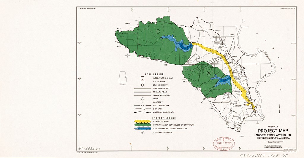
English: Shows benefited area, drainage area controlled by structure, and floodwater retarding structure. "June 1979 4-R-37144. December 1977 Base 4-R-36199." "Base compiled from USGS quadrangles." "10,000 foot grid ticks based on Alabama state plane coordinate system, east zone." "Appendix C." Includes location map. Available also through the Library of Congress Web site as a raster image. |
||
| Title | Project map, Moores Creek Watershed, Chambers County, Alabama | ||
| Shelf ID | G3972.M67 1979 .U5 | ||
| Date | |||
| Source | https://www.loc.gov/item/85693523/ | ||
| Author | United States. Soil Conservation Service | ||
| Permission (Reusing this file) |
|
||
| Other versions |
|
||
| Location | United States · Alabama · Moores Creek Watershed · Moores Creek Watershed (Chambers County) · Chambers County | ||
| Part of | American Memory · Catalog · Geography And Map Division · Additional Conservation And Environment Cartographic Items | ||
| Subject | Moores Creek Watershed (Chambers County, Ala.) · Watershed Management · United States · Maps · Moores Creek Watershed (Chambers County) · Alabama · Flood Control |


Licensing
edit
This work is in the public domain in the United States because it is a work prepared by an officer or employee of the United States Government as part of that person’s official duties under the terms of Title 17, Chapter 1, Section 105 of the US Code.
Note: This only applies to original works of the Federal Government and not to the work of any individual U.S. state, territory, commonwealth, county, municipality, or any other subdivision. This template also does not apply to postage stamp designs published by the United States Postal Service since 1978. (See § 313.6(C)(1) of Compendium of U.S. Copyright Office Practices). It also does not apply to certain US coins; see The US Mint Terms of Use.
|
 | |
| This file has been identified as being free of known restrictions under copyright law, including all related and neighboring rights. | ||
File history
Click on a date/time to view the file as it appeared at that time.
| Date/Time | Thumbnail | Dimensions | User | Comment | |
|---|---|---|---|---|---|
| current | 06:23, 5 January 2019 | | 5,973 × 3,107 (1.71 MB) | Fæ (talk | contribs) | LOC Maps https://www.loc.gov/item/85693523/ #32785 |
You cannot overwrite this file.
File usage on Commons
The following page uses this file: