File:Raeford, North Carolina LOC 2005630301.jpg

Size of this preview: 483 × 600 pixels. Other resolutions: 193 × 240 pixels | 386 × 480 pixels | 618 × 768 pixels | 824 × 1,024 pixels | 1,649 × 2,048 pixels | 6,553 × 8,140 pixels.
Original file (6,553 × 8,140 pixels, file size: 8.53 MB, MIME type: image/jpeg)
Captions
Captions
Add a one-line explanation of what this file represents
Summary edit
| Description |
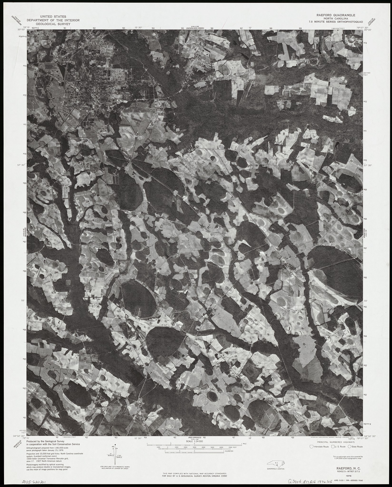
English: "Orthophotograph prepared from 1:80,000-scale aerial photograph taken January 15, 1976." "This quadrangle area also covered by 1:24,000-scale topographic map." "AMS 5153 1 NW-SERIES V042." "7.5x15 minute series othophotoquad." Includes quadrangle location. Available also through the Library of Congress Web site as a raster image. |
||
| Title | Raeford, North Carolina | ||
| Shelf ID | G3904.R17A4 1976 .U5 | ||
| Date | |||
| Source | https://www.loc.gov/item/2005630301/ | ||
| Author | Geological Survey (U.S.) | ||
| Permission (Reusing this file) |
|
||
| Other versions |
|
||
| Location | United States · Redford Region · Raeford · North Carolina | ||
| Part of | American Memory · Cities And Towns · Catalog · Geography And Map Division | ||
| Subject | United States · Raeford · Remote-Sensing Maps · North Carolina · Redford Region (N.C.) |

Licensing edit
This work is in the public domain in the United States because it is a work prepared by an officer or employee of the United States Government as part of that person’s official duties under the terms of Title 17, Chapter 1, Section 105 of the US Code.
Note: This only applies to original works of the Federal Government and not to the work of any individual U.S. state, territory, commonwealth, county, municipality, or any other subdivision. This template also does not apply to postage stamp designs published by the United States Postal Service since 1978. (See § 313.6(C)(1) of Compendium of U.S. Copyright Office Practices). It also does not apply to certain US coins; see The US Mint Terms of Use.
|
 | |
| This file has been identified as being free of known restrictions under copyright law, including all related and neighboring rights. | ||
File history
Click on a date/time to view the file as it appeared at that time.
| Date/Time | Thumbnail | Dimensions | User | Comment | |
|---|---|---|---|---|---|
| current | 10:13, 20 July 2018 | | 6,553 × 8,140 (8.53 MB) | Fæ (talk | contribs) | LOC Maps https://www.loc.gov/item/2005630301/ #5472 |
You cannot overwrite this file.
File usage on Commons
The following page uses this file: