File:Snowy Owl (240866707).jpeg

Size of this preview: 800 × 571 pixels. Other resolutions: 320 × 229 pixels | 640 × 457 pixels | 1,024 × 732 pixels | 1,280 × 914 pixels | 2,048 × 1,463 pixels.
Original file (2,048 × 1,463 pixels, file size: 350 KB, MIME type: image/jpeg)
Captions
Captions
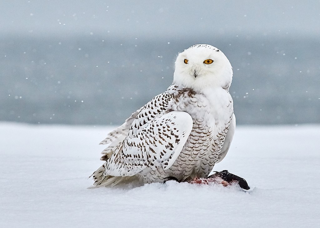
A female wintering snowy owl, on a snow-covered beach in New Jersey, mantles over its prey.
Summary
edit.jpeg&action=edit§ion=1)
| Snowy Owl | |
|---|---|
| Photographer | |
| Title |
Snowy Owl |
| Description |
500px provided description: Snowy Owl is Rare bird in New Jersey. This snowy owl has an electronic tracking device on their back. So I assume she is Higbee or Island Beach. The male is all white and larger then the female. The female has brown flecks overlaying the white coloration. I have been tracking this Snowy Owl for 2 days. 4- 5 hours walking around the beach for each days. FINALLY, I found it. [#winter ,#bird ,#cold ,#nature ,#beach ,#lighthouse ,#snow ,#wildlife ,#weather ,#freeze ,#wild ,#owl ,#lucky ,#harsh ,#snowy ,#rare ,#seabird ,#wild animal ,#pack ice ,#cold temperature ,#snowyowl ,#polar climate ,#higbee ,#NewJersey ,#winterbird ,#rarebird ,#SNOWstorm] |
| Date | 31 December 2017, 03:54:42 (UTC) |
| Source | Imported from 500px (archived version) by the Archive Team. (detail page) |
| Permission (Reusing this file) |
This file is licensed under the Creative Commons Attribution 3.0 Unported license.
|
| Camera location | | View this and other nearby images on: OpenStreetMap |
|---|
.jpeg¶ms=039.759015_N_-074.096665_E_globe:Earth_type:camera__&language=en)
File history
Click on a date/time to view the file as it appeared at that time.
| Date/Time | Thumbnail | Dimensions | User | Comment | |
|---|---|---|---|---|---|
| current | 05:02, 5 August 2018 | | 2,048 × 1,463 (350 KB) | Rodrigo.Argenton (talk | contribs) | Photo Snowy Owl imported from 500px with import-500px |
You cannot overwrite this file.
File usage on Commons
The following page uses this file:
.jpeg)
File usage on other wikis
The following other wikis use this file:
- Usage on ar.wikipedia.org
- Usage on bs.wikipedia.org
- Usage on ca.wikipedia.org
- Usage on en.wikipedia.org
- Usage on fy.wikipedia.org
- Usage on hi.wikipedia.org
- Usage on ko.wikipedia.org
- Usage on ms.wikipedia.org
- Usage on pl.wikipedia.org
- Usage on sq.wikipedia.org
- Usage on za.wikipedia.org
- Usage on zh-yue.wikipedia.org
- Usage on zh.wikinews.org
.jpeg&oldid=588185376)