File:Southeast of Amenthes Planum ESA286919.tiff

Size of this JPG preview of this TIF file: 800 × 312 pixels. Other resolutions: 320 × 125 pixels | 640 × 249 pixels | 1,024 × 399 pixels | 1,280 × 499 pixels | 2,560 × 998 pixels | 9,239 × 3,600 pixels.
Original file (9,239 × 3,600 pixels, file size: 81.66 MB, MIME type: image/tiff)
Captions
Captions
Add a one-line explanation of what this file represents
Summary
edit| Description |
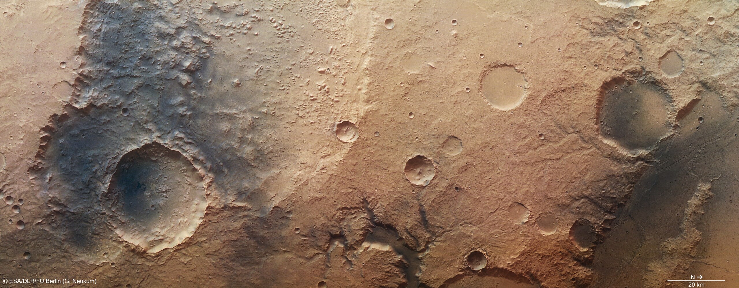
English: High-Resolution Stereo Camera nadir and colour channel data taken during revolution 11497 on 13 January 2013 by ESA’s Mars Express have been combined to form a natural-colour view of the region southeast of Amenthes Planum and north of Hesperia Planum. The region imaged, which lies to the west of Tinto Vallis and Palos crater, is centred at around 3°S and 109°E, and has a ground resolution of about 22 m per pixel.
The image features craters, lava channels and a valley from which water may have once flowed. Dark wind-blown sediments fill the valleys and the floors of the craters. |
| Date | |
| Source | http://www.esa.int/spaceinimages/Images/2013/02/Southeast_of_Amenthes_Planum |
| Author | European Space Agency |
| Permission (Reusing this file) |
ESA/DLR/FU Berlin (G. Neukum),CC BY-SA 3.0 IGO |
| Other versions |
|
| Title | Southeast of Amenthes Planum |
| Mission | Mars Express |
| Activity | Space Science |
Licensing
editThis file is licensed under the Creative Commons Attribution-ShareAlike 3.0 IGO license.
Attribution: ESA/DLR/FU Berlin (G. Neukum)
- You are free:
- to share – to copy, distribute and transmit the work
- to remix – to adapt the work
- Under the following conditions:
- attribution – You must give appropriate credit, provide a link to the license, and indicate if changes were made. You may do so in any reasonable manner, but not in any way that suggests the licensor endorses you or your use.
- share alike – If you remix, transform, or build upon the material, you must distribute your contributions under the same or compatible license as the original.
File history
Click on a date/time to view the file as it appeared at that time.
| Date/Time | Thumbnail | Dimensions | User | Comment | |
|---|---|---|---|---|---|
| current | 10:41, 24 May 2017 | 9,239 × 3,600 (81.66 MB) | Fæ (talk | contribs) | European Space Agency, Id 286919, http://www.esa.int/spaceinimages/Images/2013/02/Southeast_of_Amenthes_Planum, User:Fæ/Project_list/ESA |
You cannot overwrite this file.
File usage on Commons
The following page uses this file: