File:Svartisen Glacier (220527825).jpeg

Size of this preview: 800 × 534 pixels. Other resolutions: 320 × 213 pixels | 640 × 427 pixels | 1,024 × 683 pixels | 1,280 × 854 pixels | 2,048 × 1,366 pixels.
Original file (2,048 × 1,366 pixels, file size: 1.02 MB, MIME type: image/jpeg)
Captions
Captions
Add a one-line explanation of what this file represents
Summary
edit.jpeg&action=edit§ion=1)
| Svartisen Glacier | ||||
|---|---|---|---|---|
| Photographer | ||||
| Title |
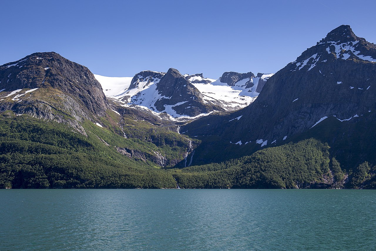
Svartisen Glacier |
|||
| Description |
500px provided description: Svartisen glacier seen from ferry on the FV17 costal highway in Nordland county, Norway. One of Norways top motorcycle roads. [#norway ,#mountain ,#glacier ,#peak ,#peaks ,#bohinj ,#moraine ,#triglav ,#dachstein ,#nordland ,#coastal highway ,#kystriksveien ,#fv17 ,#motorcycle roads] |
|||
| Date | 29 June 2017, 16:14:11 (UTC) | |||
| Source | Imported from 500px (archived version) by the Archive Team. (detail page) | |||
| Permission (Reusing this file) |
|
|||
| Camera location | | View this and other nearby images on: OpenStreetMap |
|---|
.jpeg¶ms=066.811505_N_0013.817800_E_globe:Earth_type:camera__&language=en)
File history
Click on a date/time to view the file as it appeared at that time.
| Date/Time | Thumbnail | Dimensions | User | Comment | |
|---|---|---|---|---|---|
| current | 19:58, 6 August 2018 | | 2,048 × 1,366 (1.02 MB) | Rodrigo.Argenton (talk | contribs) | Photo Svartisen Glacier imported from 500px with import-500px |
You cannot overwrite this file.
File usage on Commons
The following page uses this file:
.jpeg)
.jpeg&oldid=561479858)