File:Tazewell County, Virginia. LOC gm69002902.tif

Size of this JPG preview of this TIF file: 800 × 564 pixels. Other resolutions: 320 × 225 pixels | 640 × 451 pixels | 1,024 × 722 pixels | 1,280 × 902 pixels | 2,560 × 1,804 pixels | 6,029 × 4,248 pixels.
Original file (6,029 × 4,248 pixels, file size: 73.27 MB, MIME type: image/tiff)
Captions
Captions
Add a one-line explanation of what this file represents
Summary
edit| Description |
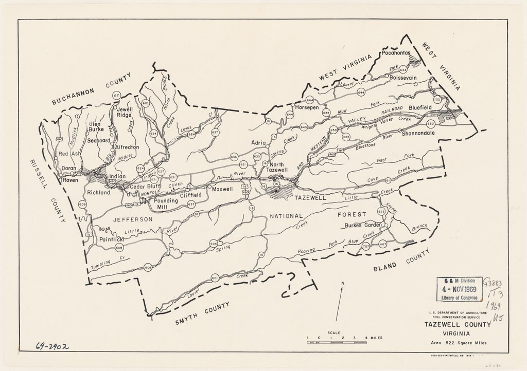
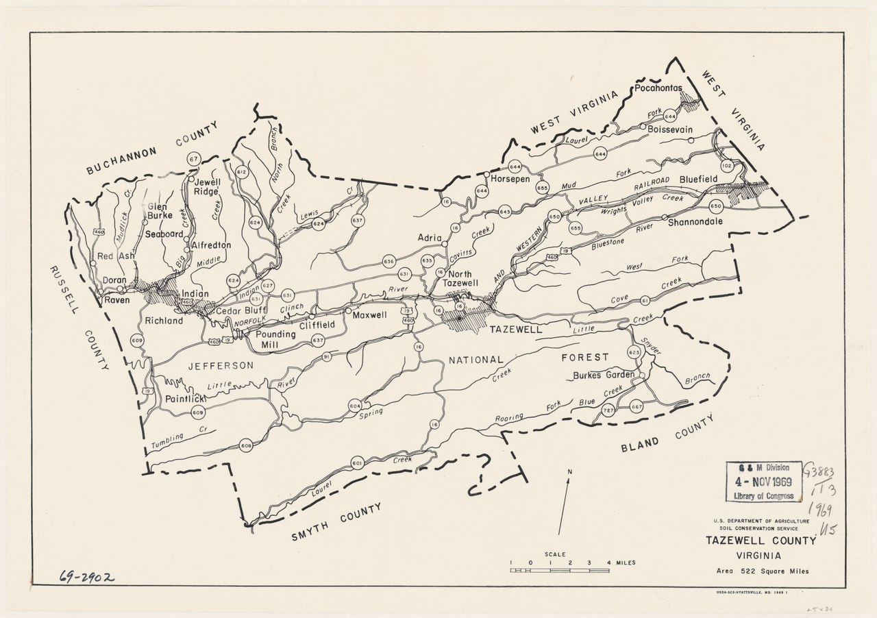
English: Scale ca. 1:190,000. Available also through the Library of Congress Web site as a raster image. AACR2 |
||
| Title | Tazewell County, Virginia. | ||
| Shelf ID | G3883.T3 1969 .U5 | ||
| Date | |||
| Source | https://www.loc.gov/item/gm69002902/ | ||
| Author | United States. Soil Conservation Service | ||
| Permission (Reusing this file) |
|
||
| Other versions |
|
||
| Location | United States · Tazewell County · Virginia | ||
| Part of | American Memory · Catalog · Geography And Map Division · Additional Conservation And Environment Cartographic Items | ||
| Subject | United States · Maps · Tazewell County · Tazewell County (Va.) · Virginia |


Licensing
edit| This work is from the Library of Congress. According to the library, there are no known copyright restrictions on the use of this work. |  |
File history
Click on a date/time to view the file as it appeared at that time.
| Date/Time | Thumbnail | Dimensions | User | Comment | |
|---|---|---|---|---|---|
| current | 08:56, 3 June 2018 |  | 6,029 × 4,248 (73.27 MB) | Fæ (talk | contribs) | LOC Maps https://www.loc.gov/item/gm69002902/ #18741 |
You cannot overwrite this file.
File usage on Commons
The following page uses this file: