File:Thaumasia mountain topography ESA382281.jpg

Size of this preview: 800 × 467 pixels. Other resolutions: 320 × 187 pixels | 640 × 374 pixels | 1,024 × 598 pixels | 1,280 × 747 pixels | 2,560 × 1,495 pixels | 6,165 × 3,600 pixels.
Original file (6,165 × 3,600 pixels, file size: 3.21 MB, MIME type: image/jpeg)
Captions
Captions
Add a one-line explanation of what this file represents
Summary
edit
| Description |
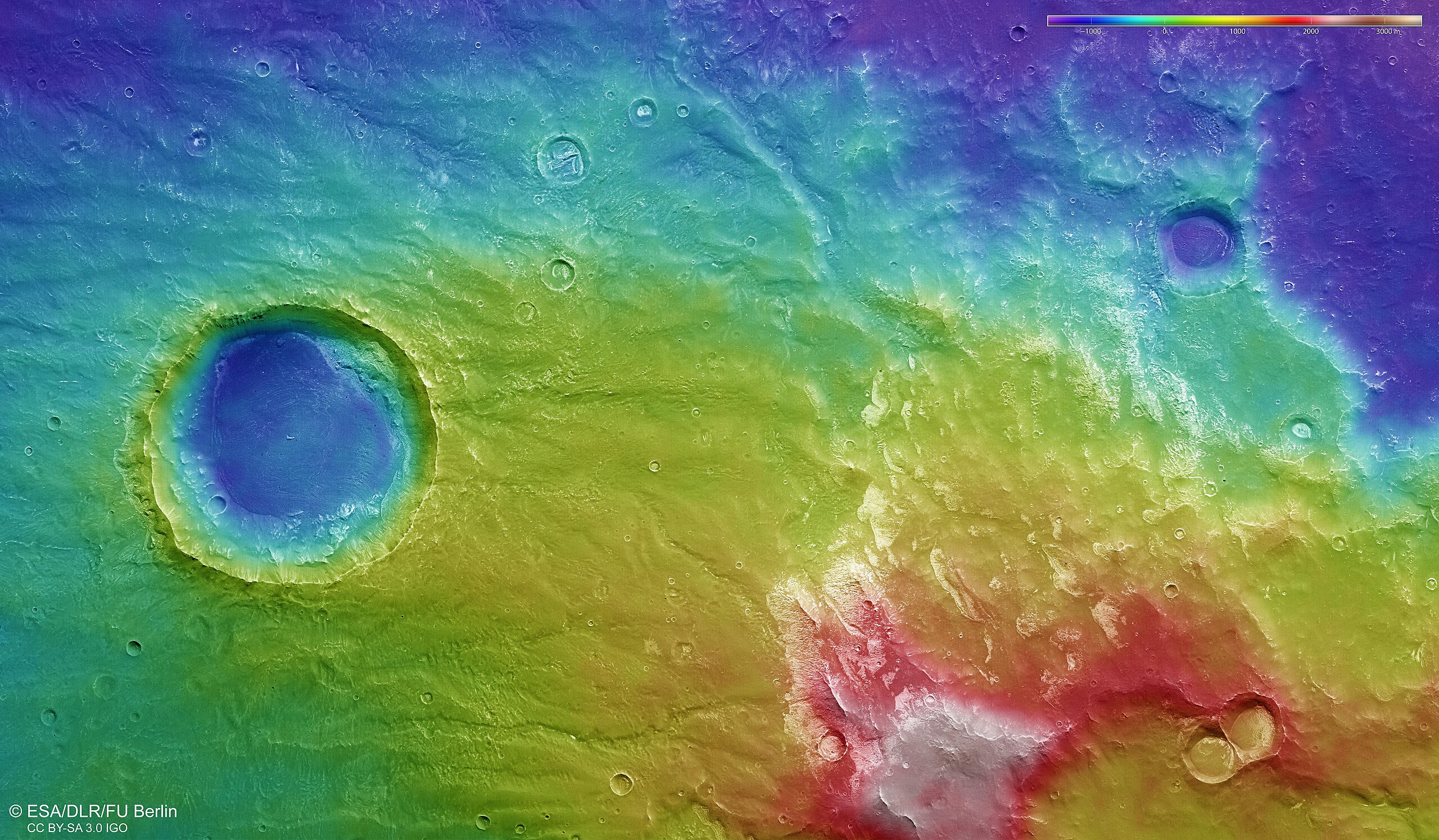
English: The colour-coded topographic view shows relative heights and depths of terrain in the Thaumasia mountain range and Coracis Fossae on Mars. As indicated in the key at top right, whites and browns/reds represent the highest terrain, while blue/purple is the lowest.
The color-coded topographic view is based on a digital terrain model of the region, from which the topography of the landscape can be derived. This region was imaged on 9 April 2017 during Mars Express orbit 16807. The ground resolution is about 13 m/pixel and the images are centred on 281ºE/31ºS. |
| Date | |
| Source | http://www.esa.int/spaceinimages/Images/2017/08/Thaumasia_mountain_topography |
| Author | European Space Agency |
| Permission (Reusing this file) |
ESA/DLR/FU Berlin, ,CC BY-SA 3.0 IGO |
| Title | Thaumasia mountain topography |
| Mission | Mars Express |
| Activity | Space Science |
Licensing
edit
This file is licensed under the Creative Commons Attribution-ShareAlike 3.0 IGO license.
Attribution: ESA/DLR/FU Berlin
- You are free:
- to share – to copy, distribute and transmit the work
- to remix – to adapt the work
- Under the following conditions:
- attribution – You must give appropriate credit, provide a link to the license, and indicate if changes were made. You may do so in any reasonable manner, but not in any way that suggests the licensor endorses you or your use.
- share alike – If you remix, transform, or build upon the material, you must distribute your contributions under the same or compatible license as the original.
File history
Click on a date/time to view the file as it appeared at that time.
| Date/Time | Thumbnail | Dimensions | User | Comment | |
|---|---|---|---|---|---|
| current | 18:51, 12 February 2023 | | 6,165 × 3,600 (3.21 MB) | Don-vip (talk | contribs) | high-res from dlr |
| 15:59, 10 August 2017 |  | 1,920 × 1,121 (1.98 MB) | Fæ (talk | contribs) | European Space Agency, Id 382281, http://www.esa.int/spaceinimages/Images/2017/08/Thaumasia_mountain_topography, User:Fæ/Project_list/ESA |
You cannot overwrite this file.
File usage on Commons
The following 2 pages use this file:
.jpeg&redirect=no)