File:The Dardanelles and The Troad ; The Bosphorus and Constantinople LOC 2012593212.jpg

Size of this preview: 800 × 592 pixels. Other resolutions: 320 × 237 pixels | 640 × 473 pixels | 1,024 × 757 pixels | 1,280 × 947 pixels | 2,560 × 1,893 pixels | 8,711 × 6,442 pixels.
Original file (8,711 × 6,442 pixels, file size: 10.33 MB, MIME type: image/jpeg)
Captions
Captions
Add a one-line explanation of what this file represents
Summary
edit| Description |
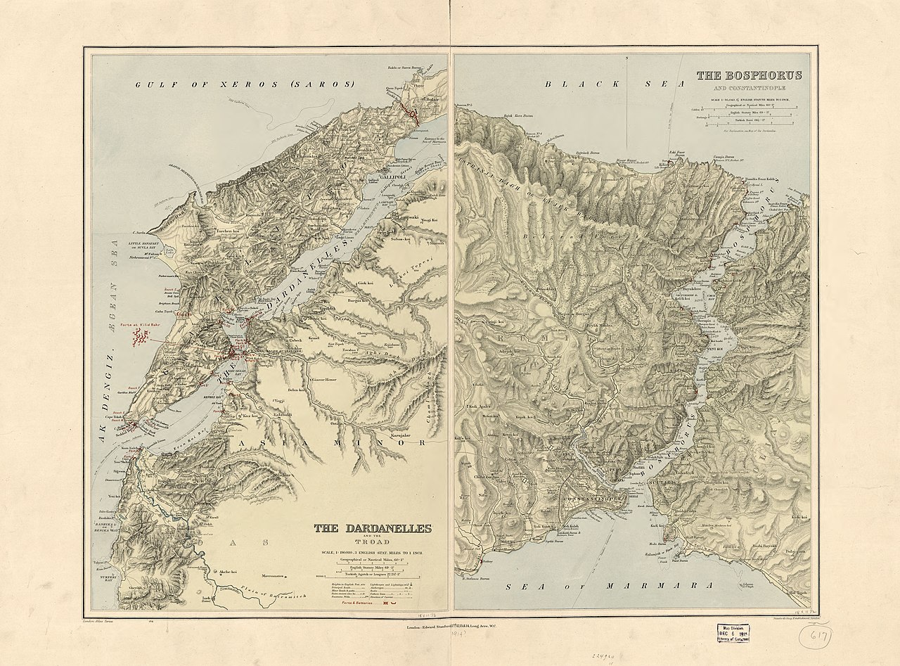
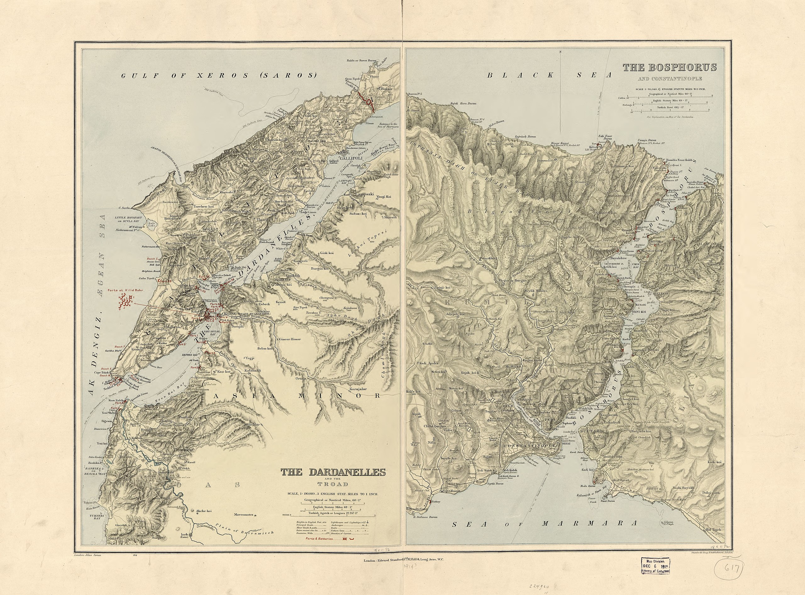
English: Relief shown by hachures. Also shows "Forts & batteries" in red overprint, tidal banks, and anchorages. Available also through the Library of Congress Web site as a raster image. Includes bar scales for nautical miles, statute miles, and leagues. "1715." LC copy imperfect: Fold-lined between the 2 maps, torn at fold line, annotated in lead pencil in lower margin, taped at upper edge on verso. |
||
| Title | The Dardanelles and The Troad ; The Bosphorus and Constantinople | ||
| Shelf ID | G7432.D3 1914 .E3 | ||
| Date | |||
| Source | https://www.loc.gov/item/2012593212/ | ||
| Author | Edward Stanford Ltd | ||
| Permission (Reusing this file) |
|
||
| Other versions |
|
||
| Location | Turkey · Istanbul Region · Bosporus · Dardanelles Strait · Dardanelles Strait Region · Troas · Bosporus Region | ||
| Part of | American Memory · General Maps · Catalog · Geography And Map Division | ||
| Subject | Turkey · Dardanelles Strait Region (Turkey) · Bosporus (Turkey) · Istanbul Region · Fortification · Troas · Bosporus · Istanbul Region (Turkey) · Maps · Troas (Turkey) · Dardanelles Strait (Turkey) · Bosporus Region · Physical Maps · Dardanelles Strait Region · Bosporus Region (Turkey) · Dardanelles Strait |

Licensing
edit
|
This is a faithful photographic reproduction of a two-dimensional, public domain work of art. The work of art itself is in the public domain for the following reason:
The official position taken by the Wikimedia Foundation is that "faithful reproductions of two-dimensional public domain works of art are public domain".
This photographic reproduction is therefore also considered to be in the public domain in the United States. In other jurisdictions, re-use of this content may be restricted; see Reuse of PD-Art photographs for details. | ||||
File history
Click on a date/time to view the file as it appeared at that time.
| Date/Time | Thumbnail | Dimensions | User | Comment | |
|---|---|---|---|---|---|
| current | 03:49, 19 May 2018 | | 8,711 × 6,442 (10.33 MB) | Fæ (talk | contribs) | LOC Maps https://www.loc.gov/item/2012593212/ #11141 |
You cannot overwrite this file.
File usage on Commons
The following page uses this file: