File:The Memorial Arch, a limestone arch on a granite base adjacent to Memorial Park in Huntington, West Virginia LCCN2015631854.tif

Size of this JPG preview of this TIF file: 616 × 600 pixels. Other resolutions: 247 × 240 pixels | 493 × 480 pixels | 789 × 768 pixels | 1,052 × 1,024 pixels | 2,104 × 2,048 pixels | 4,912 × 4,781 pixels.
Original file (4,912 × 4,781 pixels, file size: 134.45 MB, MIME type: image/tiff)
Captions
Captions
Add a one-line explanation of what this file represents
Summary edit
| Description |
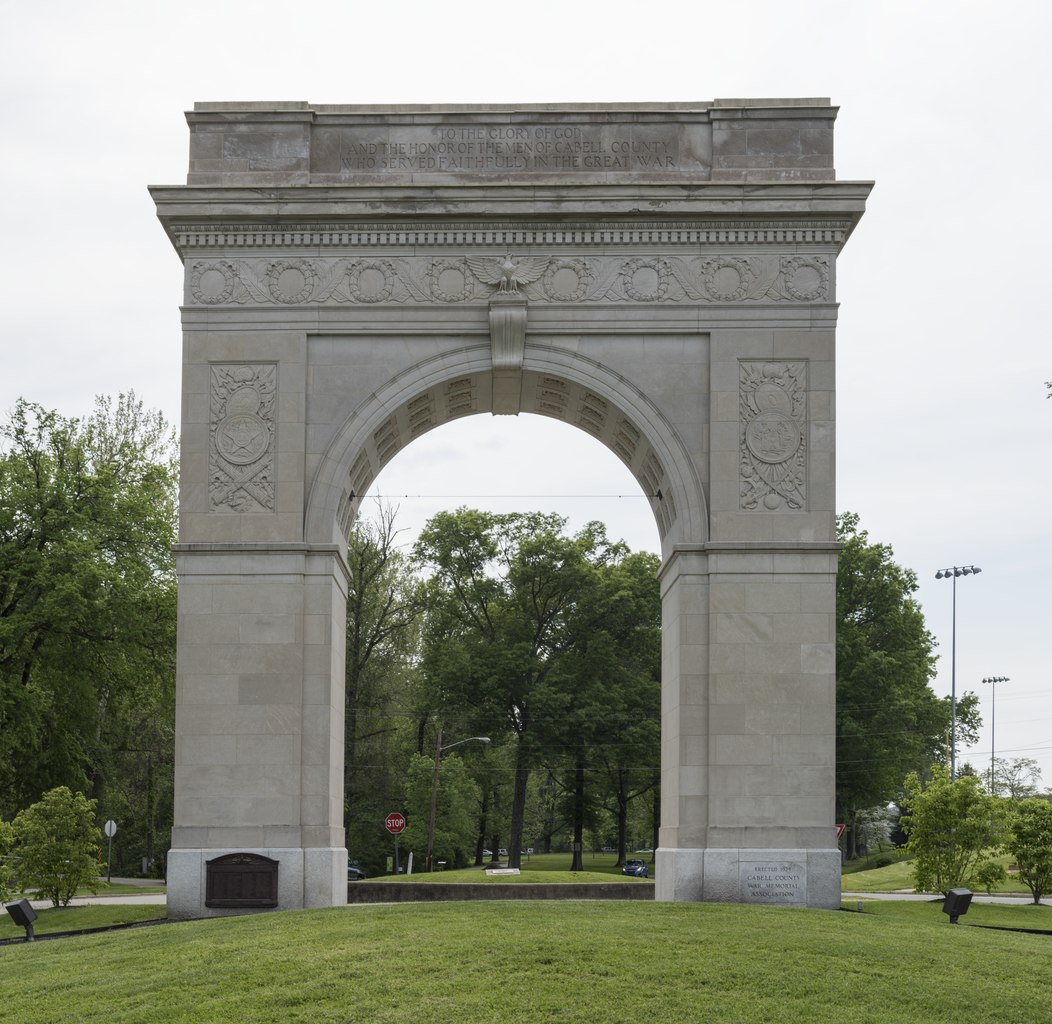
English: Title: The Memorial Arch, a limestone arch on a granite base adjacent to Memorial Park in Huntington, West Virginia
Physical description: 1 photograph : digital, tiff file, color. Notes: The grand memorial to the fallen in World War I recalls the Arc de Triomphe in Paris. Its architect, Jerry deYoung, studied in Europe after serving in the First World War there. The inscription engraved on the memorial's parapet, "Fortis et Fidelis," translates from Latin as "Strong and Faithful."; Credit line: West Virginia Collection within the Carol M. Highsmith Archive, Library of Congress, Prints and Photographs Division.; Forms part of: West Virginia Collection within the Carol M. Highsmith Archive.; Title, date and keywords based on information provided by the photographer.; Purchase; Carol M. Highsmith Photography, Inc.; 2015; (DLC/PP-2015:055). |
||||||||||||||||||||||||||
| Date | Taken on 7 May 2015, 16:16 (according to Exif data) | ||||||||||||||||||||||||||
| Source |
Library of Congress
|
||||||||||||||||||||||||||
| Author |
|
||||||||||||||||||||||||||
| Permission (Reusing this file) |
No known restrictions on publication.
|
||||||||||||||||||||||||||


| Camera location | | View this and other nearby images on: OpenStreetMap |
|---|
Licensing edit
| This work is from the Carol M. Highsmith Archive collection at the Library of Congress. According to the library, there are no known copyright restrictions on the use of this work. Carol M. Highsmith has stipulated that her photographs are in the public domain. Photographs of sculpture or other works of art may be restricted by the copyright of the artist. |
 |
File history
Click on a date/time to view the file as it appeared at that time.
| Date/Time | Thumbnail | Dimensions | User | Comment | |
|---|---|---|---|---|---|
| current | 23:45, 29 September 2016 |  | 4,912 × 4,781 (134.45 MB) | Fæ (talk | contribs) | LOC 2015631854, Carol M. Highsmith collection. P203.23291 TIFF (134.5mb) |
You cannot overwrite this file.
File usage on Commons
There are no pages that use this file.