File:The Near East. LOC 2013593016.jpg

Size of this preview: 734 × 599 pixels. Other resolutions: 294 × 240 pixels | 588 × 480 pixels | 941 × 768 pixels | 1,254 × 1,024 pixels | 2,508 × 2,048 pixels | 12,212 × 9,972 pixels.
Original file (12,212 × 9,972 pixels, file size: 11.16 MB, MIME type: image/jpeg)
Captions
Captions
Add a one-line explanation of what this file represents
Summary edit
| Warning | The original file is very high-resolution. It might not load properly or could cause your browser to freeze when opened at full size. |
|---|
| Description |
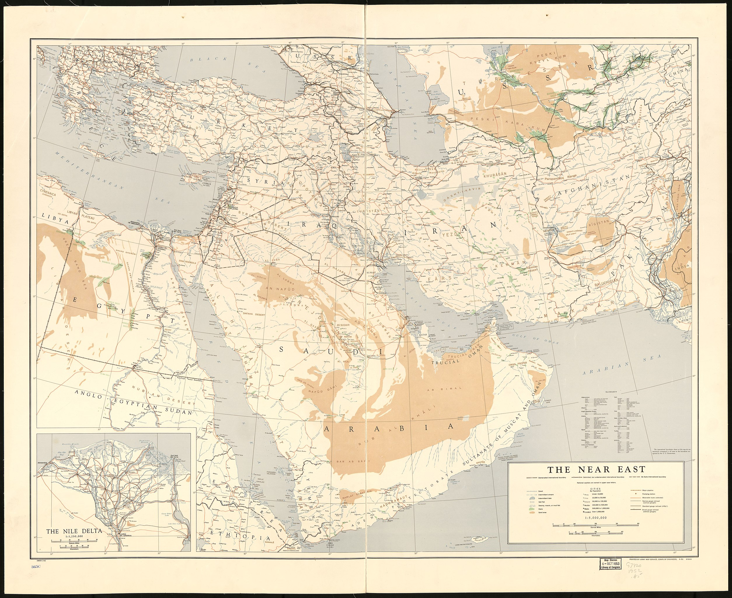
English: Shows lakes and other water bodies, international boundaries, cities by population, pipelines and railroads. "Printed by Army Map Service, Corps of Engineers. 6-52, 91666." Includes short glossary of land features given in the region's local languages. Inset: Nile Delta, scale 1:1,250,000. "10654 2-52." Available also through the Library of Congress Web site as a raster image. |
||
| Title | The Near East. | ||
| Shelf ID | G7420 1952 .U5 | ||
| Date | |||
| Source | https://www.loc.gov/item/2013593016/ | ||
| Author | United States. Army Map Service | ||
| Permission (Reusing this file) |
|
||
| Other versions |
|
||
| Location | Middle East | ||
| Part of | American Memory · General Maps · Catalog · Geography And Map Division | ||
| Subject | Maps · Middle East |


Licensing edit
| This work is from the Library of Congress. According to the library, there are no known copyright restrictions on the use of this work. |  |
File history
Click on a date/time to view the file as it appeared at that time.
| Date/Time | Thumbnail | Dimensions | User | Comment | |
|---|---|---|---|---|---|
| current | 17:59, 24 June 2018 | | 12,212 × 9,972 (11.16 MB) | Fæ (talk | contribs) | LOC Maps https://www.loc.gov/item/2013593016/ #26836 |
You cannot overwrite this file.
File usage on Commons
The following page uses this file: