File:The county of Bay - state, county, township, city and village maps LOC 2008622018-10.jpg

Size of this preview: 800 × 466 pixels. Other resolutions: 320 × 187 pixels | 640 × 373 pixels | 1,024 × 597 pixels | 1,280 × 746 pixels | 2,560 × 1,492 pixels | 5,006 × 2,918 pixels.
Original file (5,006 × 2,918 pixels, file size: 2.3 MB, MIME type: image/jpeg)
Captions
Captions
Add a one-line explanation of what this file represents
Summary
edit| Description |
English: LeGear. Atlases of the United States, 4963 Available also through the Library of Congress Web site as a raster image. Includes indexes. Vendor: John Carbonell Acquisitions control no. 2008-051 |
||
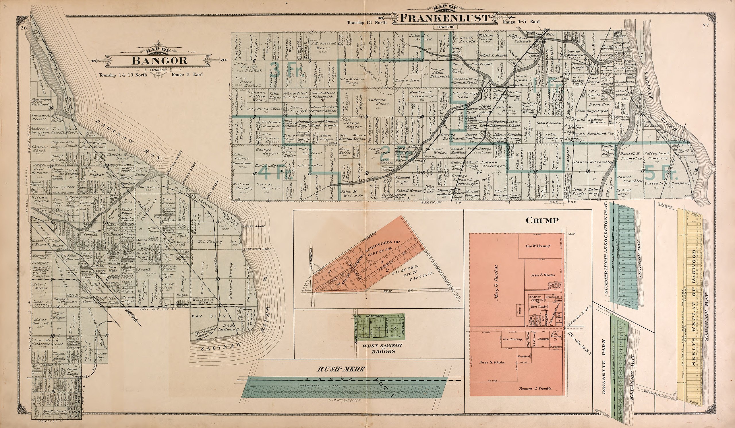
| Title | The county of Bay : state, county, township, city and village maps | ||
| Shelf ID | G1413.B4 M6 1916 | ||
| Parent | https://www.loc.gov/resource/g4113bm.gla00086/ | ||
| Sheet title | Bangor and Frankenlust Townships | ||
| Date | |||
| Source | https://www.loc.gov/item/2008622018/ | ||
| Author | Monroe & Learman; Standard Map Company | ||
| Permission (Reusing this file) |
|
||
| Other versions |
|
||
| Location | Bay County · United States · Michigan | ||
| Part of | American Memory · Catalog · County Landownership Maps · Geography And Map Division · Cultural Landscapes | ||
| Subject | Bay County · Bay County (Mich.) · Michigan · United States · Maps · Real Property · Landowners |


Licensing
edit
|
This is a faithful photographic reproduction of a two-dimensional, public domain work of art. The work of art itself is in the public domain for the following reason:
The official position taken by the Wikimedia Foundation is that "faithful reproductions of two-dimensional public domain works of art are public domain".
This photographic reproduction is therefore also considered to be in the public domain in the United States. In other jurisdictions, re-use of this content may be restricted; see Reuse of PD-Art photographs for details. | ||||
File history
Click on a date/time to view the file as it appeared at that time.
| Date/Time | Thumbnail | Dimensions | User | Comment | |
|---|---|---|---|---|---|
| current | 19:20, 11 July 2018 | | 5,006 × 2,918 (2.3 MB) | Fæ (talk | contribs) | LOC Maps multisheet https://www.loc.gov/item/2008622018/ sheet 10 of 20 #34 |
You cannot overwrite this file.
File usage on Commons
The following page uses this file: