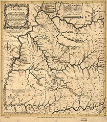
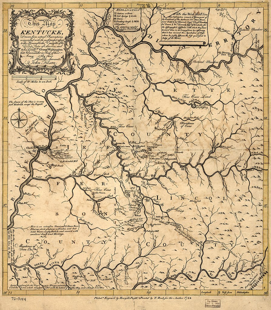
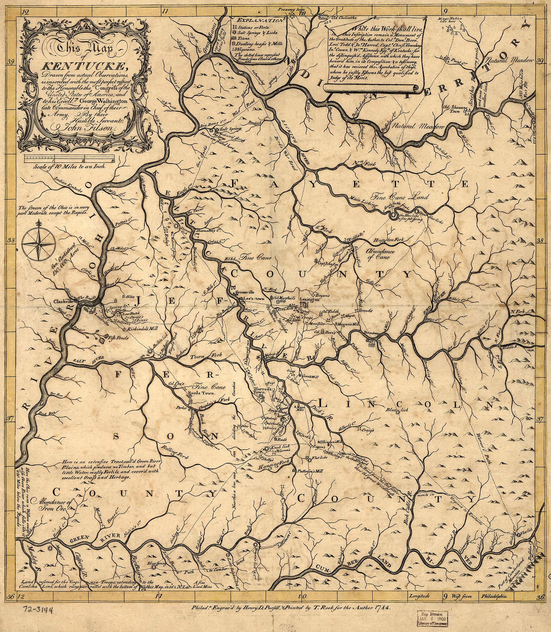
File:This map of Kentucke, drawn from actual observations, is inscribed with the most perfect respect, to the Honorable the Congress of the United States of America; and to His Excellcy. George Washington, LOC gm72003144.jpg

Size of this preview: 523 × 599 pixels. Other resolutions: 209 × 240 pixels | 419 × 480 pixels | 670 × 768 pixels | 894 × 1,024 pixels | 1,788 × 2,048 pixels | 5,489 × 6,287 pixels.
Original file (5,489 × 6,287 pixels, file size: 5.66 MB, MIME type: image/jpeg)
Captions
Captions
Add a one-line explanation of what this file represents
Summary edit
| Description |
English: Scale 1:633,600; 10 miles to an in. Hand colored. Relief shown pictorially. Prime meridian: Philadelphia. Includes inscriptions. LC Maps of North America, 1750-1789, 792 Available also through the Library of Congress Web site as a raster image. Vault AACR2 |
||
| Title | This map of Kentucke, drawn from actual observations, is inscribed with the most perfect respect, to the Honorable the Congress of the United States of America; and to His Excellcy. George Washington, late Commander in Chief of their Army. | ||
| Shelf ID | G3950 1784 .F5 | ||
| Date | |||
| Source | https://www.loc.gov/item/gm72003144/ | ||
| Author | Filson, John; Pursell, Henry D.; Rook, Ternon | ||
| Permission (Reusing this file) |
|
||
| Other versions |
|
||
| Location | United States · Kentucky | ||
| Part of | Louisiana: European Explorations And The Louisiana Purchase · Military Battles And Campaigns · Catalog · American Memory · Geography And Map Division · American Revolution And Its Era: Maps And Charts Of North America And The West Indies, 1750-1789 | ||
| Subject | United States · Maps · Early Works To 1800 · Kentucky |


Licensing edit
|
This is a faithful photographic reproduction of a two-dimensional, public domain work of art. The work of art itself is in the public domain for the following reason:
The official position taken by the Wikimedia Foundation is that "faithful reproductions of two-dimensional public domain works of art are public domain".
This photographic reproduction is therefore also considered to be in the public domain in the United States. In other jurisdictions, re-use of this content may be restricted; see Reuse of PD-Art photographs for details. | ||||
File history
Click on a date/time to view the file as it appeared at that time.
| Date/Time | Thumbnail | Dimensions | User | Comment | |
|---|---|---|---|---|---|
| current | 10:53, 3 June 2018 | | 5,489 × 6,287 (5.66 MB) | Fæ (talk | contribs) | LOC Maps https://www.loc.gov/item/gm72003144/ #3354 |
You cannot overwrite this file.
File usage on Commons
The following page uses this file: