File:Thucydides, Maps and Plans illustrative of Wellcome L0031928.jpg

Original file (4,026 × 2,642 pixels, file size: 3.52 MB, MIME type: image/jpeg)
Captions
Captions
Summary edit
| Thucydides, Maps and Plans illustrative of | |||
|---|---|---|---|
| Title |
Thucydides, Maps and Plans illustrative of |
||
| Description |
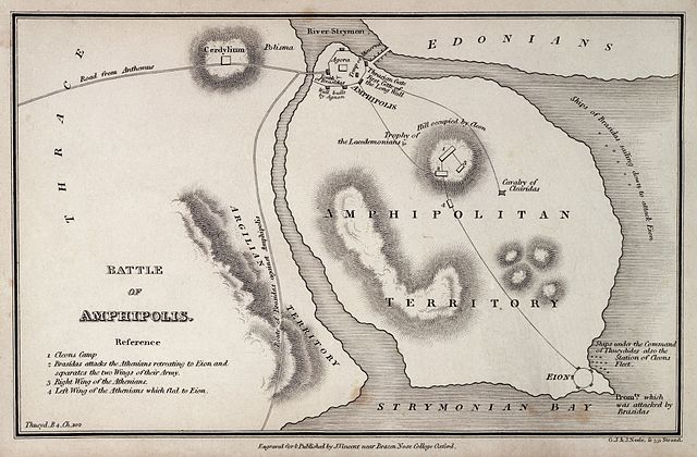
THUCYDIDES Thucydides, Maps and Plans illustrative of Thucydides, containing Northern Greece, Southern Greece, Coast of Asia Minor, etc. Oxford: J. Vincent, ca.1825. Map of Battle of Amphipolis Rare Books |
||
| Credit line |
|
||
| References |
|
||
| Source/Photographer |
https://wellcomeimages.org/indexplus/obf_images/83/0a/d1ba1742571da0c04b11d93ad561.jpg
|
||
Licensing edit
- You are free:
- to share – to copy, distribute and transmit the work
- to remix – to adapt the work
- Under the following conditions:
- attribution – You must give appropriate credit, provide a link to the license, and indicate if changes were made. You may do so in any reasonable manner, but not in any way that suggests the licensor endorses you or your use.
File history
Click on a date/time to view the file as it appeared at that time.
| Date/Time | Thumbnail | Dimensions | User | Comment | |
|---|---|---|---|---|---|
| current | 13:47, 11 October 2014 | | 4,026 × 2,642 (3.52 MB) | Fæ (talk | contribs) | =={{int:filedesc}}== {{Artwork |artist = |author = |title = Thucydides, Maps and Plans illustrative of |description = THUCYDIDES Thucydides, Maps and Plans illustrative of Thucydides, containing Northern Gree... |
You cannot overwrite this file.
File usage on Commons
The following 3 pages use this file:
File usage on other wikis
The following other wikis use this file:
- Usage on bg.wikipedia.org
- Usage on cs.wikipedia.org
- Usage on el.wikipedia.org
- Usage on en.wikipedia.org
- Usage on es.wikipedia.org
- Usage on it.wikipedia.org
- Usage on ja.wikipedia.org
- Usage on nl.wikipedia.org
- Usage on sr.wikipedia.org
- Usage on ta.wikipedia.org
- Usage on uk.wikipedia.org
- Usage on www.wikidata.org