File:To the Honourable Thomas Penn and Richard Penn, Esqrs., true & absolute proprietaries & Governours of the Province of Pennsylvania & counties of New-Castle, Kent & Sussex on Delaware this map of the LOC 74692506.jpg

Size of this preview: 800 × 406 pixels. Other resolutions: 320 × 162 pixels | 640 × 324 pixels | 1,024 × 519 pixels | 1,280 × 649 pixels | 2,560 × 1,298 pixels | 18,386 × 9,320 pixels.
Original file (18,386 × 9,320 pixels, file size: 20.88 MB, MIME type: image/jpeg)
Captions
Captions
Add a one-line explanation of what this file represents
Summary
edit| Warning | The original file is very high-resolution. It might not load properly or could cause your browser to freeze when opened at full size. |
|---|
| Description |
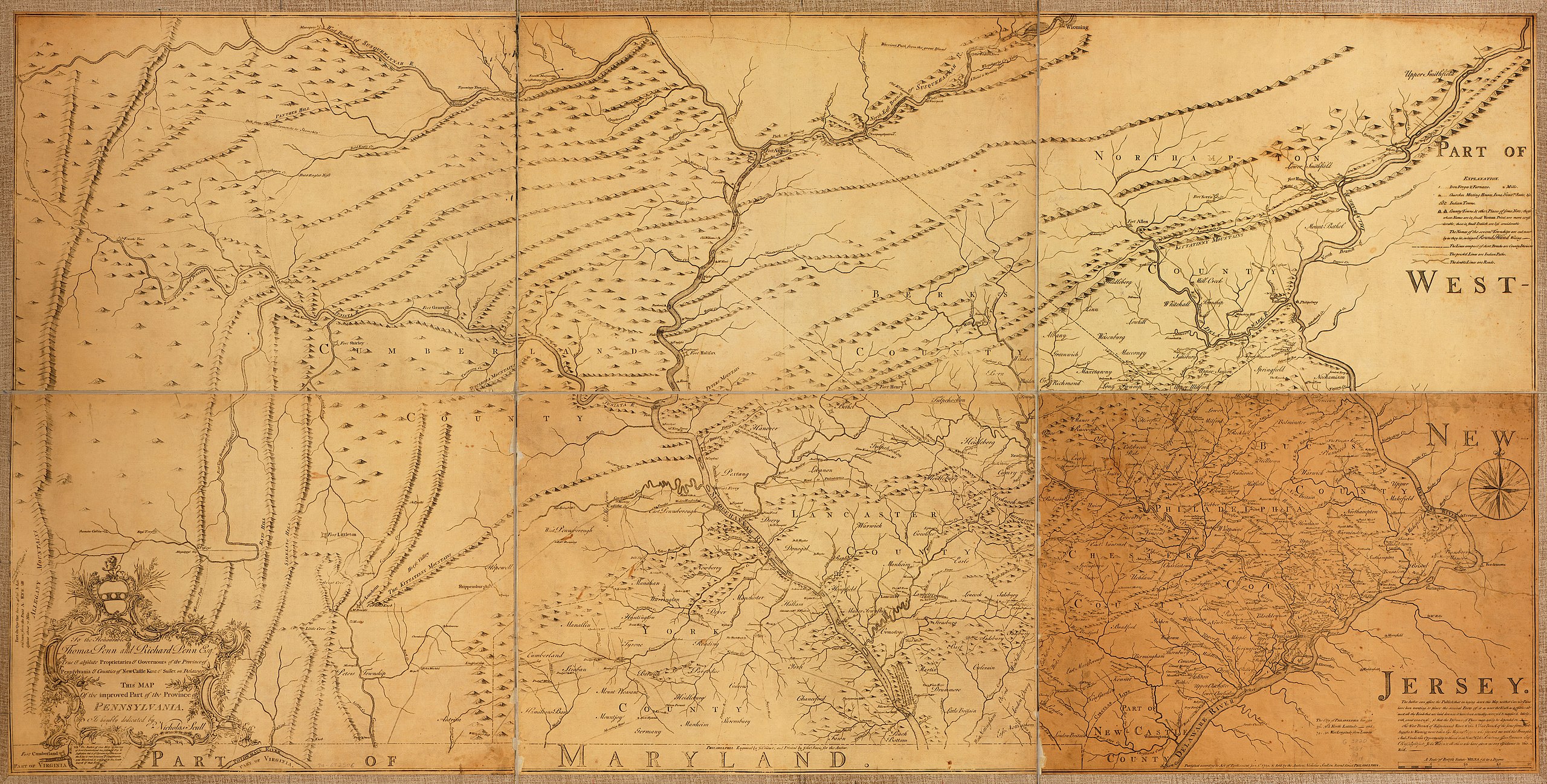
English: Scale ca. 1:250,000. Sectioned and mounted on cloth backing with reinforced edges. Relief shown pictorially. Shows county boundaries. LC Maps of North America, 1750-1789, 1294 Available also through the Library of Congress Web site as a raster image. Vault AACR2: 440; 651/1; 651/2; 700/1; 700/2 |
||
| Title | To the Honourable Thomas Penn and Richard Penn, Esqrs., true & absolute proprietaries & Governours of the Province of Pennsylvania & counties of New-Castle, Kent & Sussex on Delaware this map of the improved part of the Province of Pennsylvania. | ||
| Shelf ID | G3820 1759 .S3 | ||
| Date | |||
| Source | https://www.loc.gov/item/74692506/ | ||
| Author | Scull, Nicholas; Turner, James; Davis, John | ||
| Permission (Reusing this file) |
|
||
| Location | Pennsylvania · United States | ||
| Part of | Military Battles And Campaigns · American Memory · Catalog · Geography And Map Division · American Revolution And Its Era: Maps And Charts Of North America And The West Indies, 1750-1789 | ||
| Subject | Pennsylvania · Maps · Early Works To 1800 · United States · Counties |

Licensing
edit
|
This is a faithful photographic reproduction of a two-dimensional, public domain work of art. The work of art itself is in the public domain for the following reason:
The official position taken by the Wikimedia Foundation is that "faithful reproductions of two-dimensional public domain works of art are public domain".
This photographic reproduction is therefore also considered to be in the public domain in the United States. In other jurisdictions, re-use of this content may be restricted; see Reuse of PD-Art photographs for details. | ||||
File history
Click on a date/time to view the file as it appeared at that time.
| Date/Time | Thumbnail | Dimensions | User | Comment | |
|---|---|---|---|---|---|
| current | 09:46, 15 May 2018 | | 18,386 × 9,320 (20.88 MB) | Fæ (talk | contribs) | LOC Maps https://www.loc.gov/item/74692506/ #8853 |
You cannot overwrite this file.
File usage on Commons
There are no pages that use this file.
File usage on other wikis
The following other wikis use this file:
- Usage on en.wikipedia.org