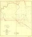
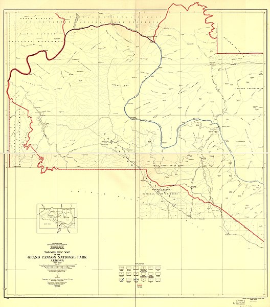
File:Topographic map of the Grand Canyon National Park Arizona . LOC 98687188.jpg

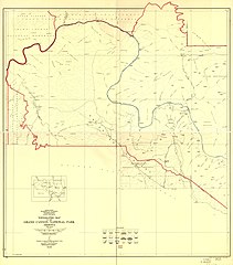
Size of this preview: 528 × 600 pixels. Other resolutions: 211 × 240 pixels | 423 × 480 pixels | 676 × 768 pixels | 901 × 1,024 pixels | 1,803 × 2,048 pixels | 12,009 × 13,640 pixels.
Original file (12,009 × 13,640 pixels, file size: 10.49 MB, MIME type: image/jpeg)
Captions
Captions
Add a one-line explanation of what this file represents
Summary
edit| Warning | The original file is very high-resolution. It might not load properly or could cause your browser to freeze when opened at full size. |
|---|
| Description |
English: Available also through the Library of Congress web site as a raster image. |
||
| Title | Topographic map of the Grand Canyon National Park Arizona . | ||
| Shelf ID | G4332.G7 1948 .G4 TIL | ||
| Date | |||
| Source | https://www.loc.gov/item/98687188/ | ||
| Author | Geological Survey (U.S.) | ||
| Permission (Reusing this file) |
|
||
| Other versions |
|
||
| Location | United States · Arizona · Grand Canyon National Park | ||
| Part of | American Memory · Catalog · Mapping The National Parks · Geography And Map Division · Additional Conservation And Environment Cartographic Items | ||
| Subject | United States · Grand Canyon National Park (Ariz.) · Arizona · Grand Canyon National Park · Maps |

Licensing
edit
| This work is from the Library of Congress. According to the library, there are no known copyright restrictions on the use of this work. |  |
File history
Click on a date/time to view the file as it appeared at that time.
| Date/Time | Thumbnail | Dimensions | User | Comment | |
|---|---|---|---|---|---|
| current | 02:14, 20 June 2018 | | 12,009 × 13,640 (10.49 MB) | Fæ (talk | contribs) | LOC Maps https://www.loc.gov/item/98687188/ #21243 |
You cannot overwrite this file.
File usage on Commons
The following page uses this file: