File:U.S. Capitol visitor guide - U.S. Capitol Visitor Center - (Washington D.C.). LOC 2010588296.tif

Size of this JPG preview of this TIF file: 775 × 600 pixels. Other resolutions: 310 × 240 pixels | 620 × 480 pixels | 992 × 768 pixels | 1,280 × 991 pixels | 2,560 × 1,982 pixels | 7,327 × 5,672 pixels.
Original file (7,327 × 5,672 pixels, file size: 118.9 MB, MIME type: image/tiff)
Captions
Captions
Add a one-line explanation of what this file represents
Summary edit
| Description |
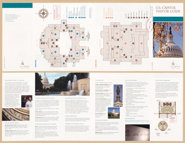
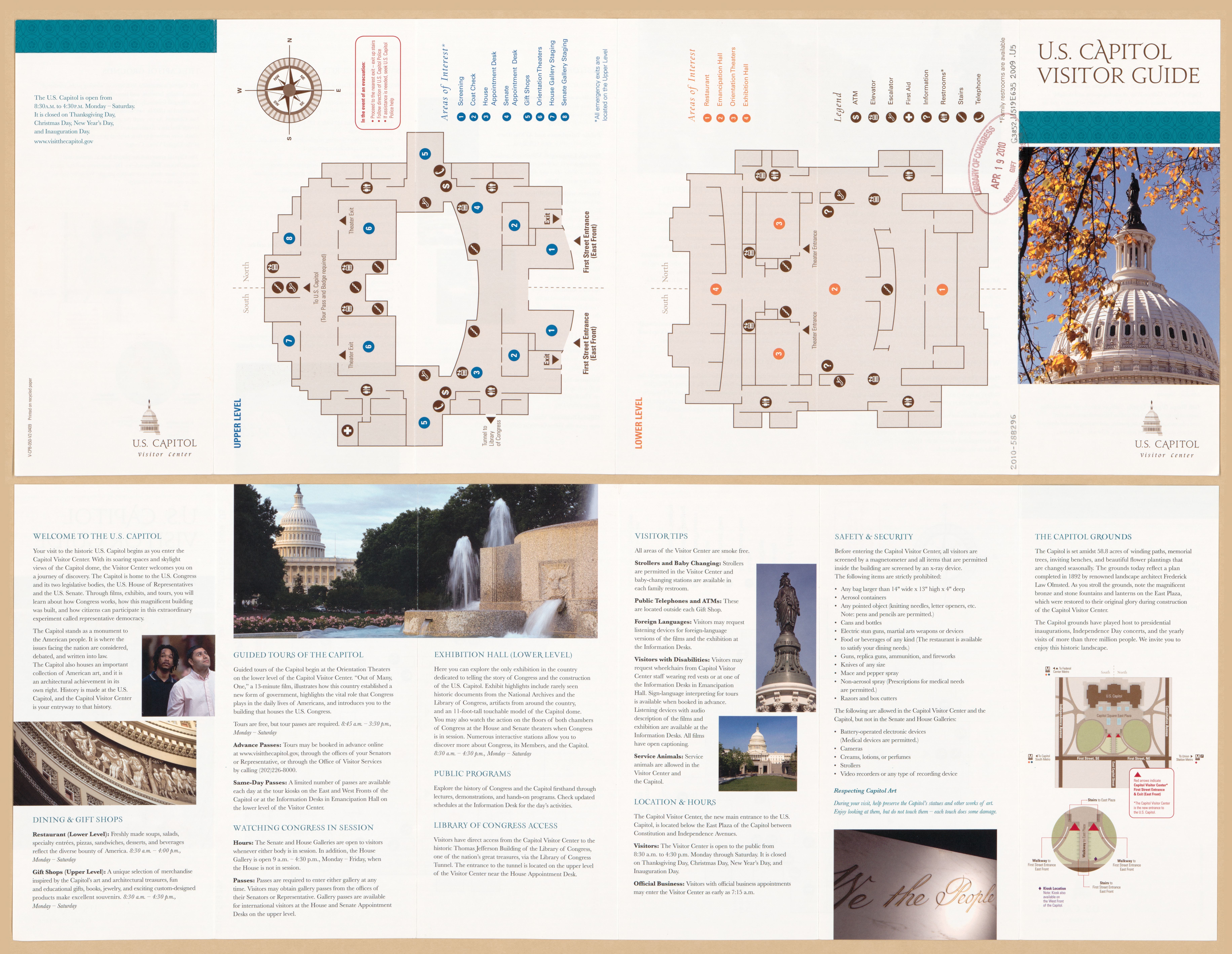
English: Each map is a floorplan showing amenities of the underground visitors' center open to tourists and the public. Title from panel. Oriented with north to the right. Includes notes, indexes to "Areas of interest", col. ill., and mailing-address panel. Text, map of "The Capitol grounds", diagram of stairways/walkways leading to the underground visitor center, and col. ill. on verso. "V-CPB-050-V2-0409." Available also through the Library of Congress Web site as a raster image. DCP |
||
| Title | U.S. Capitol visitor guide : U.S. Capitol Visitor Center : [Washington D.C.]. | ||
| Shelf ID | G3852.U519E635 2009 .U5 | ||
| Date | |||
| Source | https://www.loc.gov/item/2010588296/ | ||
| Author | United States Capitol Visitor Center (Washington, D.C.) | ||
| Permission (Reusing this file) |
|
||
| Other versions |
|
||
| Location | Washington D.C. · United States · Washington · Washington. · Washington · United States · District Of Columbia · District Of Columbia | ||
| Part of | American Memory · Cities And Towns · Catalog · Geography And Map Division | ||
| Subject | Washington (D.C.) · United States Capitol · United States Capitol Visitor Center (Washington, D.C.) · Washington · Tourist Maps · Charts, Diagrams, Etc · United States Capitol (Washington, D.C.) · United States Capitol Visitor Center · United States · Maps · District Of Columbia · Visitors' Centers |

._LOC_2010588296.jpg)
Licensing edit
| This work is from the Library of Congress. According to the library, there are no known copyright restrictions on the use of this work. |  |
File history
Click on a date/time to view the file as it appeared at that time.
| Date/Time | Thumbnail | Dimensions | User | Comment | |
|---|---|---|---|---|---|
| current | 15:42, 22 September 2018 |  | 7,327 × 5,672 (118.9 MB) | Fæ (talk | contribs) | LOC Maps https://www.loc.gov/item/2010588296/ #181 |
You cannot overwrite this file.
File usage on Commons
The following page uses this file: