File:U.S. Route 60 Large Array (24561221889).jpg

Size of this preview: 800 × 335 pixels. Other resolutions: 320 × 134 pixels | 640 × 268 pixels | 1,024 × 428 pixels | 1,280 × 536 pixels | 2,560 × 1,071 pixels | 5,334 × 2,232 pixels.
Original file (5,334 × 2,232 pixels, file size: 10.64 MB, MIME type: image/jpeg)
Captions
Captions
Add a one-line explanation of what this file represents
Summary
edit.jpg&action=edit§ion=1)
| Description |
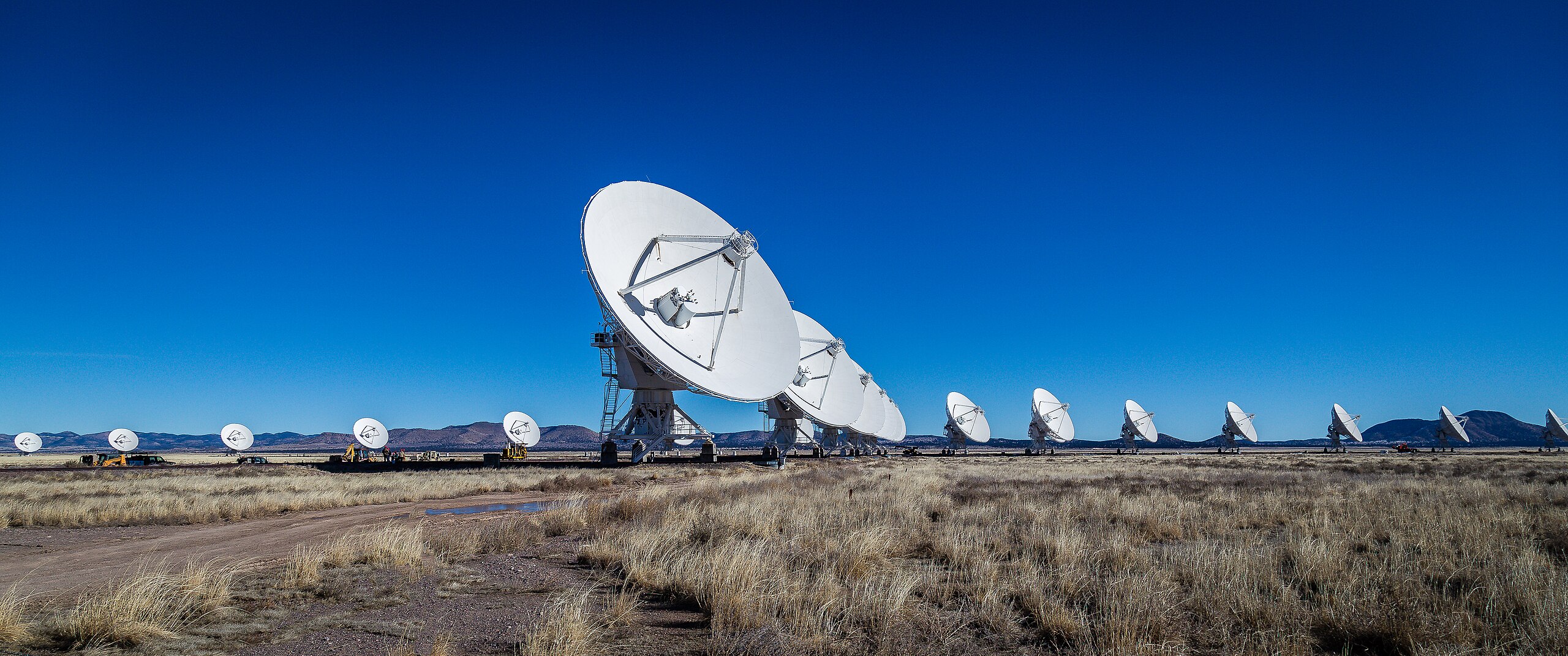
English: The Very Large Array The Very Large Array, one of the world's premier astronomical radio observatories, consists of 27 radio antennas in a Y-shaped configuration on the Plains of San Agustin fifty miles west of Socorro, New Mexico. Each antenna is 25 meters (82 feet) in diameter. The data from the antennas is combined electronically to give the resolution of an antenna 36km (22 miles) across, with the sensitivity of a dish 130 meters (422 feet) in diameter. - http://www.vla.nrao.edu/ |
| Date | |
| Source | https://www.flickr.com/photos/mobili/24561221889/ |
| Author | Mobilus In Mobili |
| Permission (Reusing this file) |
At the time of upload, the image license was automatically confirmed using the Flickr API. For more information see Flickr API detail. |
| Flickr sets |
|
| Flickr pools |
|
| Flickr tags |
|
| Camera location | | View this and other nearby images on: OpenStreetMap |
|---|
.jpg¶ms=034.076280_N_-107.622408_E_globe:Earth_type:camera_alt:2129.5_source:exif_&language=en)
Licensing
edit.jpg&action=edit§ion=2)
This file is licensed under the Creative Commons Attribution-Share Alike 2.0 Generic license.
- You are free:
- to share – to copy, distribute and transmit the work
- to remix – to adapt the work
- Under the following conditions:
- attribution – You must give appropriate credit, provide a link to the license, and indicate if changes were made. You may do so in any reasonable manner, but not in any way that suggests the licensor endorses you or your use.
- share alike – If you remix, transform, or build upon the material, you must distribute your contributions under the same or compatible license as the original.
| This image was originally posted to Flickr by Mobilus In Mobili at https://flickr.com/photos/52257493@N00/24561221889. It was reviewed on 15 March 2017 by FlickreviewR and was confirmed to be licensed under the terms of the cc-by-sa-2.0. |
File history
Click on a date/time to view the file as it appeared at that time.
| Date/Time | Thumbnail | Dimensions | User | Comment | |
|---|---|---|---|---|---|
| current | 20:16, 15 March 2017 | | 5,334 × 2,232 (10.64 MB) | Fæ (talk | contribs) | Mobilus In Mobili, Set 72157662127250564, ID 24561221889, Original title U.S. Route 60 Large Array |
You cannot overwrite this file.
File usage on Commons
There are no pages that use this file.
File usage on other wikis
The following other wikis use this file:
- Usage on nl.wikipedia.org
.jpg&oldid=875377638)