File:Vanuatu (formerly New Hebrides). LOC 82692644.jpg

Size of this preview: 456 × 599 pixels. Other resolutions: 183 × 240 pixels | 365 × 480 pixels | 584 × 768 pixels | 779 × 1,024 pixels | 1,558 × 2,048 pixels | 3,127 × 4,109 pixels.
Original file (3,127 × 4,109 pixels, file size: 1.11 MB, MIME type: image/jpeg)
Captions
Captions
Add a one-line explanation of what this file represents
Summary
edit| Description |
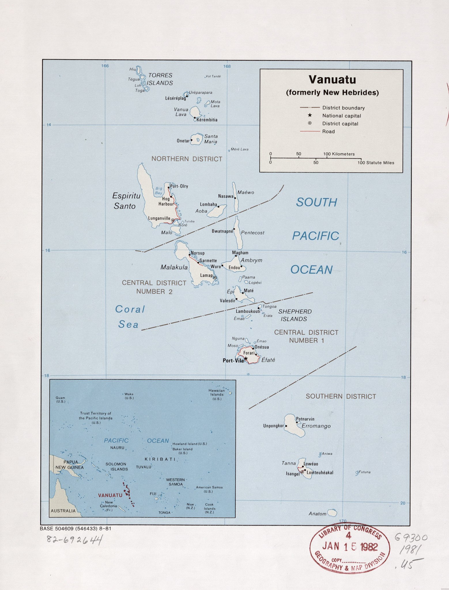
English: Shows district boundaries. "Base 504609 (546433) 8-81." Includes inset of Pacific Ocean. Available also through the Library of Congress Web site as a raster image. |
||
| Title | Vanuatu (formerly New Hebrides). | ||
| Shelf ID | G9300 1981 .U5 | ||
| Date | |||
| Source | https://www.loc.gov/item/82692644/ | ||
| Author | United States. Central Intelligence Agency | ||
| Permission (Reusing this file) |
|
||
| Other versions |
|
||
| Location | Vanuatu | ||
| Part of | American Memory · General Maps · Catalog · Geography And Map Division | ||
| Subject | Maps · Vanuatu |

._LOC_82692644.jpg&action=edit§ion=1)
Licensing
edit._LOC_82692644.jpg&action=edit§ion=2)
| This image is a work of a Central Intelligence Agency employee, taken or made as part of that person's official duties. As a Work of the United States Government, this image or media is in the public domain in the United States.
|

|
File history
Click on a date/time to view the file as it appeared at that time.
| Date/Time | Thumbnail | Dimensions | User | Comment | |
|---|---|---|---|---|---|
| current | 22:32, 31 May 2018 | | 3,127 × 4,109 (1.11 MB) | Fæ (talk | contribs) | LOC Maps https://www.loc.gov/item/82692644/ #1150 |
You cannot overwrite this file.
File usage on Commons
The following page uses this file:
._LOC_82692644.jpg&oldid=611138282)