File:Warrantee landholdings in the townships of Wayne County, Pa., ca. 1828-1835 LOC 2010588940-1.jpg

Size of this preview: 461 × 599 pixels. Other resolutions: 184 × 240 pixels | 369 × 480 pixels | 591 × 768 pixels | 787 × 1,024 pixels | 1,575 × 2,048 pixels | 4,176 × 5,430 pixels.
Original file (4,176 × 5,430 pixels, file size: 2.1 MB, MIME type: image/jpeg)
Captions
Captions
Add a one-line explanation of what this file represents
Summary
edit| Description |
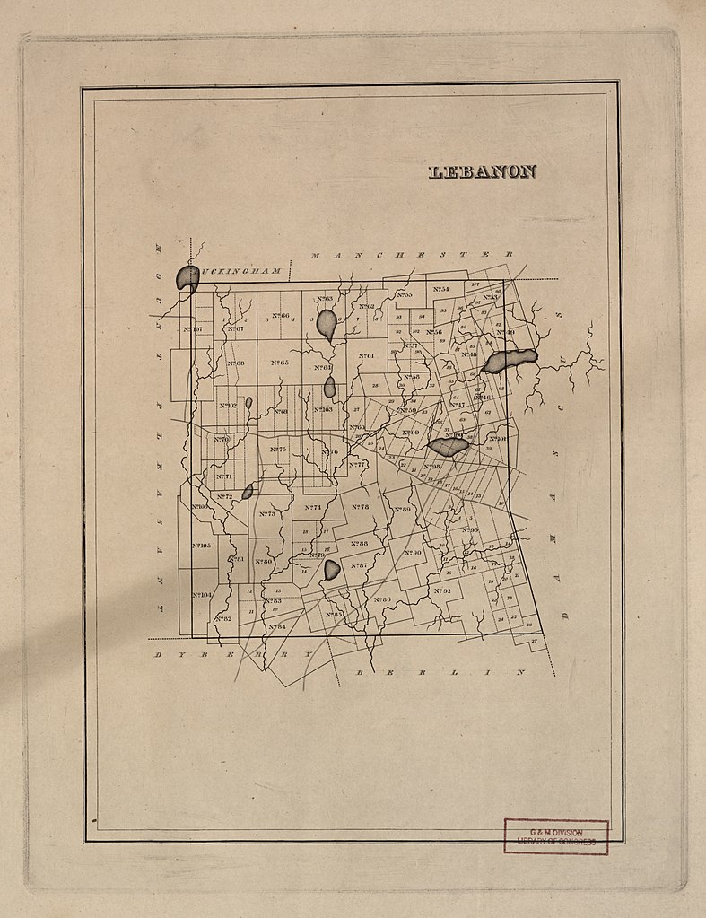
English: The maps show warrantee landholding boundaries and numbers. The assigned landholders' names are not given. Each map (engraving) covers a single township in Wayne County. Title devised by cataloguer. The engraver's name appears in the lower margin of the Dyberry and Salem Township maps only. Available also through the Library of Congress Web site as a raster image. Purchase; Boston Rare Maps; Oct. 2010. LC sheets imperfect: Some printer's creases, small marginal tears, set presumed to be incomplete. |
||
| Title | [Warrantee landholdings in the townships of Wayne County, Pa., ca. 1828-1835] | ||
| Shelf ID | G3823.W4G46 s72 .H3 | ||
| Parent | https://www.loc.gov/resource/g3823wm.gct00243/ | ||
| Sheet title | Lebanon | ||
| Date | |||
| Source | https://www.loc.gov/item/2010588940/ | ||
| Author | Hamm, Phineas Eldridge | ||
| Permission (Reusing this file) |
|
||
| Other versions |
|
||
| Location | Wayne County · United States · Dyberry · Pennsylvania · Mount Pleasant · Lebanon · Lebanon (Township) · Mount Pleasant (Wayne County : Township) · Salem · Dyberry (Township) · Township · Salem (Wayne County : Township) | ||
| Part of | American Memory · General Maps · Catalog · Geography And Map Division | ||
| Subject | Wayne County · Lebanon (Pa. : Township) · Mount Pleasant (Wayne County, Pa. : Township) · Pennsylvania · Salem (Wayne County, Pa. : Township) · Mount Pleasant (Wayne County : Township) · Land Grants · Lebanon (Township) · Maps · Dyberry (Township) · Dyberry (Pa. : Township) · Real Property · Salem (Wayne County : Township) · United States |


Licensing
edit
|
This is a faithful photographic reproduction of a two-dimensional, public domain work of art. The work of art itself is in the public domain for the following reason:
The official position taken by the Wikimedia Foundation is that "faithful reproductions of two-dimensional public domain works of art are public domain".
This photographic reproduction is therefore also considered to be in the public domain in the United States. In other jurisdictions, re-use of this content may be restricted; see Reuse of PD-Art photographs for details. | ||||
File history
Click on a date/time to view the file as it appeared at that time.
| Date/Time | Thumbnail | Dimensions | User | Comment | |
|---|---|---|---|---|---|
| current | 10:29, 9 July 2018 | | 4,176 × 5,430 (2.1 MB) | Fæ (talk | contribs) | LOC Maps multisheet https://www.loc.gov/item/2010588940/ sheet 1 of 4 #206 |
You cannot overwrite this file.
File usage on Commons
The following page uses this file: