File:White Mountain National Forest, New Hampshire, Maine LOC 2011589176.jpg

Size of this preview: 226 × 599 pixels. Other resolutions: 90 × 240 pixels | 181 × 480 pixels | 290 × 768 pixels | 386 × 1,024 pixels | 773 × 2,048 pixels | 5,550 × 14,700 pixels.
Original file (5,550 × 14,700 pixels, file size: 13.01 MB, MIME type: image/jpeg)
Captions
Captions
Add a one-line explanation of what this file represents
Summary
edit| Warning | The original file is very high-resolution. It might not load properly or could cause your browser to freeze when opened at full size. |
|---|
| Description |
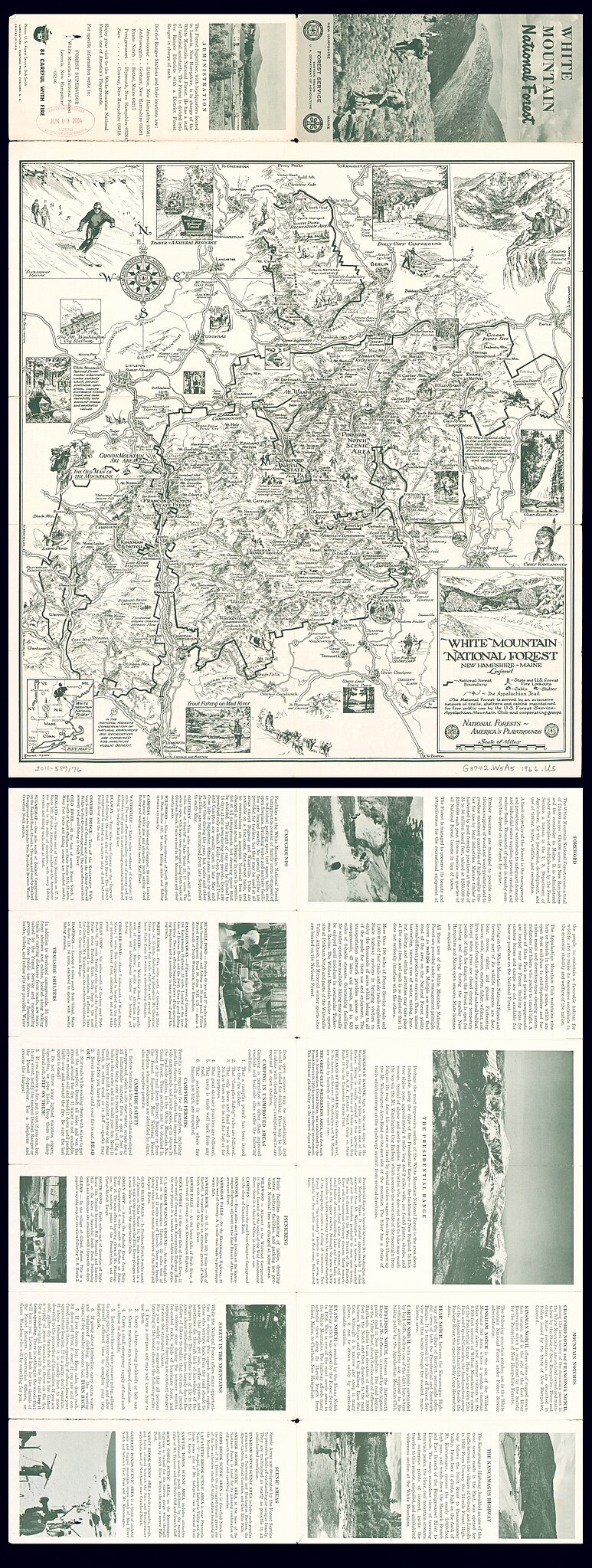
English: Pictorial map. Relief shown pictorially and by spot heights. Title from panel. At lower left: Culverwell -- Ted Ray. Includes location map, notes, text, and ill. Text and ill. on verso. Available also through the Library of Congress Web site as a raster image. |
||
| Title | White Mountain National Forest, New Hampshire, Maine | ||
| Shelf ID | G3742.W5A5 1966 .U5 | ||
| Date | |||
| Source | https://www.loc.gov/item/2011589176/ | ||
| Author | United States. Forest Service. Eastern Region; Ray, Ted | ||
| Permission (Reusing this file) |
|
||
| Other versions |
|
||
| Location | United States · New Hampshire · Maine · White Mountain National Forest | ||
| Part of | American Memory · General Maps · Catalog · Geography And Map Division | ||
| Subject | Pictorial Maps · White Mountain National Forest (N.H. And Me.) · United States · Maps · New Hampshire · White Mountain National Forest · Maine |

Licensing
edit
| This work is from the Library of Congress. According to the library, there are no known copyright restrictions on the use of this work. |  |
File history
Click on a date/time to view the file as it appeared at that time.
| Date/Time | Thumbnail | Dimensions | User | Comment | |
|---|---|---|---|---|---|
| current | 01:16, 31 May 2018 | 5,550 × 14,700 (13.01 MB) | Fæ (talk | contribs) | LOC Maps https://www.loc.gov/item/2011589176/ #15782 |
You cannot overwrite this file.
File usage on Commons
The following page uses this file: