File:Zeelandbrug (245723033).jpeg
Size of this preview: 800 × 532 pixels. Other resolutions: 320 × 213 pixels | 640 × 426 pixels | 1,024 × 681 pixels | 1,280 × 851 pixels | 2,048 × 1,362 pixels.
Original file (2,048 × 1,362 pixels, file size: 840 KB, MIME type: image/jpeg)
Captions
Captions
Add a one-line explanation of what this file represents
Summary
edit.jpeg&action=edit§ion=1)
| Zeelandbrug | |
|---|---|
| Photographer | |
| Title |
Zeelandbrug |
| Description |
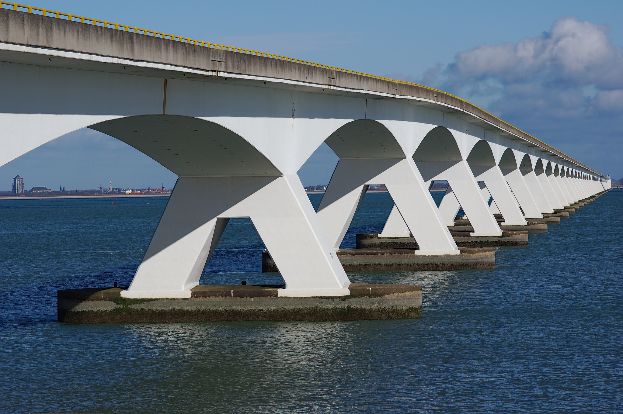
500px provided description: en.wikipedia.org/wiki/Zeeland_Bridge This brigde is 5 km long, when it was built in 1965 it was the longest bridge of Europe. This image shows almost the full length of the bridge, as seen from the south (Colijnsplaat). Through the first span you can see the "fat tower" of Zierikzee on the other side of the Oosterschelde. en.wikipedia.org/wiki/Sint-Lievensmonstertoren [#bridge ,#pier ,#waterfront ,#dock ,#waterway ,#Zeeland ,#Netherlands ,#Zeelandbrug ,#Zierikzee ,#water-front ,#Colijnsplaat] |
| Date | 10 February 2018, 14:05:08 (UTC) |
| Source | Imported from 500px (archived version) by the Archive Team. (detail page) |
| Permission (Reusing this file) |
This file is licensed under the Creative Commons Attribution-Share Alike 3.0 Unported license.
|
| Camera location | | View this and other nearby images on: OpenStreetMap |
|---|
.jpeg¶ms=051.595310_N_0003.868722_E_globe:Earth_type:camera__&language=en)
File history
Click on a date/time to view the file as it appeared at that time.
| Date/Time | Thumbnail | Dimensions | User | Comment | |
|---|---|---|---|---|---|
| current | 05:57, 4 August 2018 | | 2,048 × 1,362 (840 KB) | Rodrigo.Argenton (talk | contribs) | Photo Zeelandbrug imported from 500px with import-500px |
You cannot overwrite this file.
File usage on Commons
The following page uses this file:
.jpeg)
.jpeg&oldid=522298398)