Magyarország
country in Central Europe
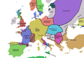
Countries of Europe: Albania · Andorra · Armenia‡ · Austria · Azerbaijan‡ · Belarus · Belgium · Bosnia and Herzegovina · Bulgaria · Croatia · Cyprus‡ · Czech Republic · Denmark · Estonia · Finland · France‡ · Georgia‡ · Germany · Greece · Hungary · Iceland · Republic of Ireland · Italy · Kazakhstan‡ · Latvia · Liechtenstein · Lithuania · Luxembourg · Malta · Moldova · Monaco · Montenegro · Netherlands‡ · North Macedonia · Norway · Poland · Portugal‡ · Romania · Russia‡ · San Marino · Serbia · Slovakia · Slovenia · Spain‡ · Sweden · Switzerland · Turkey‡ · Ukraine · United Kingdom · Vatican City
Specific status: Akrotiri and Dhekelia‡ · Faroe Islands · Gibraltar · Bailiwick of Guernsey · Isle of Man · Jersey · Svalbard – Limited recognition: Abkhazia‡ · Gagauzia · Kosovo · South Ossetia‡ · Transnistria · Northern Cyprus‡ · United Nations Buffer Zone in Cyprus‡
‡: partly located in Europe
Specific status: Akrotiri and Dhekelia‡ · Faroe Islands · Gibraltar · Bailiwick of Guernsey · Isle of Man · Jersey · Svalbard – Limited recognition: Abkhazia‡ · Gagauzia · Kosovo · South Ossetia‡ · Transnistria · Northern Cyprus‡ · United Nations Buffer Zone in Cyprus‡
‡: partly located in Europe
country in Central Europe    .svg)  | |||||
| Upload media | |||||
| Pronunciation audio | |||||
|---|---|---|---|---|---|
| Instance of |
| ||||
| Part of | |||||
| Named after |
| ||||
| Culture | |||||
| Location |
| ||||
| Located in or next to body of water | |||||
| Capital | |||||
| Basic form of government |
| ||||
| Legislative body | |||||
| Executive body | |||||
| Highest judicial authority | |||||
| Official language |
| ||||
| Anthem | |||||
| Currency |
| ||||
| Head of state |
| ||||
| Head of government |
| ||||
| Inception |
| ||||
| Significant event |
| ||||
| Highest point |
| ||||
| Population |
| ||||
| Area |
| ||||
| Replaces |
| ||||
| Top-level Internet domain | |||||
| Different from | |||||
| official website | |||||
 | |||||
עברית: הונגריה היא מדינה במרכז אירופה, בירתה בודפשט..
தமிழ்: ஹங்கேரி என்பது ஐரோப்பாக் கண்டத்திலுள்ள ஒரு சுதந்திரமான, குடியரசு நாடு...அதன் தலைநகரம் புடாபெஸ்ட் ஆகும்..
- You can find all pictures in Symbols of Hungary
- You can find all pictures in Maps of Hungary and Atlas of Hungary
-

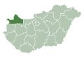
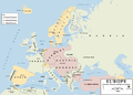
 Magyarország elhelyezkedése (sötét zöld) Európában (zöld és sötét szürke) és az Európai Unióban (zöld)
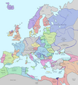
 Location of Hungary (dark green) in Europe (green & dark grey) and in the European Union (green)
 -
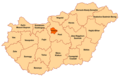
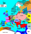
 Magyarország politikai térképe (angol) Political map of Hungary
 -
 Magyarország topográfiai térképe Topographic map of Hungary
 -
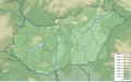 Magyarország domborzati térképe Physical map of Hungary
 -
-
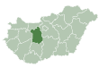
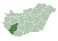
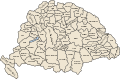
 Hungary total fertility rate by region, 2014


-
 Térképe, Map
 -
 Zászlaja, Flag
 -
 Címere, Coat of arms
 -

-


_4.jpg)
-
 Térképe, Map
 -
 Zászlaja, Flag
 -
 Címere, Coat of arms
 -

-


-
 Térképe, Map
 -
 Zászlaja, Flag
 -
 Címere, Coat of arms
 -

-


-
 Térképe, Map
 -
 Zászlaja, Flag
 -
 Címere, Coat of arms
 -

-


-
 Térképe, Map
 -
 Zászlaja, Flag
 -
 Címere, Coat of arms
 -

-


.svg)

_3.jpg)

-
 Térképe, Map
 -
 Zászlaja, Flag
 -
 Címere, Coat of arms
 -

-


.JPG)
-
 Térképe, Map
 -
 Zászlaja, Flag
 -
 Címere, Coat of arms
 -
-


_4.jpg)

-
 Térképe, Map
 -
 Zászlaja, Flag
 -
 Címere, Coat of arms
 -
-


_35.jpg)

-
 Térképe, Map
 -
 Zászlaja, Flag
 -
 Címere, Coat of arms
 -
-


_12.jpg)
-
 Térképe, Map
 -
 Zászlaja, Flag
 -
 Címere, Coat of arms
 -

-


-
 Térképe, Map
 -
 Zászlaja, Flag
 -
 Címere, Coat of arms
 -

-


_3.jpg)
-
 Térképe, Map
 -
 Zászlaja, Flag
 -
 Címere, Coat of arms
 -
-


-
 Térképe, Map
 -
 Zászlaja, Flag
 -
 Címere, Coat of arms
 -

-


-
 Térképe, Map
 -
 Zászlaja, Flag
 -
 Címere, Coat of arms
 -

-


_5.jpg)
-
 Térképe, Map
 -
 Zászlaja, Flag
 -
 Címere, Coat of arms
 -

-


-
 Térképe, Map
 -
 Zászlaja, Flag
 -
 Címere, Coat of arms
 -
-


-
 Térképe, Map
 -
 Zászlaja, Flag
 -
 Címere, Coat of arms
 -

-


-
 Térképe, Map
 -
 Zászlaja, Flag
 -
 Címere, Coat of arms
 -

-


-
 Térképe, Map
 -
 Zászlaja, Flag
 -
 Címere, Coat of arms
 -

-


_3.jpg)
.jpg)
-
 Térképe, Map
 -
 Zászlaja, Flag
 -
 Címere, Coat of arms
 -

-


_5.jpg)
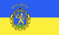
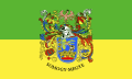
Featured cities and villages / Kiemelt városok és községek
edit-

-
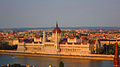
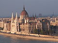
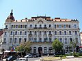
 Budapest, Hungarian Parliament Building
 -
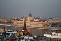
 Budapest, Parliament Building from the Buda Castle
 -
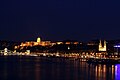
 Budapest, Panorama
 -
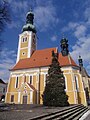
 Budapest, Matthias Church
 -
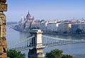
 Budapest, Chain Bridge
 -
 Budapest, Museum of Fine Arts
 -
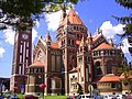
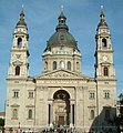 Budapest, St Stephen's Basilica
 -
 Budapest, Cupola of the St Stephen's Basilica
 -
 Budapest, Hereo's Square
 -
 Budapest, Castle District
 -
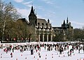 Budapest, Vajdahunyad Castle and the City Ice Ring
 -
 Budapest, Museum of Applied Arts
 -
 Budapest, Széchenyi Bath
 -
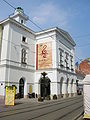
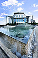 Budapest, Hungarian National Theater
 -
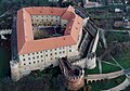
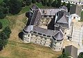
 Budapest Castle
 -
 Buda Castle
 -
 Budapest, Városliget
 -
 Budapest
 -
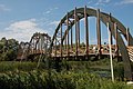
 Budapest Freedom bridge
 -
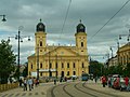 Debrecen, Great Church
 -
 Debrecen, Downtown
 -
 Debrecen, Piac Street
 -
 Debrecen, County House
 -
 Debrecen, University
 -
 Pécs, Cathedral from the Middle Ages
 -
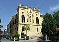
 Pécs, County Hall
 -
 Pécs, Széchenyi Square
 -
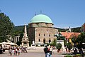
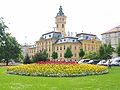
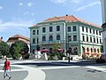
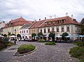
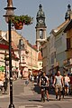
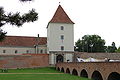
 Győr, In the downtown
 -

-
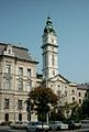
 Győr, City Hall
 -
 Győr
Győr -
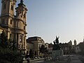
 Győr, the Baroque City
 -

-
 Győr, Széchenyi Square
 -
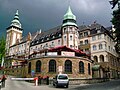
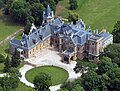
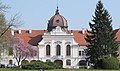
 Kecskemét, Cifra Palace (hungarian Art Noveau building)
 -
 National Theatre
 -
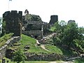
 Miskolc, Diosgyőr Castle
 -
 Miskolc, Downtown
 -
 Miskolc, National Theatre
 -
 Miskolc, Downtown
 -
 Miskolc
 -
 Miskolc-Lilafüred, Palace Hotel
 -
 Miskolc
 -
 Miskolc
 -
 Szeged, the Dome
 -
 Szeged, Dome Square
 -
 National Theatre
 -
 Szeged, Dömötör tower
 -
 Szeged, City Hall
 -
 Szeged, Ferenc Móra Museum
 -
 Szeged, Synagogue
 -
 Sopron, Fire Tower
 -

-

-

-
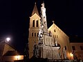
 Eger
Eger -
 Eger
Eger -
 Eger, Dobó Square
 -
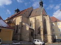
 Eger, Minorite Church
 -
 Eger, Downtown
 -

-
 Eger, Basilica
 -
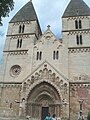
 Esztergom, from the Danube
 -
 Esztergom, Basilika
 -
 Esztergom
 -
 Esztergom, Dark Gate and the Basilica
 -
 Esztergom, Castle
 -
 Esztergom, City Hall
 -
 Esztergom, Franciscan church
 -
 Esztergom, Seminary
 -
 Esztergom
 -
 Esztergom
 -
 Esztergom, Round Church
 -
 Esztergom, the Mária Valréria Bridge and the Danube from the Castle
 -
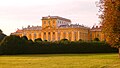
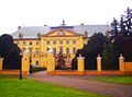
 Eszterházy-Palace, the "Hungarian Versailles"
 -
 Eszterházy-Palace
 -
 Eszterháza
 -
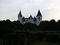
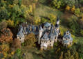
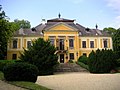
 Fertőd, the Palace
 -
 Eszterházy-Palace, Fertőd
 -

-
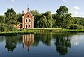
 Keszthely
 -
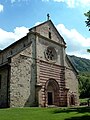
 Keszthely, gothic Church
 -
 Kőszeg
 -
 Kőszeg, Jacob Church
 -
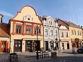 Kőszeg, Main Square
 -
 Kőszeg, Jurisics Square
 -
 Kőszeg
 -
 Kőszeg
 -
 Kőszeg
 -
 Kőszeg, the Jurisics Castle
 -
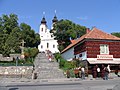
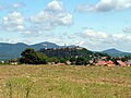
 Hollókő
 -
 Gyöngyös
 -
 Hódmezővásárhely
 -
 Szentendre
 -
 Szentendre
 -
 Szentendre, Castle church
 -
 Szentendre
 -
 Szentendre
 -
 Szentendre
 -
 Pannonhalma
 -
 Zsámbék Ruins
 -
 Siklós
 -
 Siklós Castle
 -
 Siklós
 -
 Siklós
 -
 Tihany
 -
 Tihany
 -
 Panorama from Tihany
 -
Kaposvár
-
 Kaposvár
 -
 Kaposvár
 -
 Kaposvár
 -
 Kaposvár
 -
 Kaposvár
 -
 Ják
Ják -
 Ják
Ják -
 Ják
Ják -
 Veszprém
 -
 Veszprém
 -
 Veszprém
 -
 Veszprém
 -
 Veszprém
 -
 Veszprém
 -
 Veszprém
 -
 Veszprém
 -
 Baja
Baja -
 Öskü
Öskü -
 Csempeszkopács


.jpg)


.jpg)


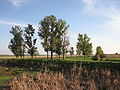
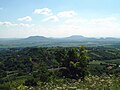
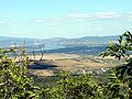
Landscapes and scenes of Hungary / Magyarország tájai és színtere
editThe 1106 km long route of the Countrywide Blue Tour rambles the varied counties of Hungary along the Transdanubian Medium Mountains and the Northern Medium Mountains. It visits the most beautiful built and natural sights of the country. The following pictures was taken on its route in western-eastern direction.
-
 Hortobágy
 -
 Hortobágy
 -
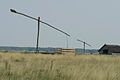
 Lookout tower on the top of the Irottkő Mountain (884 m) on the Austrian-Hungarian boundary.
 -
 The main square of town Kőszeg
 -
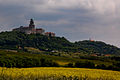
 The Castle of Sümeg
 -
 Tiszadob
 -
 Tiszadob
 -
 The palace of Festetics in town Keszthely
 -
 The view of the Basin of Tapolca with the spent volcanoes
 -
 Water Mill Lake of town Tapoca
 -
 The view of Szent György-hegy from the border of town Tapoca
 -
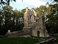 The ruins of an old abbey close to village Nagyvázsony
 -
 The Castle of Vázsonykő in village Nagyvázsony
 -
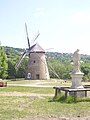
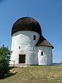
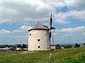 An old wind mill in the Bakony Mountains at village Tés
 -
 View from the side of Öreg-kő in the Gerecse Hilly Country
 -
 View from the top of Kőszikla in the Gerecse Hilly Country
 -
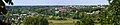
 Körmend
 -
 The panorama of Budapest from the Árpád lookout terrace
 -
 The view of Pilis Mountains from the top of Nagy-Kevély
 -
 In the Gorge of Pilis
 -
 The panorama of the Danube Bend from the rocks of Borjúfő
 -
 The Castle of Visegrád from the lookout tower of Nagy-Villám
 -
 The panorama of the Danube Bend from the top of Hegyes-tető
 -
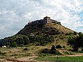
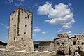
 The Castle of Nógrád
 -
 View from the walls of Castle of Nógrád
 -
 Seregélyes
 -
 Lebény
 -
 Nagymágocs
 -
 The main road of village Hollókő (it is a World Heritage Site)
 -
 The Kékestető Mountain is the highest in Hungary (1014 m) in the Mátra Mountains
 -
 View from the ridge of Mátra Mountains
 -
 Old abbey in village Bélapátfalva at the foot of the Bükk Mountains
 -
At the foot of Bükk Mountains
-
 The Reservoir of Lázbérc at village Dédestapolcány
 -
 A fishing lake close to town Putnok
 -
 The rock above the entry of the Stalagtite Cave of Aggtelek
 -
 In Stalagtite Cave of Aggtelek (it is a World Heritage Site)
 -
 The 900 years old church of village Rakacaszend among the hills of Cserehát
 -
 The Castle of Boldogkő
 -
 The Castle of Füzér
 -
 Pápa
Pápa -
 Fót
Fót -
 The view of Hegyköz from the walls of Castle of Füzér
 -
 Old church of Zalaháshágy
 -
 Nagyvásony Castle
 -
 Tura
Tura -
 Kalocsa
 -
 Kalocsa
 -
 Kaposvár - panorama
 -
 Noszvaj
 -
 Nádasdladány
 -
 Nádasdladány
 -
 Sárvár
 -
 Gyula
Gyula -
 Martonvásár
 -
 Szabadkígyós
 -
 Nagycenk
 -
 Gödöllő
 -
 Gödöllő
 -
 Gödöllő
 -
 River Ipoly valley - Nógrádszakál
 -
 Baranya
 -
 Bükk
Bükk -
 Kőröshegy
 -
 Szigliget
 -
 Balatonudvari
 -
 The view of the Highland of Balaton
 -
 Small Balaton
 -
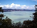
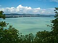 Lake Balaton
 -

-
 Lake Balaton
 -
 Lake Balaton
 -
 Lake Balaton
 -
 Lake Balaton
 -
 Lake Balaton
 -
 Lake Balaton
 -
 Lake Velence
 -
 Lake Velence
 -
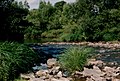
 River Tisza
 -
Danube, Esztergom
-
 River Danube
 -
 The Castle of Visegrád taken from the other side of the Danube
 -
 Danube, Budapest
 -
 River Dráva


_021.JPG)


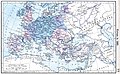
Historical maps of Hungary / Magyarország történelmi térképei
edit-
 Duchy of Hungary (998)
 -
 Kingdom of Hungary (1000)
 -
 Kingdom of Hungary (11th century)
 -
 Kingdom of Hungary (1097)
 -
 Kingdom of Hungary (1142)
 -
 Kingdom of Hungary (1190)
 -
 Kingdom of Hungary (1328)
 -
 Kingdom of Hungary (1360)
 -
 Kingdom of Hungary (1470)
 -
 Habsburg Hungary and Transylvania (1700)
 -
 Kingdom of Hungary in the Habsburg Empire (1740)
 -
 Kingdom of Hungary (19th century)
 -
 Austria-Hungary 20th century
 -
 Austria-Hungary (1914)
 -
 Austria-Hungary (WWI)
 -
 English: Hungary (1920)Magyar: Magyarország (1920)
 -
 1920
1920 -
 English: Hungary (1942)Magyar: Magyarország (1942)
 -
 People's Republic of Hungary(Communist era) 1945-1989
 -
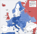
 Hungary in the EU2007


Hungarian treasures / Magyar állami kincsek és jelvények
edit-
 The Hungarian Crown of Saint Stephen.
 -
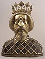 St.Ladislaus of Hungary, Basilica in Győr(Hungary)
 -
 Golden Forint, wich depict King Saint Ladislaus,
 -
 The treasure of Nagyszentmiklós. The Álmos legend from the Hungarian mythology: Emese's dream of the Turul bird.


