Europe
continent
(Redirected from Europa)
"Europa" redirects here. For the moon of Jupiter, see Europa (moon).

|

|

|

|

|

|
| 30 degrees, 1800x1800 | ||
Maps edit
Main category: Maps of Europe
Countries recognized as part of Europe edit
Miscellaneous edit
-
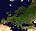 Satellite view of EuropeMain category: Satellite pictures of Europe
 -
 ISS view of North Europe
 -
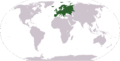 World map: Europe (location)
 -
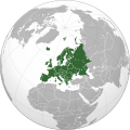 Orthographic projection of Europe
 -
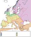
 Climatic map of Europe (French)
 -
 Rainfall map 2020
 -
 Europe countries map with numbers
 -
 Map of Europe with flags
 -
 Europe population map
 -
 Tectonic map Europe
 -

-
 Europe time zones map
 -
 Europe's borders
 -
 Borders of Europe (German texts)
 -
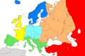 Regions of Europe, no text
 -
 Regions of Europe, English text
 -
 Europe's borders with Swedish text
 -
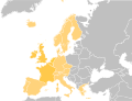 Map of Europe with the Western part highlighted
 -
 Historical distribution of central Europe
 -
 Latin Europe
 -
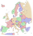
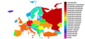
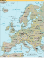
 Political map of Europe
 -
 Physical map of Europe
 -
 Geopolitical map of Europe (vectorized, in French)
 -
 Russia, Ukraine, Belarus and Dnieper-Basin
 -
 Nations of Europe
 -
 Trans-European Transport Networks


.svg)


European flags edit

National cuisines edit
Spain edit
-
 Palo Santo Cafe, Aranda de Duero, Spain, Jamón serrano
 -
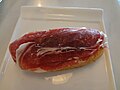 Jamón serrano sevred at Palo Santo Cafe, Aranda de Duero
 -
 Anchovies in Spanish Olive OIl
 -
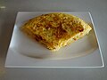 (Spanish Tortilla)


France edit
-
 A nouvelle cuisine presentation
 -
 French haute cuisine presentation
 -
 French wines are usually made to accompany French cuisine


edit
_en.png)
.png)
.jpg)
Countries of Europe: Albania · Andorra · Armenia‡ · Austria · Azerbaijan‡ · Belarus · Belgium · Bosnia and Herzegovina · Bulgaria · Croatia · Cyprus‡ · Czech Republic · Denmark · Estonia · Finland · France‡ · Georgia‡ · Germany · Greece · Hungary · Iceland · Republic of Ireland · Italy · Kazakhstan‡ · Latvia · Liechtenstein · Lithuania · Luxembourg · Malta · Moldova · Monaco · Montenegro · Netherlands‡ · North Macedonia · Norway · Poland · Portugal‡ · Romania · Russia‡ · San Marino · Serbia · Slovakia · Slovenia · Spain‡ · Sweden · Switzerland · Turkey‡ · Ukraine · United Kingdom · Vatican City
Specific status: Akrotiri and Dhekelia‡ · Faroe Islands · Gibraltar · Bailiwick of Guernsey · Isle of Man · Jersey · Svalbard – Limited recognition: Abkhazia‡ · Gagauzia · Kosovo · South Ossetia‡ · Transnistria · Northern Cyprus‡ · United Nations Buffer Zone in Cyprus‡
‡: partly located in Europe
Specific status: Akrotiri and Dhekelia‡ · Faroe Islands · Gibraltar · Bailiwick of Guernsey · Isle of Man · Jersey · Svalbard – Limited recognition: Abkhazia‡ · Gagauzia · Kosovo · South Ossetia‡ · Transnistria · Northern Cyprus‡ · United Nations Buffer Zone in Cyprus‡
‡: partly located in Europe